Double-click photos for full-frame view. This page edited 11/11/2012.
Damage Evaluations (Earthquake, Landslide, Flood) What was damaged and how severely? What caused the damage? Is future damage likely? Is their anything I can do? Disclosure Reports for Real Estate Transactions How do you inform potential buyers fully to minimize the risk of litigation due to "failure to disclose?" How do you show your property in the best light and still disclose all that must be? Erosion-Control Prescriptions When is enough, enough? Erosion-Rate Studies to Determine Setbacks Should I consider global sea level rise in my planning? "Geological Surveys" What is the least amount of work I need done for my permit? Groundwater Availability Evaluations Can you give me information just from geologic maps? Landslide Mapping for Hazard and Risk Assessments Is the neighbor's landslide threatening ME? Is MY landslide threatening THEM? Did he cause it; did I? Landslide Stabilization Recommendations What are the cost-effective options for this site? Will spending more reduce the long-term risk of another failure? Litigation and Arbitration Support What geologic or geotechnical information does my attorney need? Project Feasibility Investigations Can I get 10 lots on this parcel? Where would a road be most stable? Real Estate Support Services Are you buying or selling or just shopping around? Resource Management Support (e.g., Timberlands) How can I maximize my harvest and remain in compliance? What is the approximate volume of available rock? Borrow? Road Alignment and Stability Evaluations Where is the most stable alignment? What are my cut / fill options? Reports for Lot Splits and Subdivisions Our short-form "checklist" report will get the job done! Slope Monitoring with Inclinometers, Tiltmeters, Grid Pins Do you need accurate, precise quantitative information? Which monitoring method is most appropriate, most affordable? "Soil Reports" (Residential, Commercial, & Industrial) I just want it to be easy! We can help. Verbal Assessments for Real Estate Purchase Decisions What's the risk from this hill? Could the ocean erode back to here? Could a tsunami reach this high? Is a Cascadia earthquake really likely? Is that stream or a high groundwater table a threat? Plain and simple, "What's the risk? Is it safe? Should I build?" "What does this crack mean?" Stability analysis of soils and hillslopes. Analysis of the cause of settlement or movement of structures. "Why is this tree leaning?" Is it a sun-loving (heliotropic) or gravity-loving (geotropic) tree? Mathematical slope stability analysis via "eyes only" methods. Inspection of individual trees and groups.
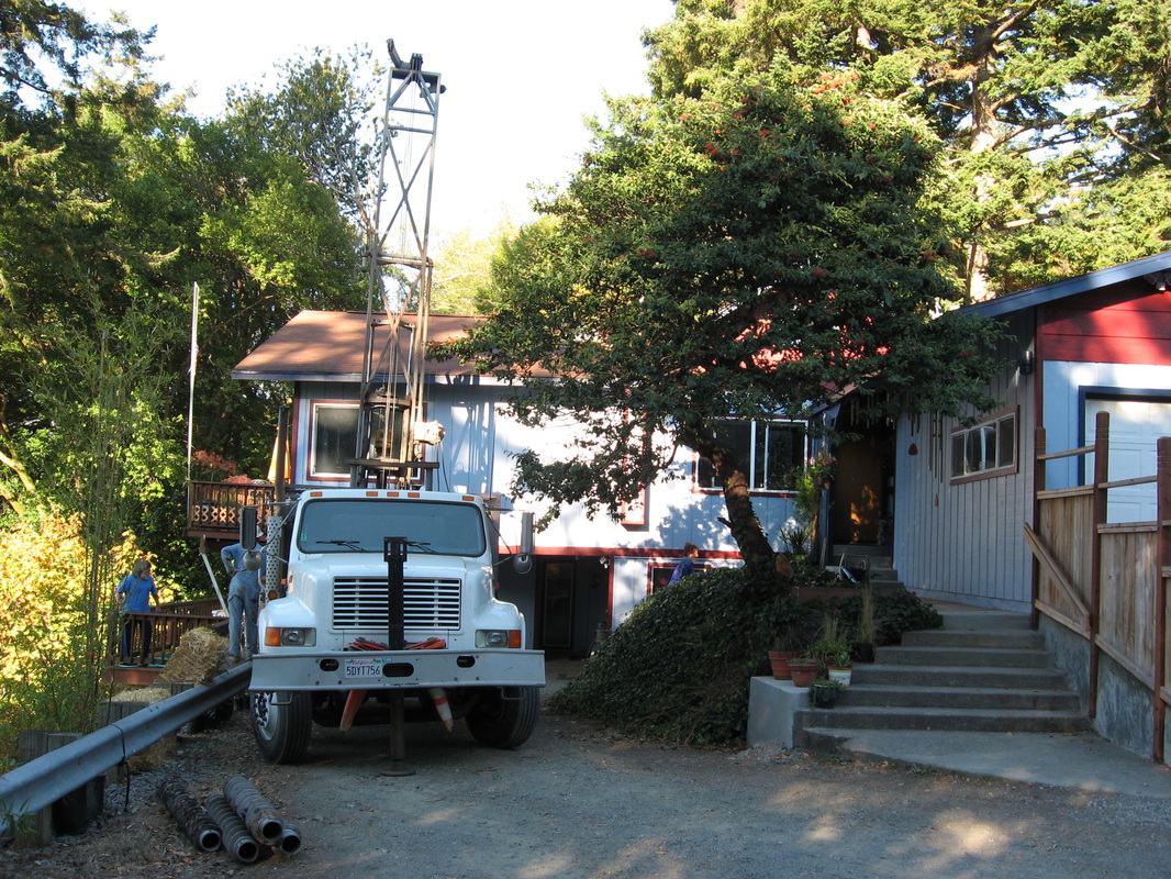
Drilling to set a slope inclinometer at the head of a large rotataional landslide, South Bank Chetco River Road, Brookings, Oregon. We have been monitoring this home since 1999 and the ground has remained stable, to the relief of the owners.
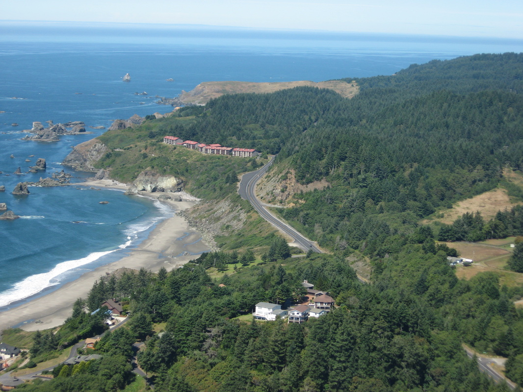
Aerial view of the Rainbow Rock Condominium Complex just north of Brookings. Site-specfic stability evaluations are essential for development efforts in coastal Curry Co., Oregon, due to highly variable, often structurally incompetent bedrock.
A debris slide along Requa Road, Del Norte County, CA, triggered by a high-rainfall event. This slide closed the road and has progressed upslope over time. It is still growing headward.
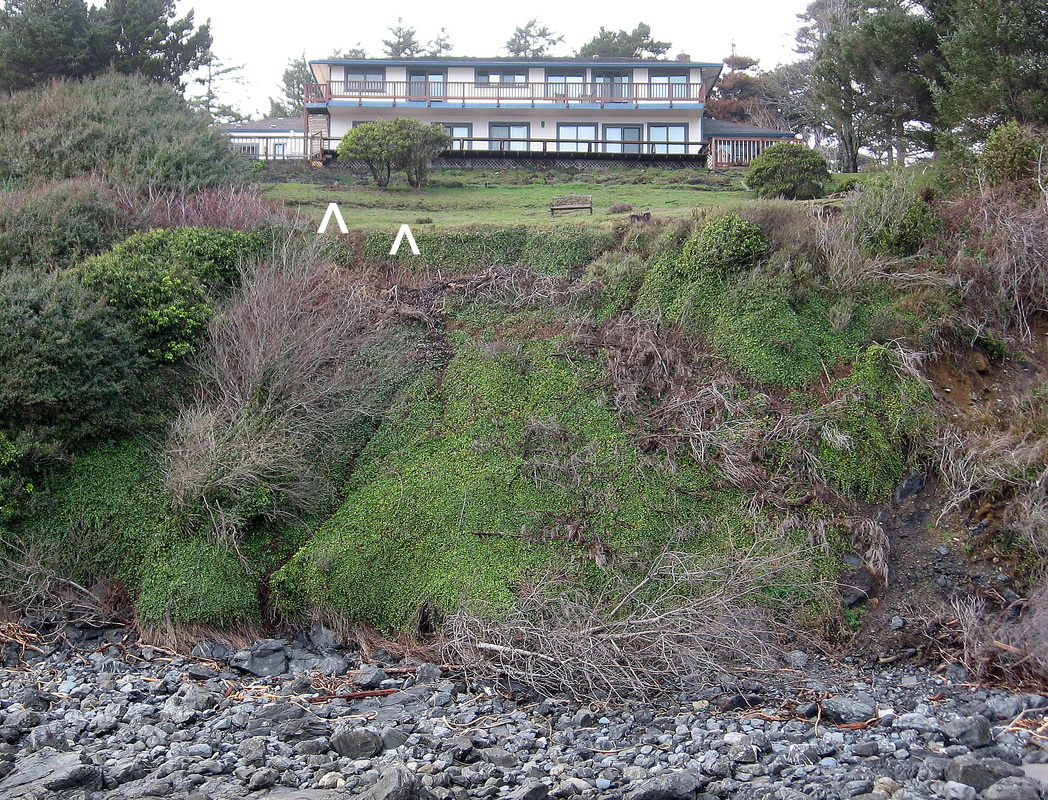
This Brookings, OR, home is many inches out of level. The foundation rests on deep topsoil and, additionally, the bedrock is an intrinsically weak, easily erodible mudstone. The white ^ point at two of the most prominent ground breaks on the yard.
This "Park Model" mobile home in the Whaleshead Creek development north of Brookings, OR, is sliding downhill, dramatically tilting, and pulling apart because the contractor who build the pad did not properly prepare the ground to receive fill, nor did he compact the fill adequately.
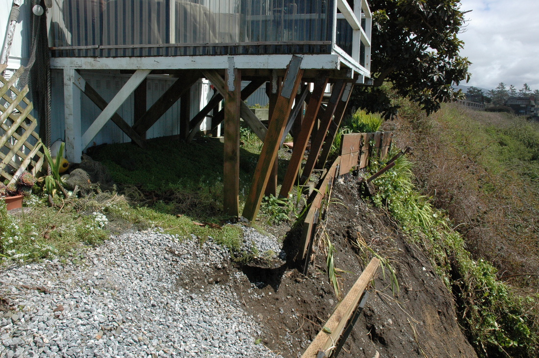
This deck, now partially undermined by sliding soils, faces the incredibly beautiful mouth of the Smith River. But would you have a martini on it? We answered that question for the owner.
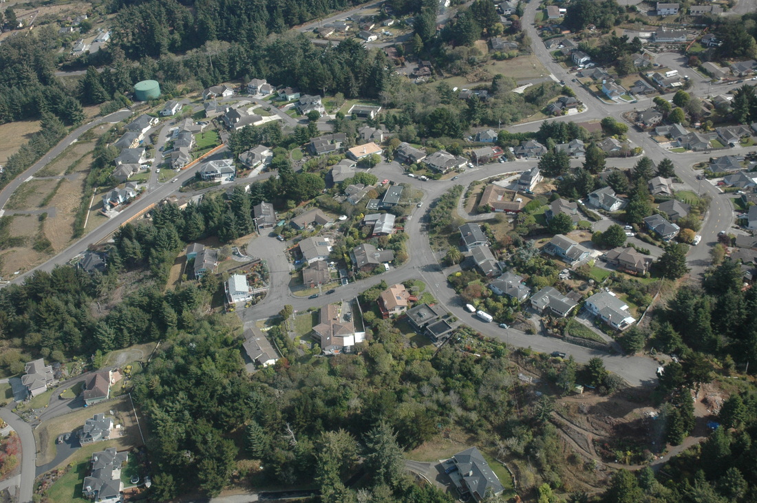
BGC did fault evaluation reports for many of the parcels in this photo before development occurred, and we did the geologic hazards and risks / foundation soils reports for many of the individual subdivisions or lots. Humboldt Hill, Eureka, California.