Primary Sedimentary Structures on Beaches
As of February 20, 2015, the galleries contain photographs from:
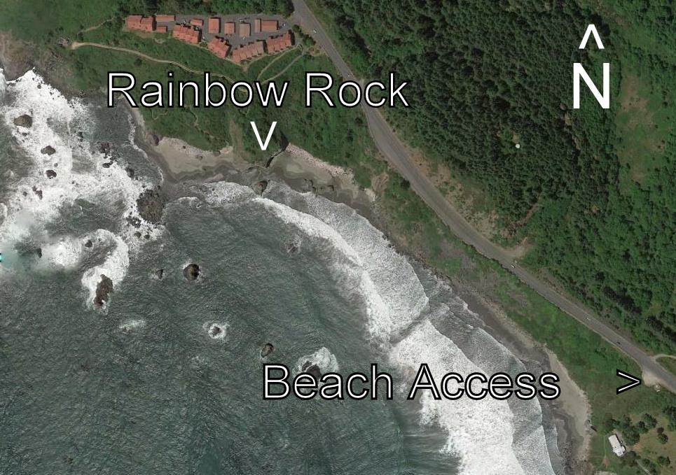
- Rainbow Rock Beach, Brookings, Oregon (north of Brookings)
- Crescent City Beach, Crescent City, CA (south of the city)
- Beach at Mouth of Pistol River, Oregon
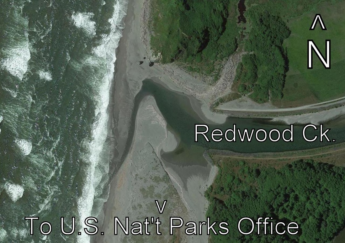
- Beach at the mouth of Redwood Creek, Orick, CA (west of city)
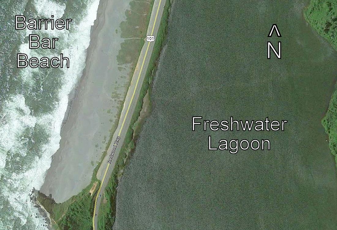
- Freshwater Lagoon Barrier Bar Beach, Orick, CA (south of Orick)
- Kauai, Hawaii Beaches (to be updated).
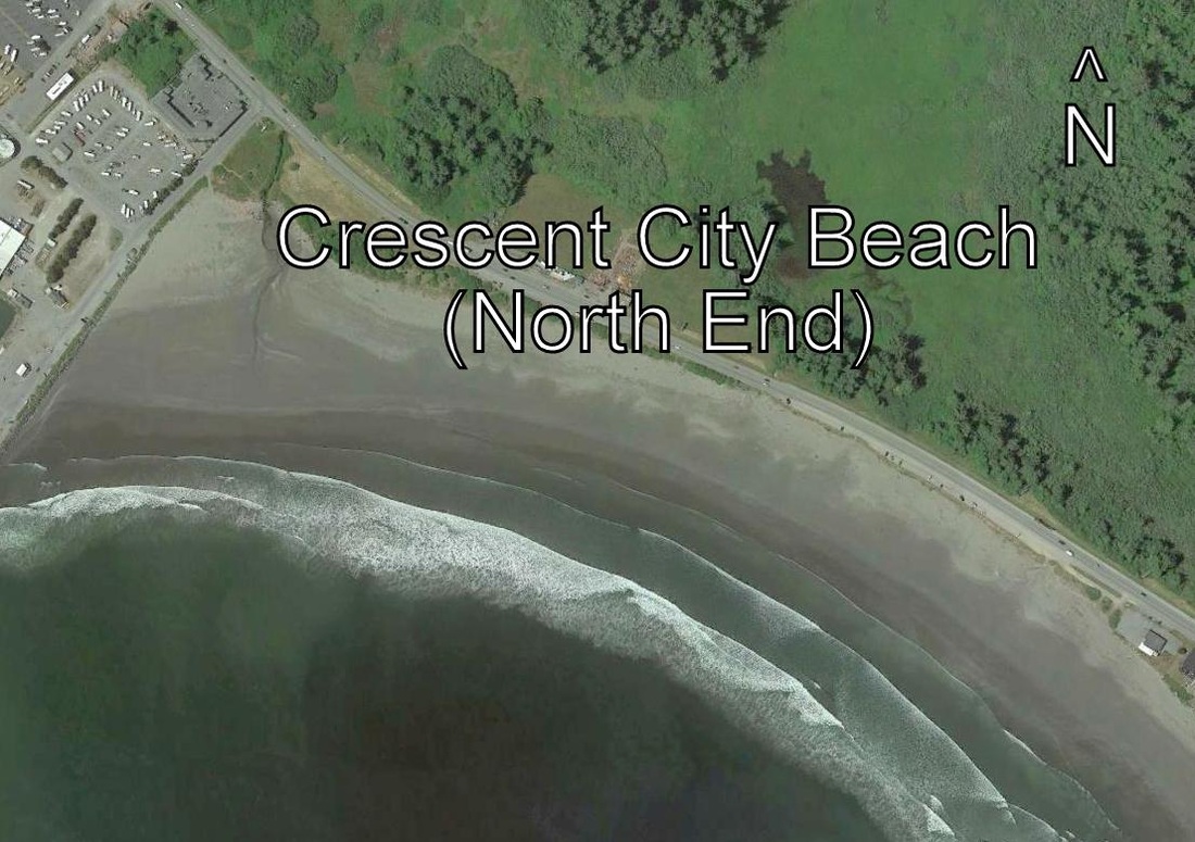
- Pebble Beach, Crescent City, CA (north end)
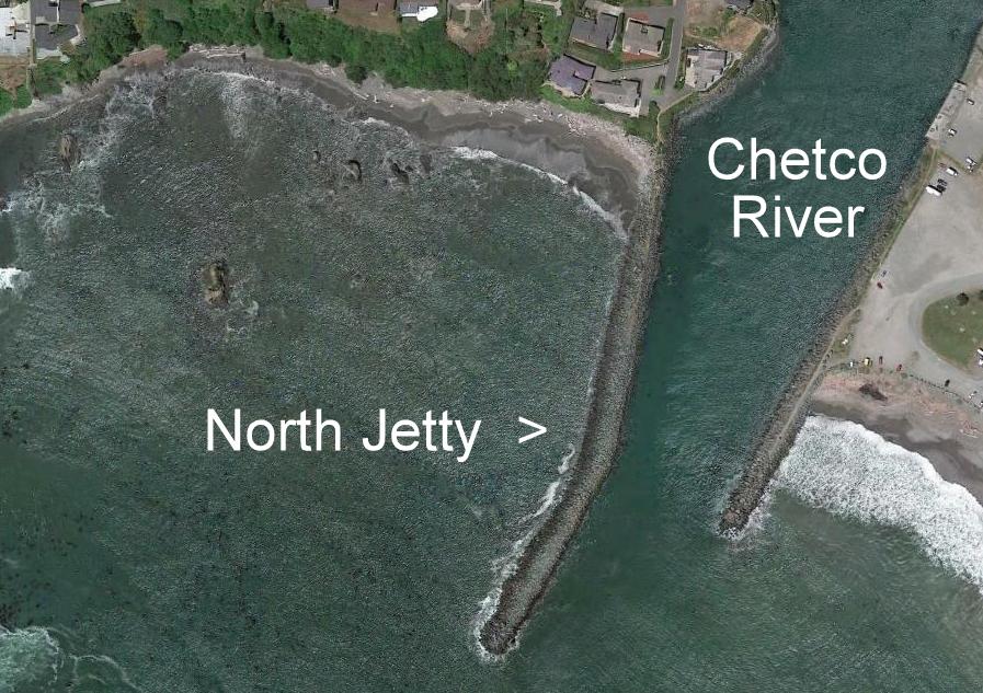
- North Jetty Beach, Brookings, Oregon
- Sisters Rocks - Pigeon Point, Oregon
- Nesika Beach, Oregon
|
I have captioned many of the photographs with the name of the beach feature or primary sedimentary structure. Two great references with a geologic bias are: (1) Pettijohn and Potter, 1964. Atlas and Glossary of Primary Sedimentary Structures, Springer-Verlag, New York, 370 pp. and (2) Lucchi, F. R. 1995. A Photographic Atlas of Sedimentary Structures, Second Edition. Columbia University Press, , New York. 255 pp. Some of my photographs are just of lovely beach settings, features be damned. Not all photos have captions. Some captions are always on, some pop on if you enlarge the image, and some appear if you hover the mouse over the image.
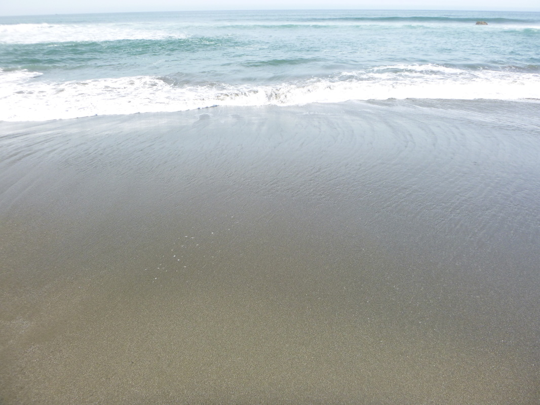
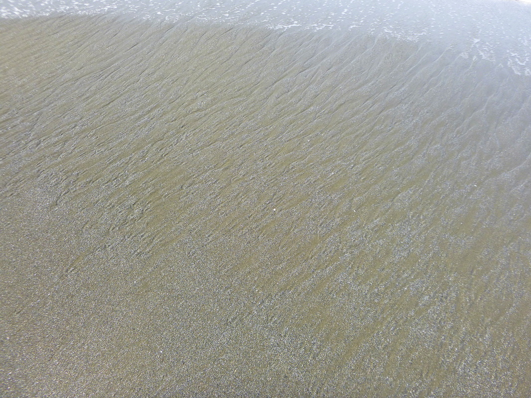
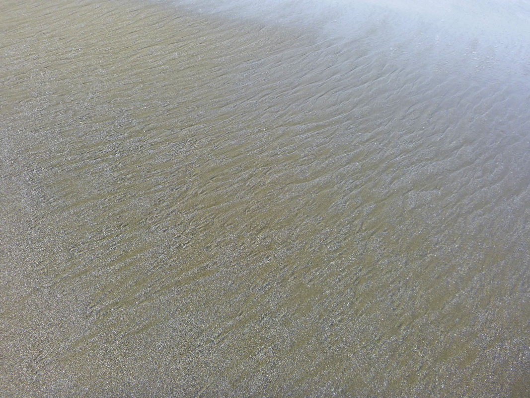
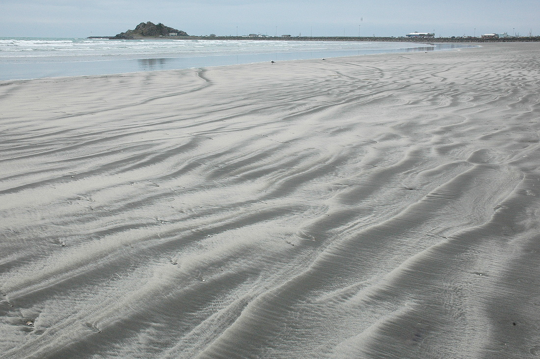
1. Rainbow Rock Beach, Brookings, OR |
|


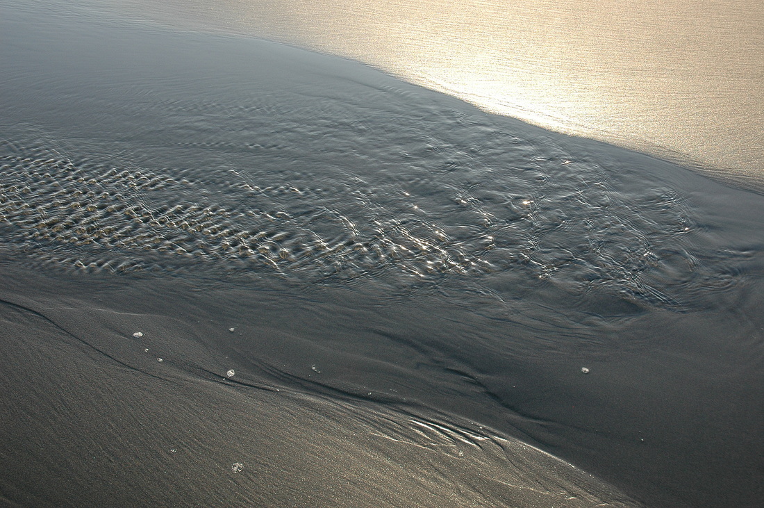
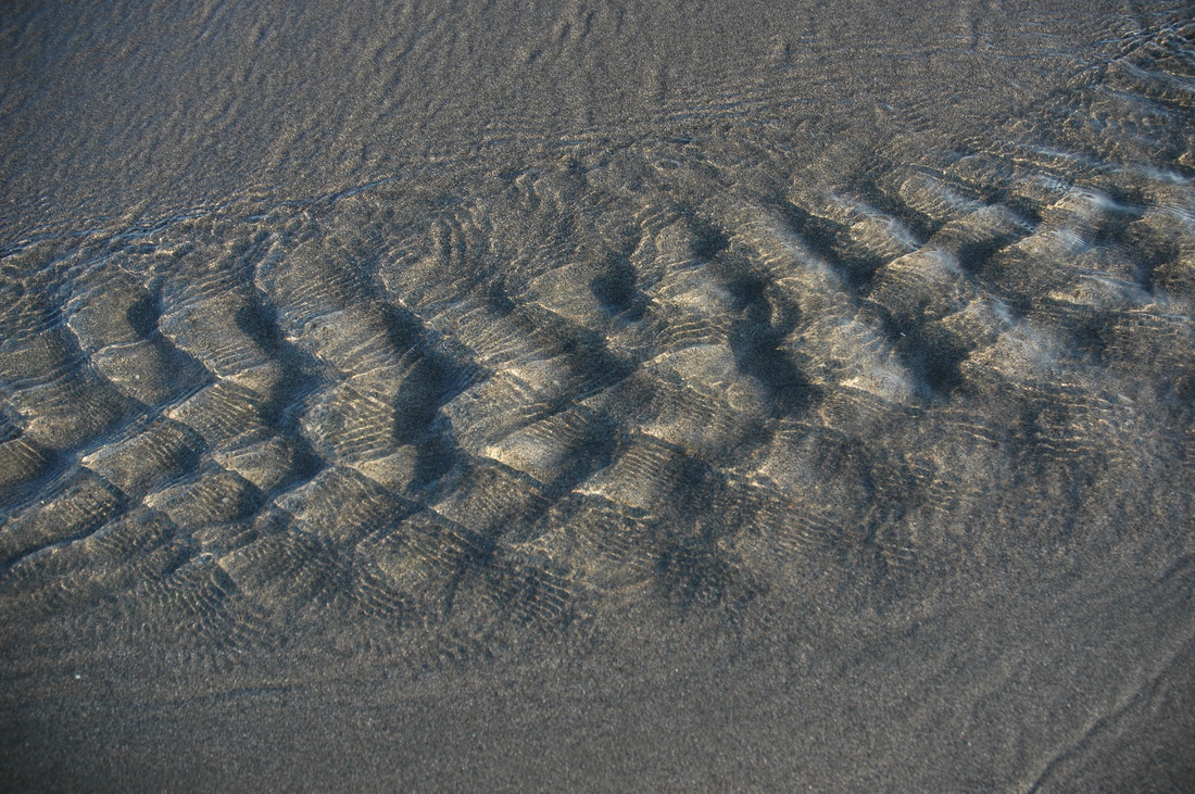
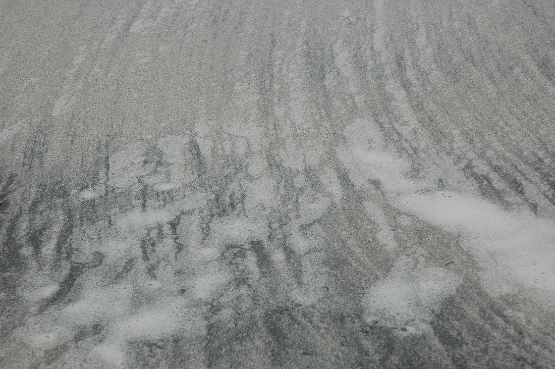
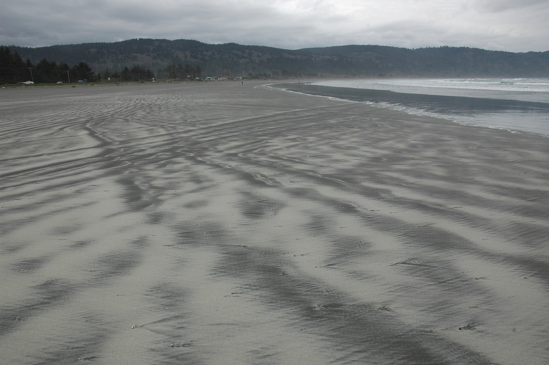
2. Crescent City Beach, Crescent City, CA


3. Beach at Mouth of Pistol River, Oregon
|
|

|
|
|
|
|
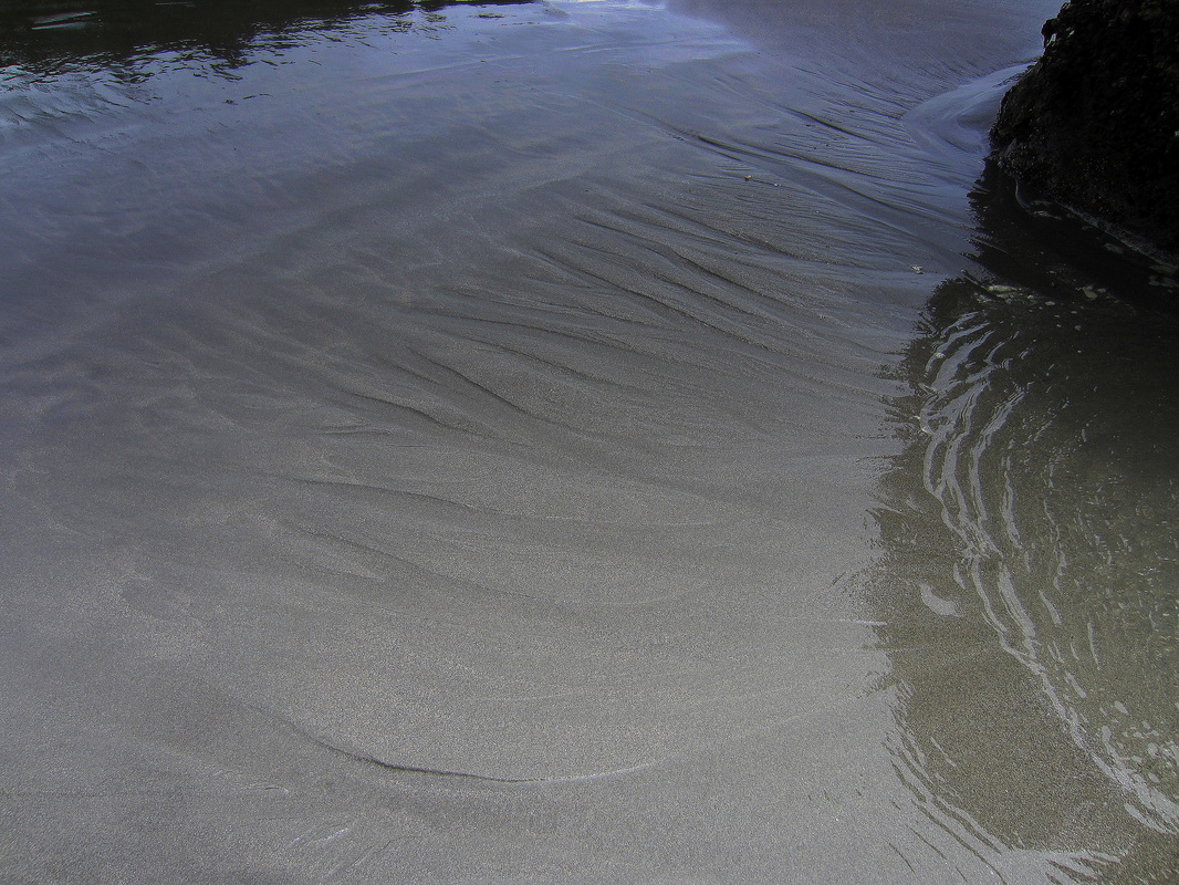
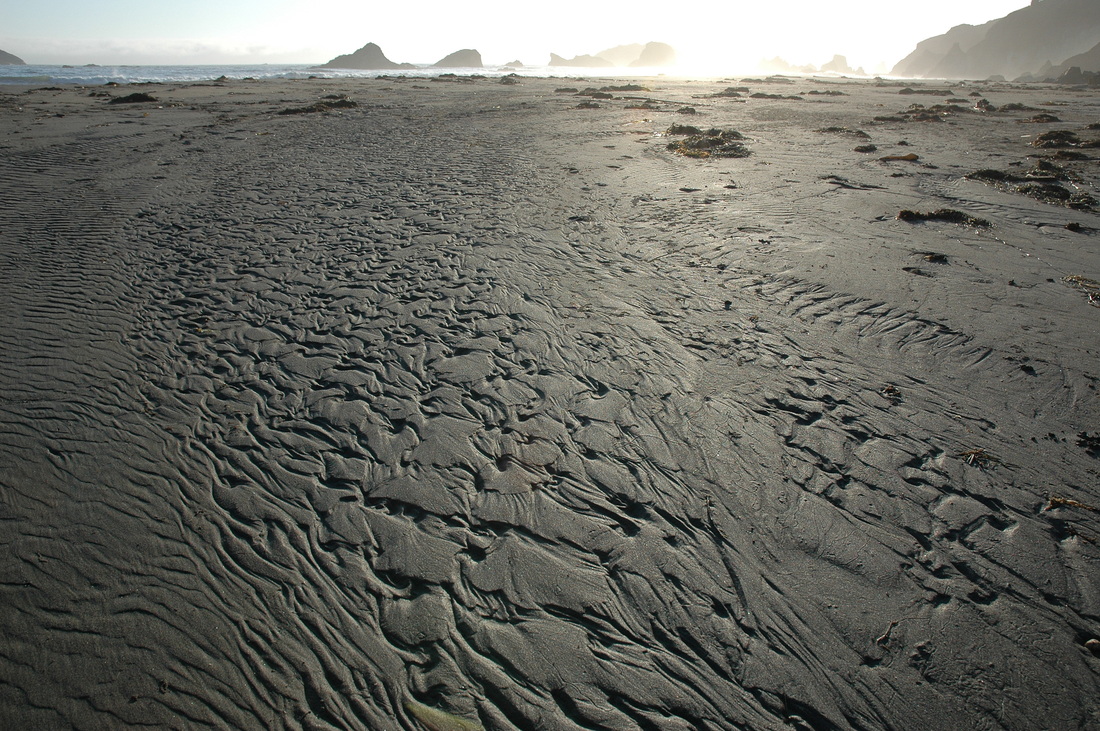
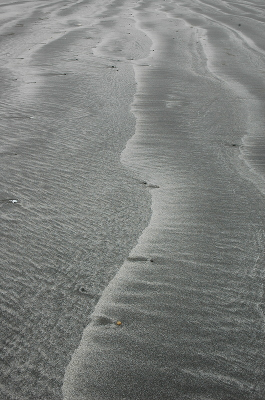
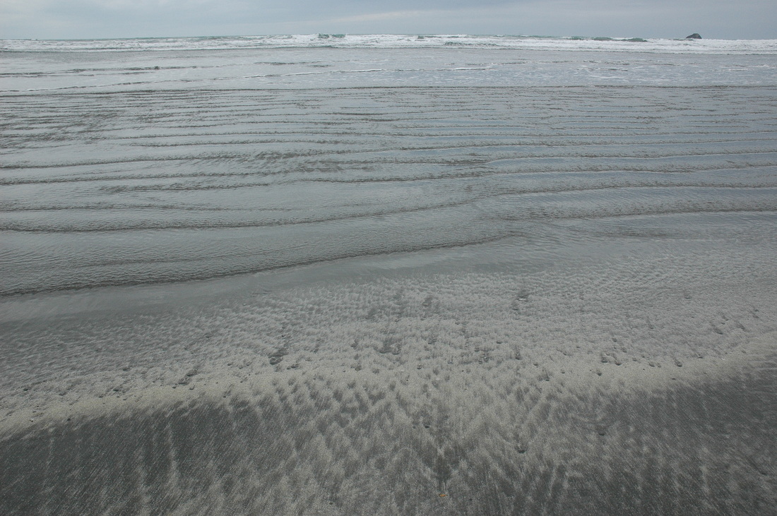
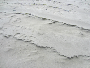
4. Mouth of Redwood Creek Beach, Orick, CA
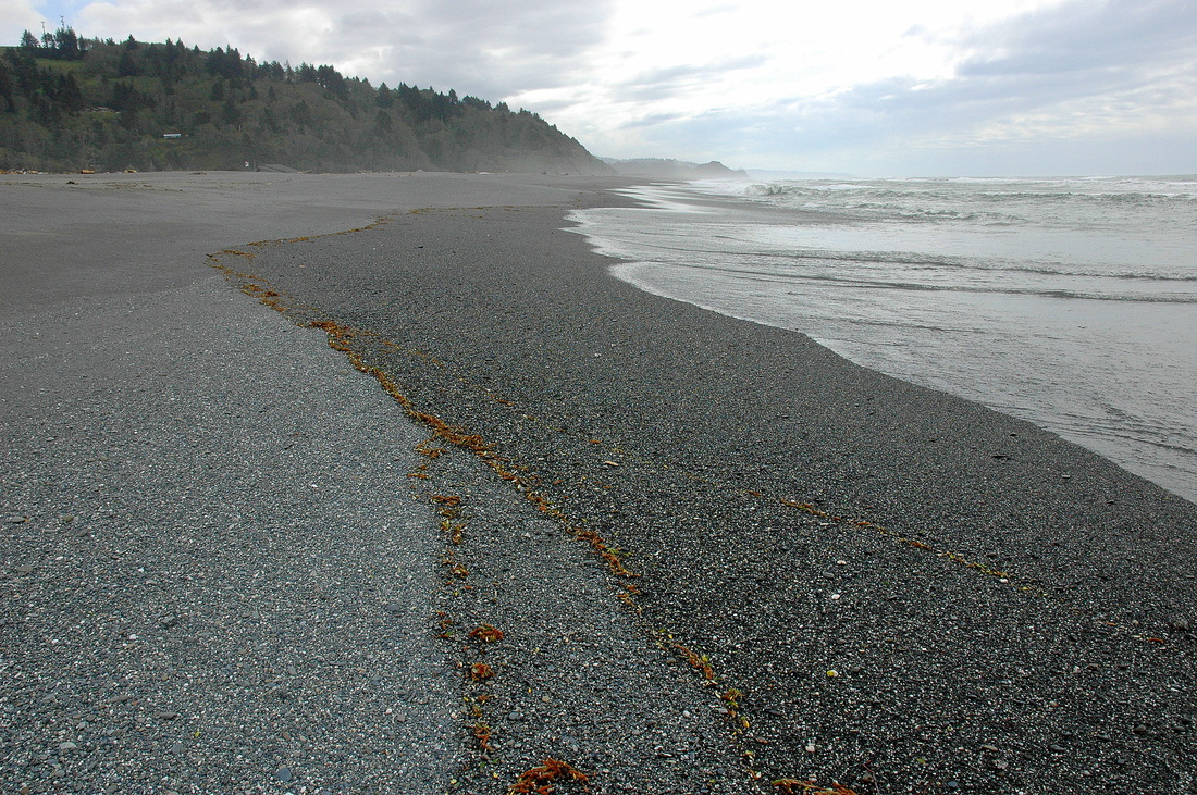


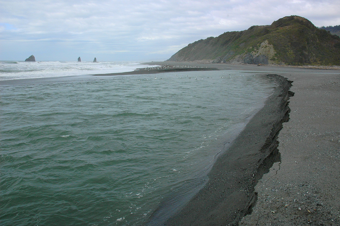
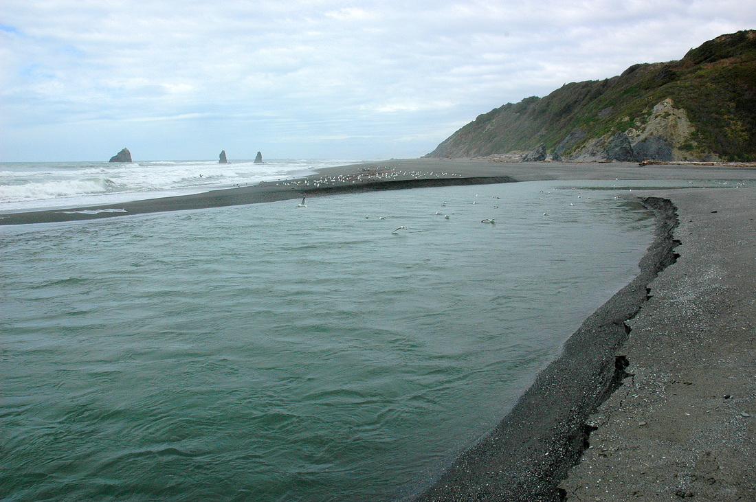
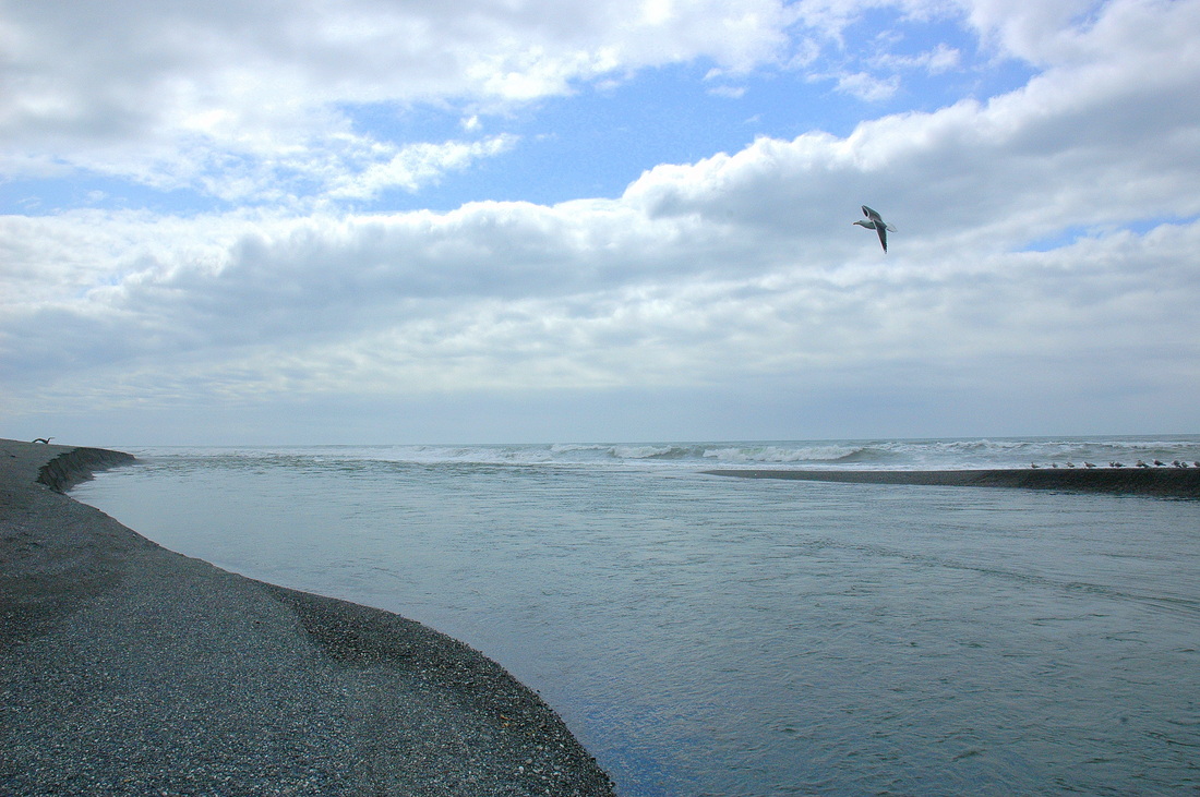
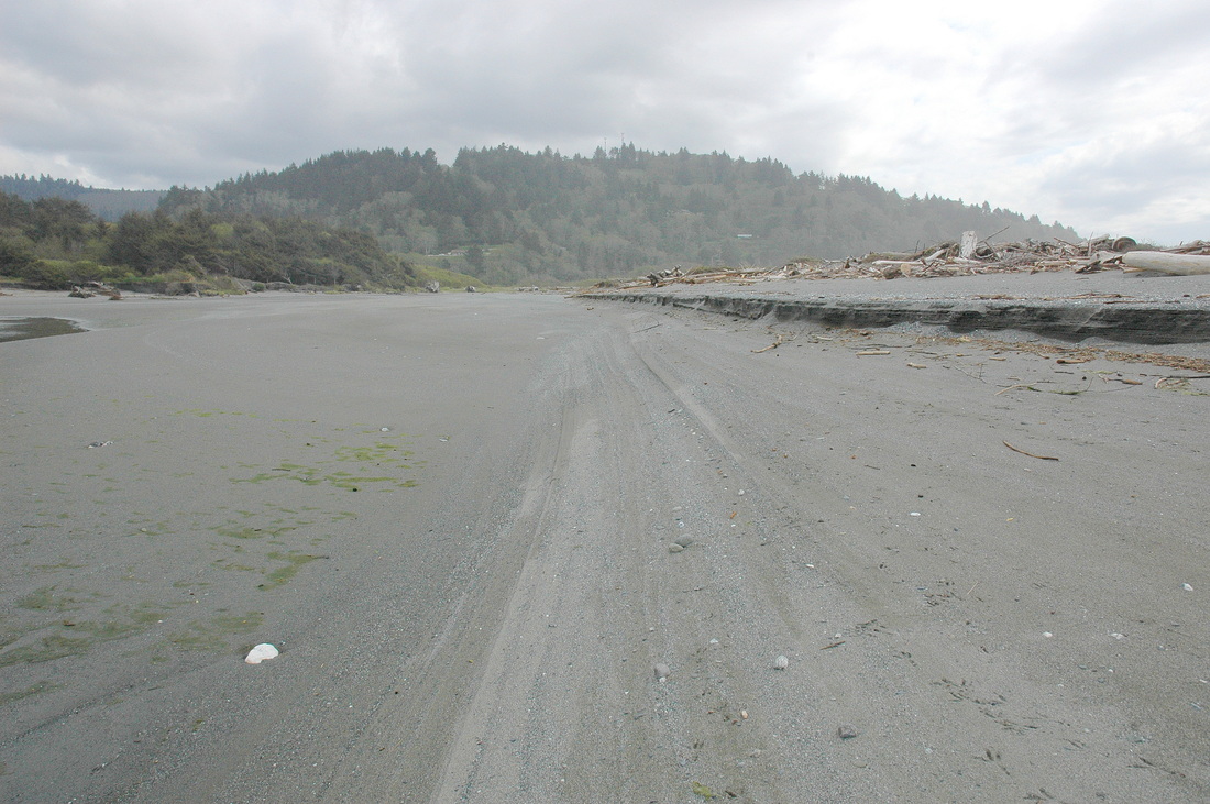
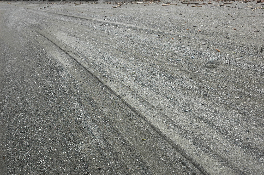
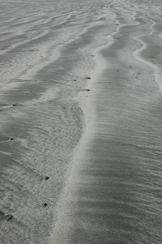
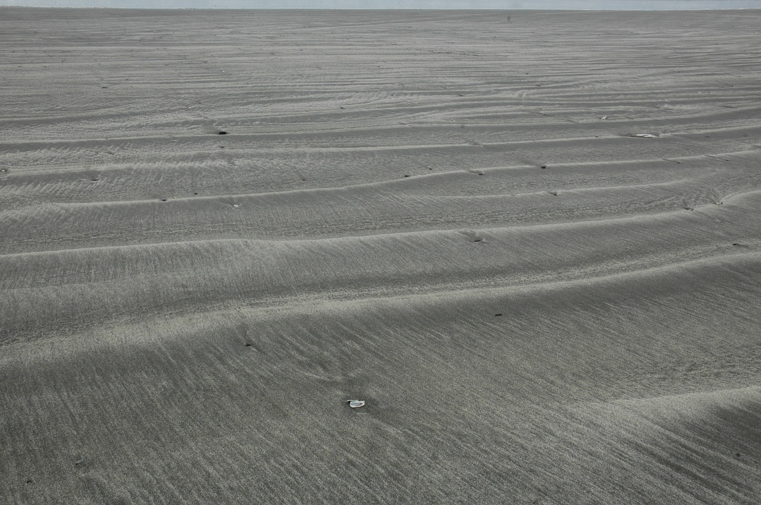
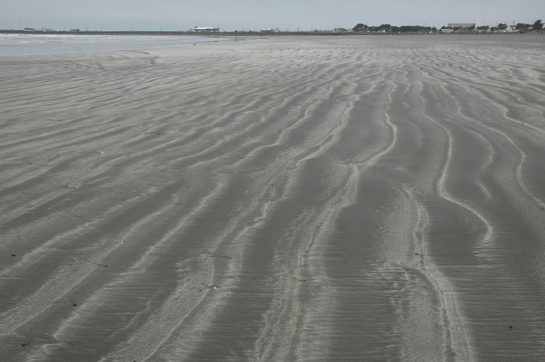
5. Freshwater Lagoon Barrier Bar Beach, Orick, CA
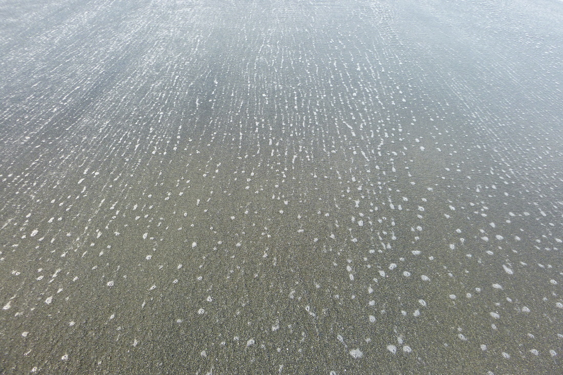
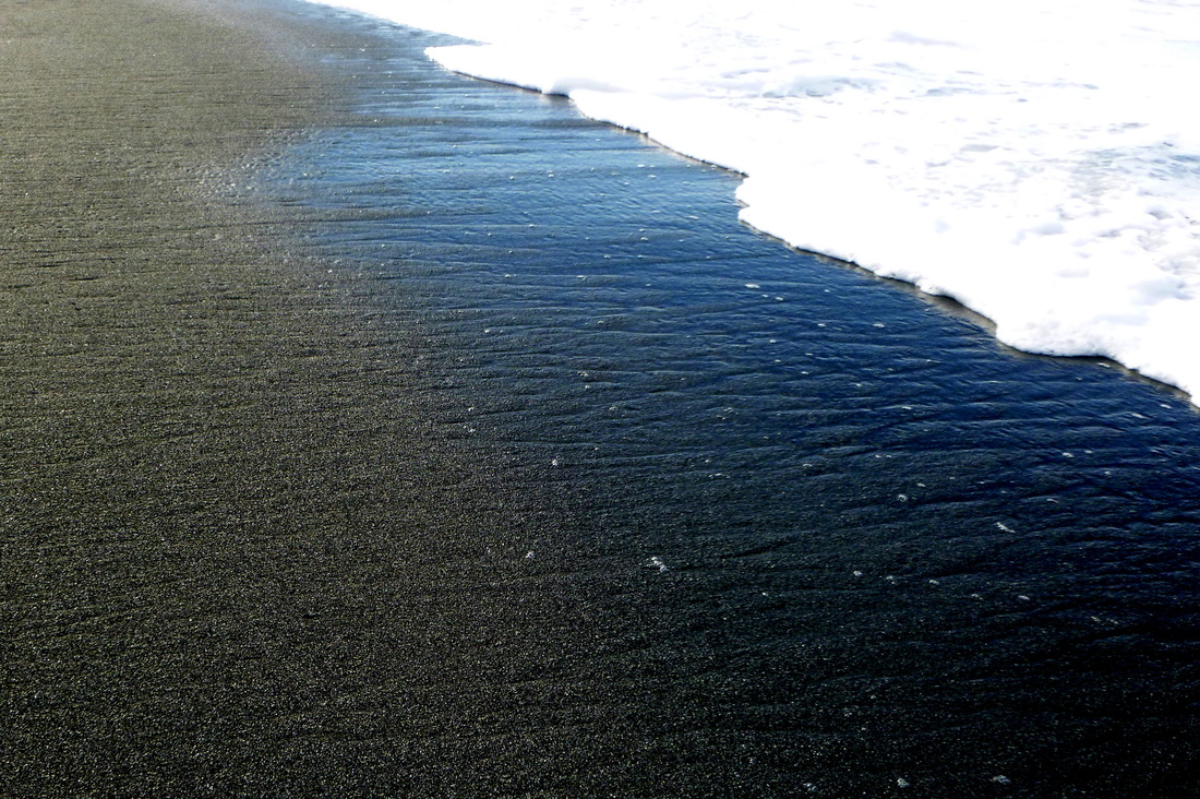
Looking south toward the headland. The beach pinches out here. During the winter, the grains are mostly coarse and very coarse, with some granules (fine pebbles). The view shows swash marks left behind during a receding tide.
|
Another south-looking view of the beach near the headland. Here swash is rushing up the face. As it stops it drops the grains it carries, leaving behind swash marks.
|
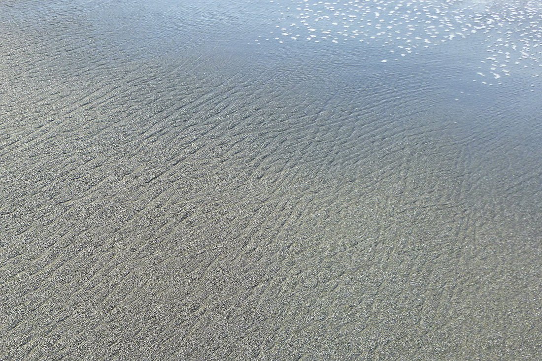
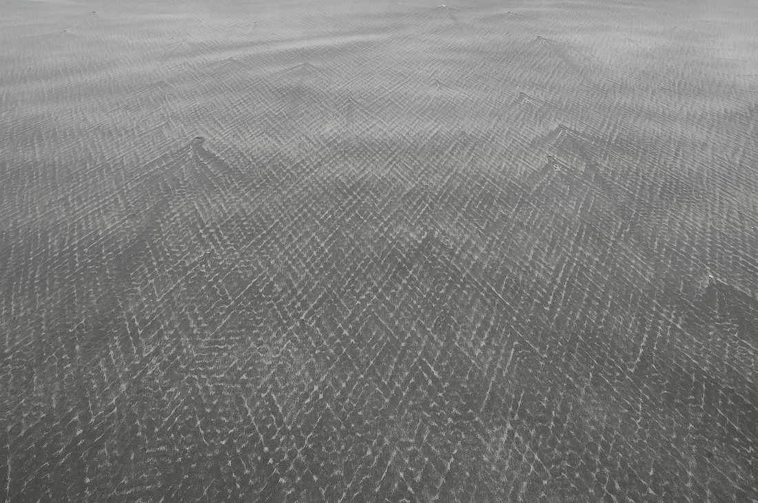
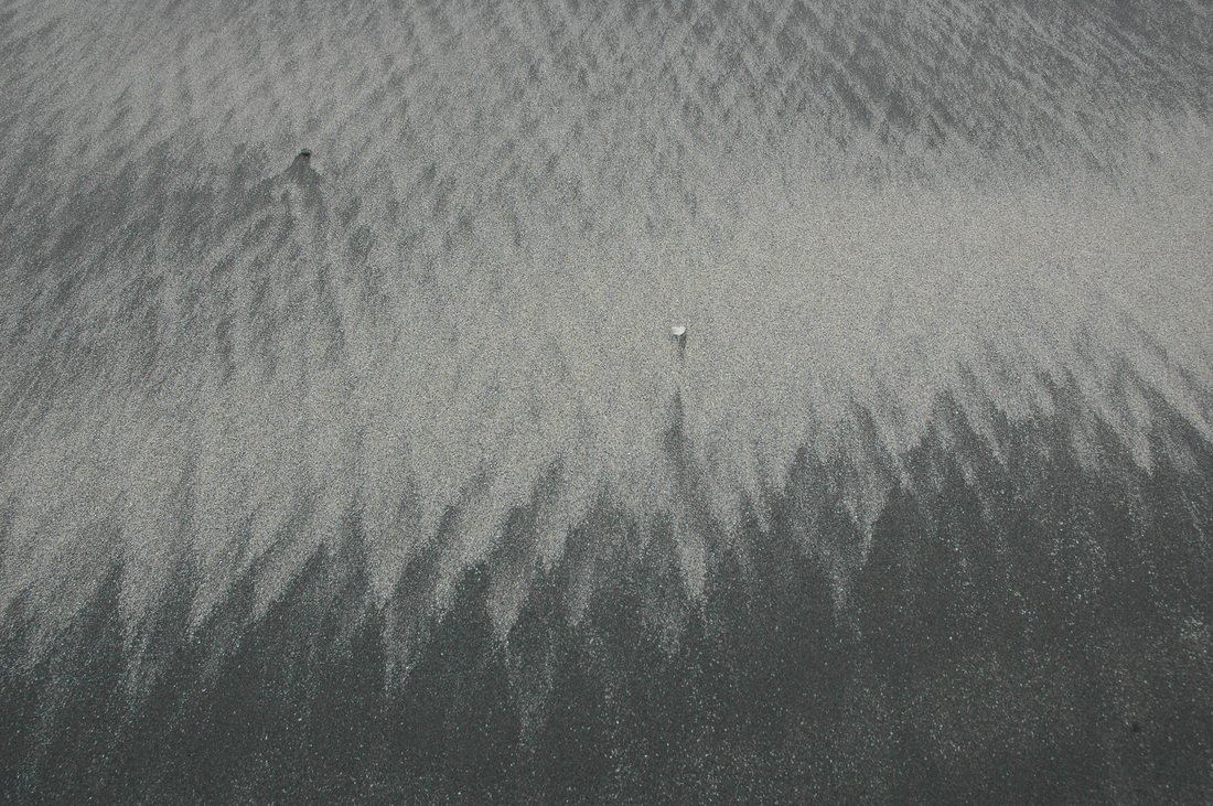
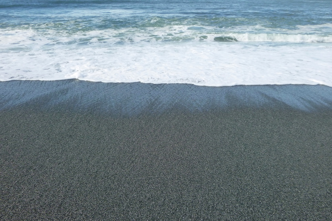
Where the beach is flattest, back swash creates rhombohedral ripple marks. They are difficult to photograph with high sun, but become striking when low-angle sunlight falls on them. The water ran from lower left to upper right (the bubbles are nearest the surf).
|
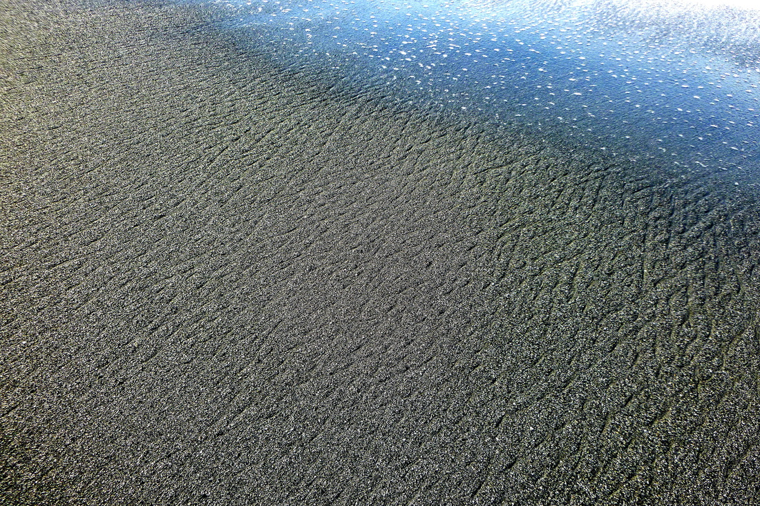
Early in the stage of rhombohedral ripple mark formation. There are a few just forming in the foreground. The bubble trails lead toward the surface.
|
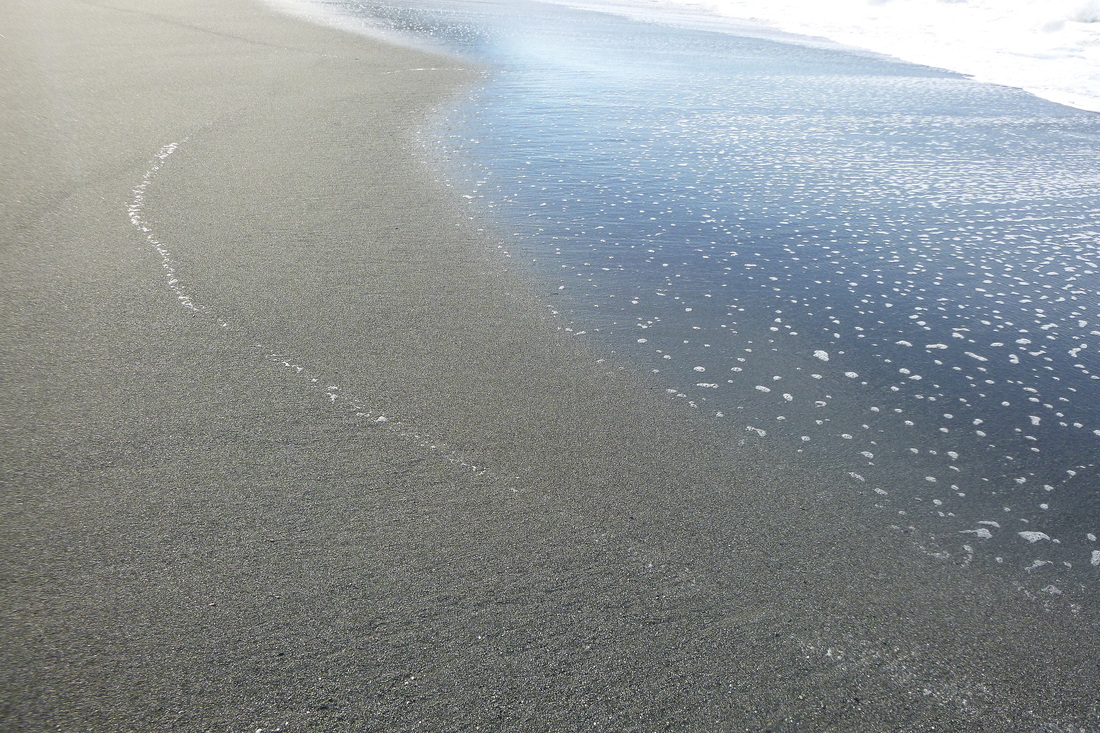
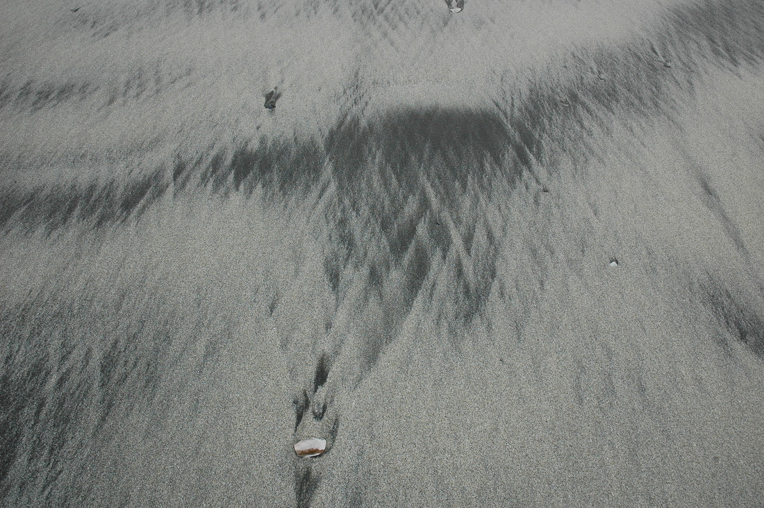
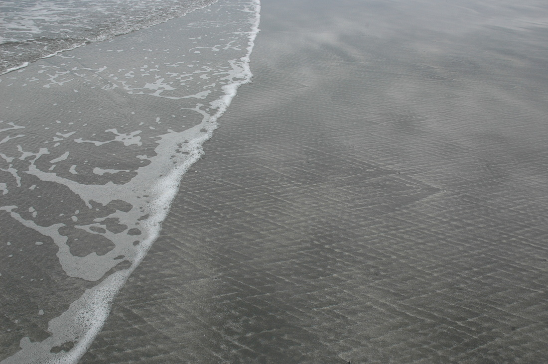
This image has it all. In the left foreground are remnants of poorly defined rhombohedral ripple marks. The white arc of bubbles defines the last swash mark. The trail of bubbles leading to the surf are the last part of the back-swash, the part that makes the ripple marks.
Here is another darkened photo to show the texture of the rhombohedral ripple marks in coarse-grained sand.
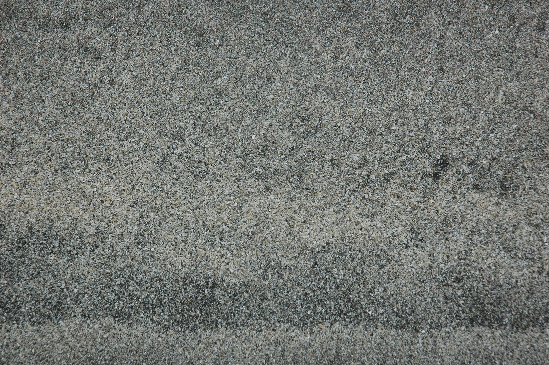
Here is a macrophotograph showing granules (fine pebbles), very coarse grains, coarse grains, and a few medium grains. Coarse grains are most abundant where the wave energy is the highest because the finer grains are carried away.
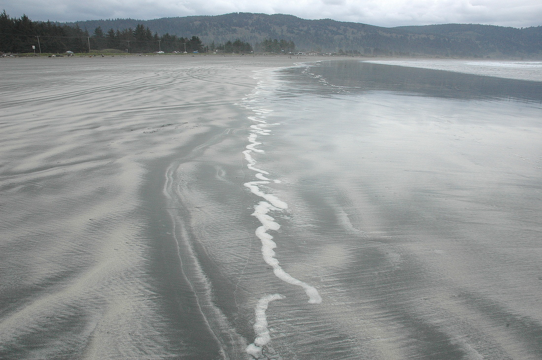
Looking north along the face of the Freshwater barrier bar beach. The mouth of Redwood Creek is in the distance (see photo set in the gallery).
|
Here I've darkened the image to better illustrate the texture that develops in the deepest ripple marks. The in-rushing swash will erase them as it passes over the sand.
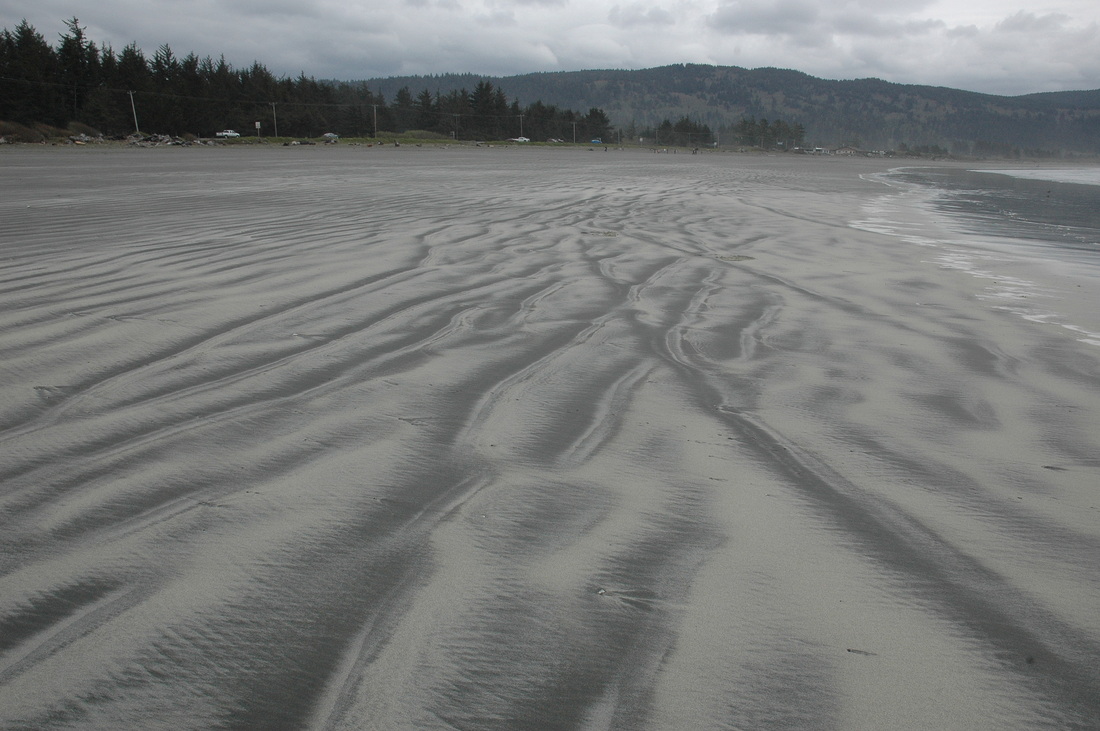
Here's a view looking about due west, straight down the beach. Along the beach are larger features called horns and cusps. The horns are the "high" areas between the bowl-shaped cusps. I took this view in the lower part of a cusp. I've once again darkened it slightly to enhance the marks.
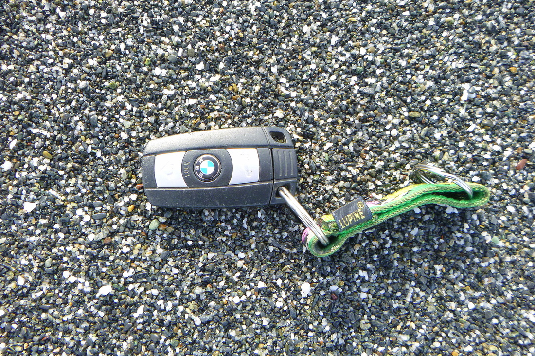
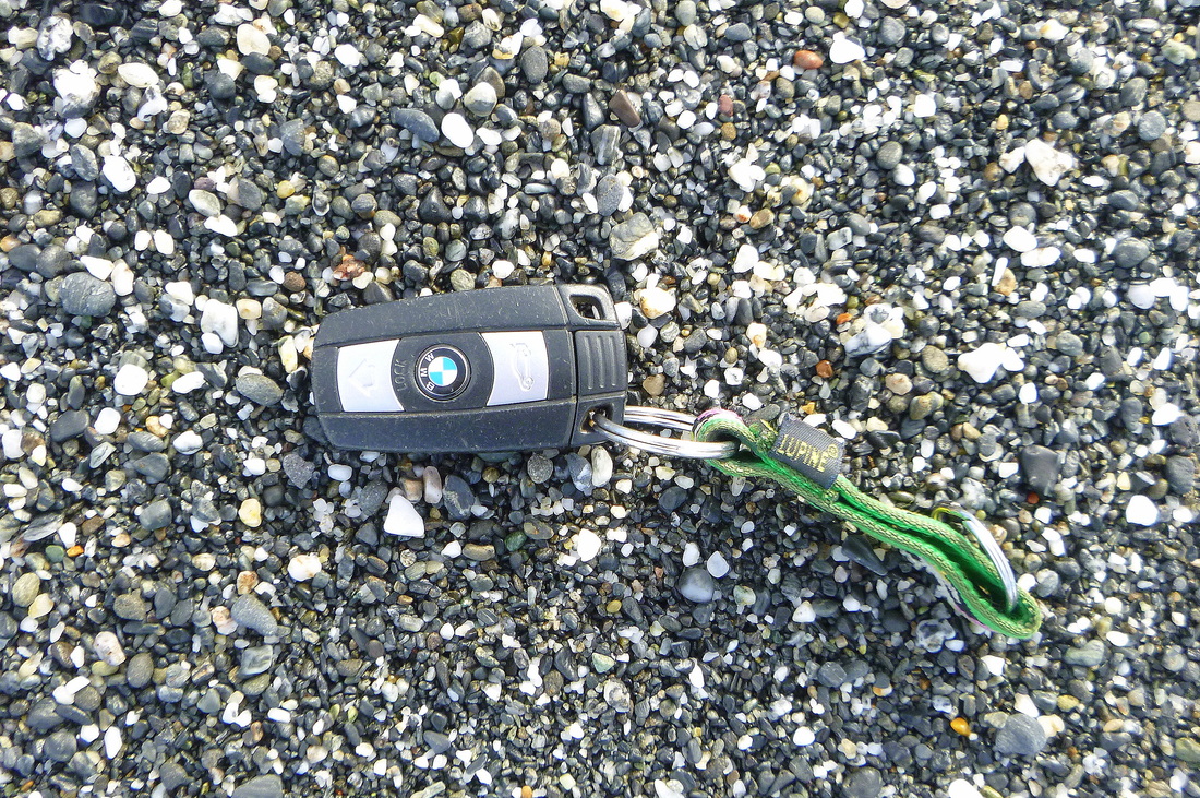
Here is the second dominant grain size on the beach, coarse sand. Lenses of finer sand are likely to be present at depth, deposited during summer conditions. The blue and white BMW logo is 6 mm in diameter.
|
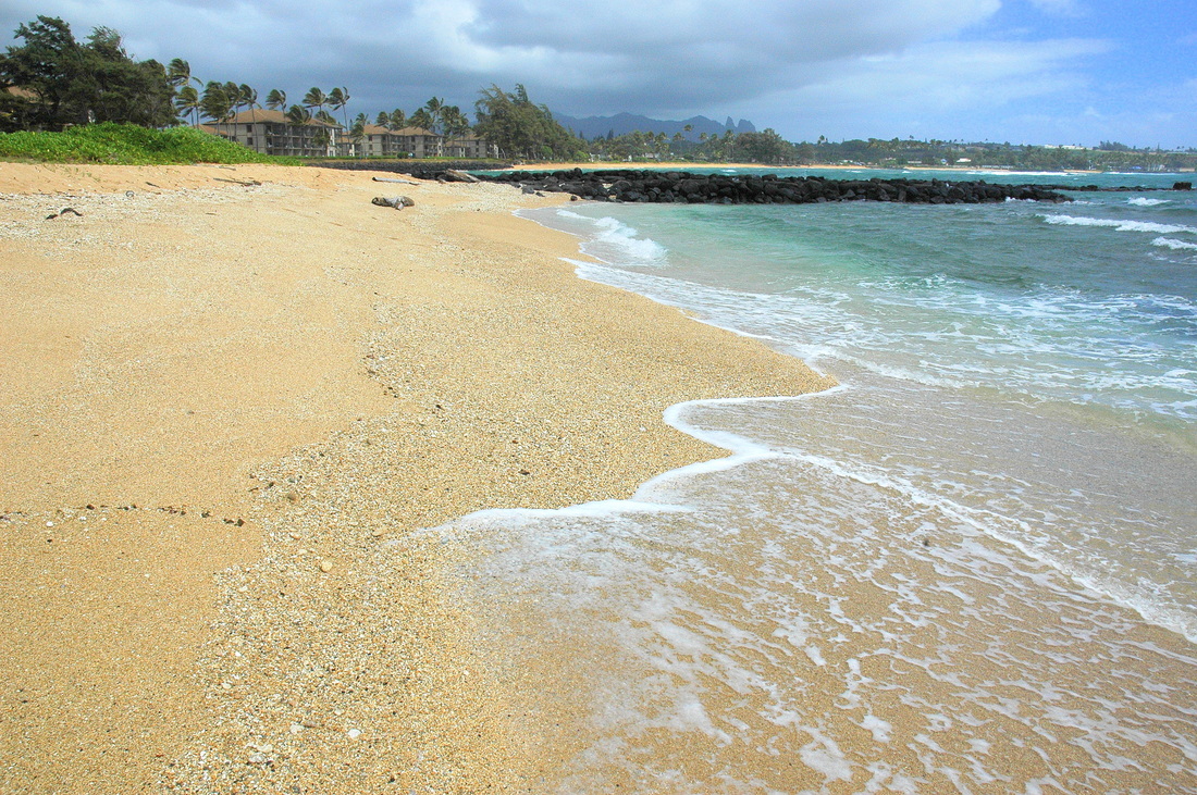
6. Kauai Beaches, H.I., U.S.A.
(More Kauai Beaches, location info, and captions to follow.)
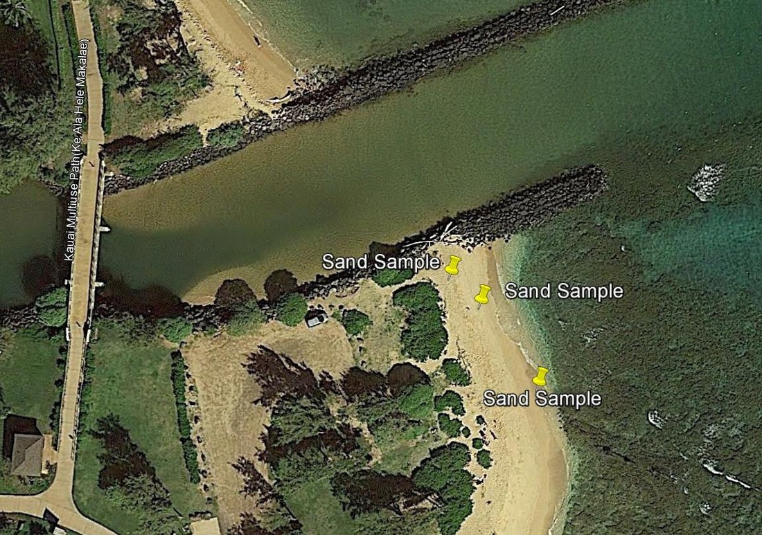
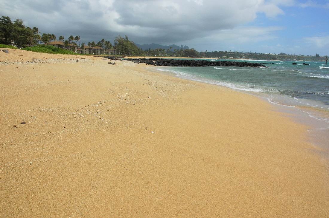
Looking north across Kapa'a Beach Park toward the basalt jetties that extend the Mo'ikeha Canal to sea. This shot shows the low part of the beach face, i.e., the typical (non-storm) condition. Note the coral fragments in the midground and high on the beach.
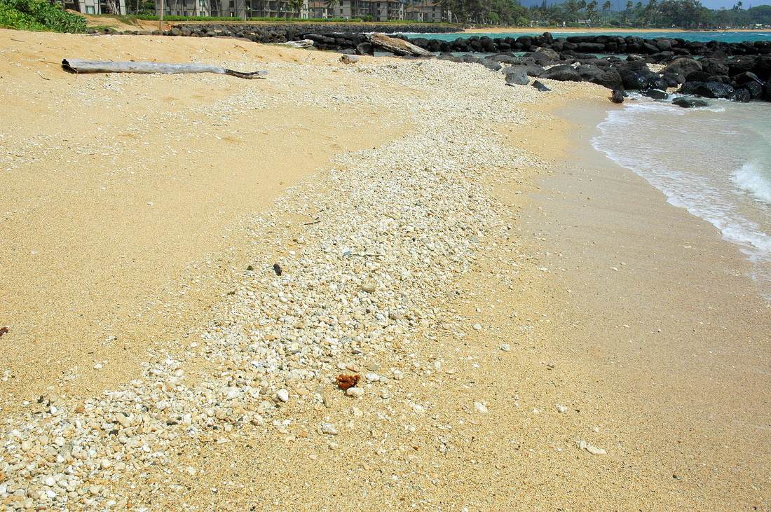
Farther north yet. Here is a winter berm...a concentration of bioclastic debris---mostly coral---washed higher up onto the berm by larger winter waves.
|
Moving north on the beach, and higher up the face, we see a coarser fraction of the beach...storm wave deposits composed primarily of coral fragments and the bioclastic debris from other organisms that spend their life in the coral environment.
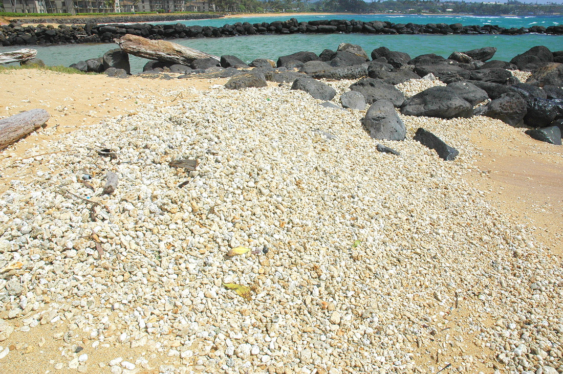
The 4th photo of 4: a winter berm composed entirely of coral and bioclastic debris rubble.
|
7. Pebble Beach, Crescent City, CA, north end


8. North Jetty Beach, Brookings, Oregon
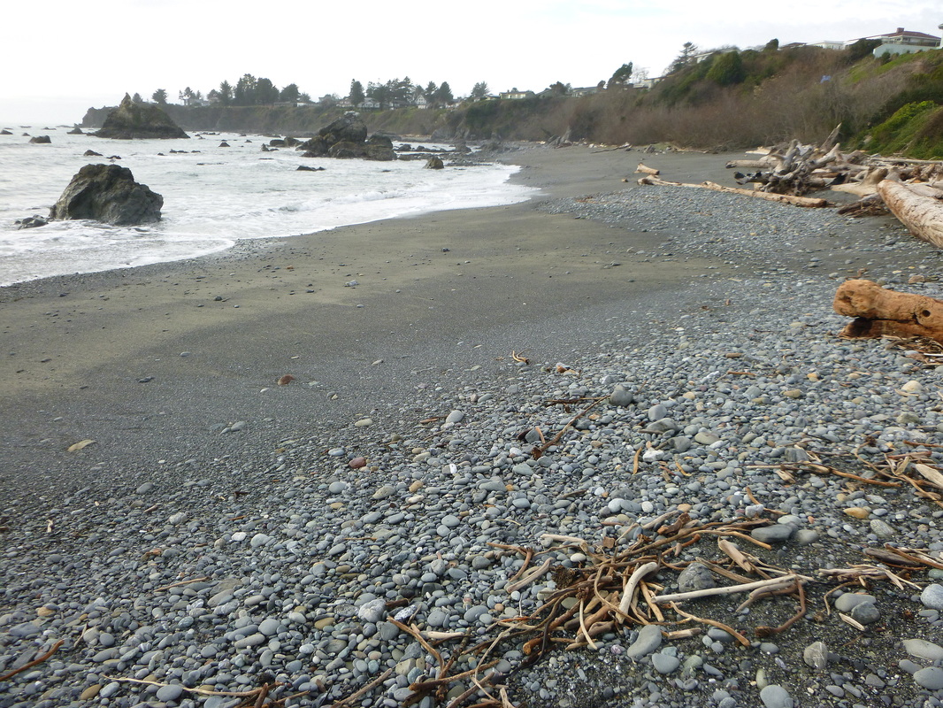
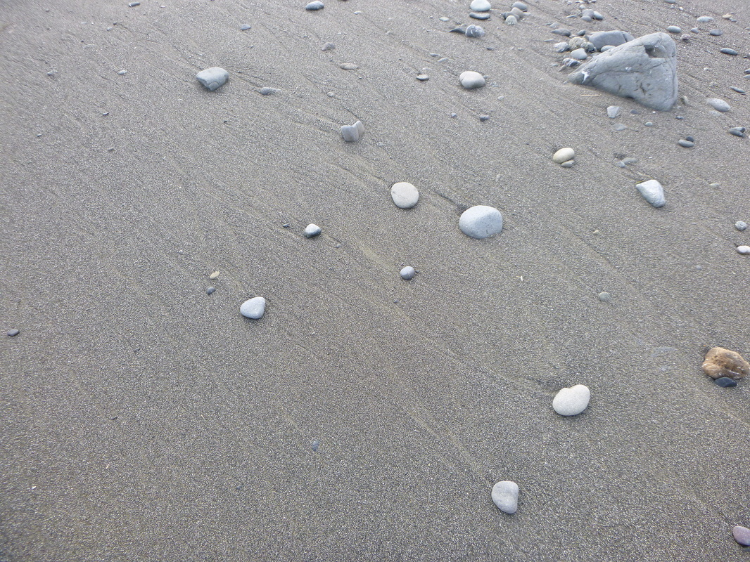
Looking upcoast (westerly) up the beach. Note the cobble horn jutting down into the face in the midground. The cobbles are high on the beach face and represent winter storm lag deposits. The light brown sand is remnant summer sand. It is mostly fine grained.
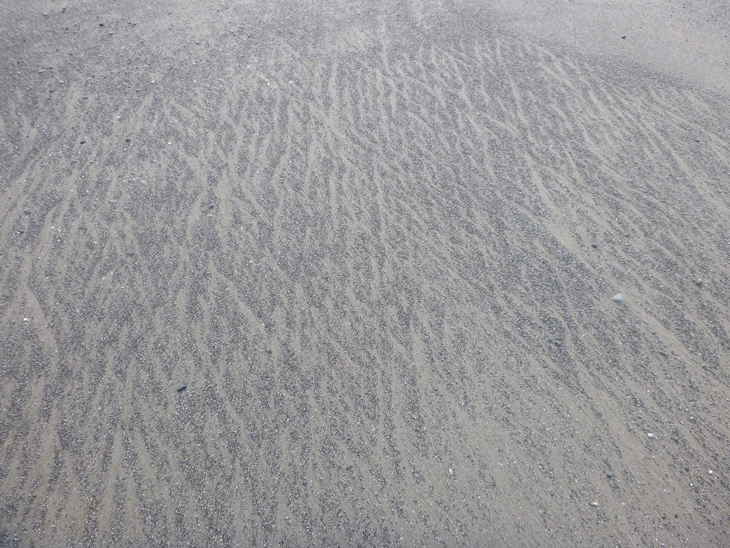
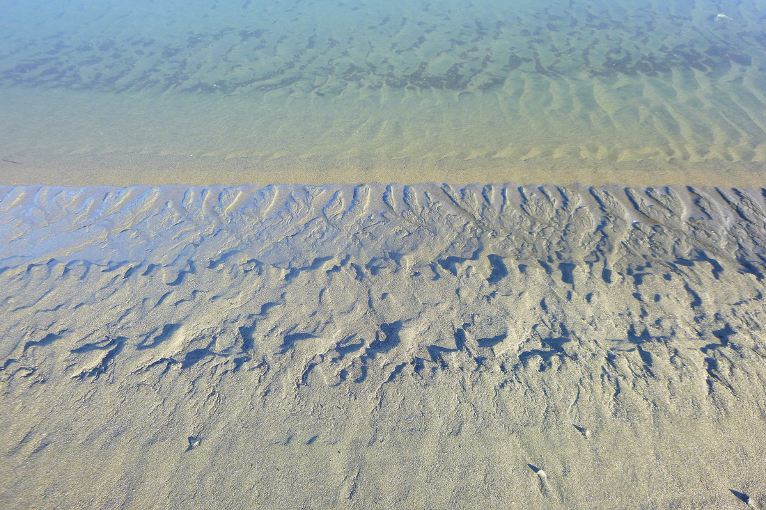
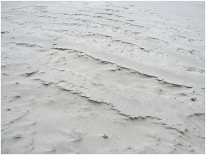
Rhomboidal ripple marks (a common photograph in many of the gallery pages). The back swash flowed over the fine sand and "through" the coarse grains veneering the beach face, creating these characteristic diamond-shaped marks. The current direction was into the photograph, toward the left slightly.
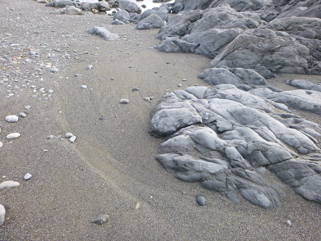
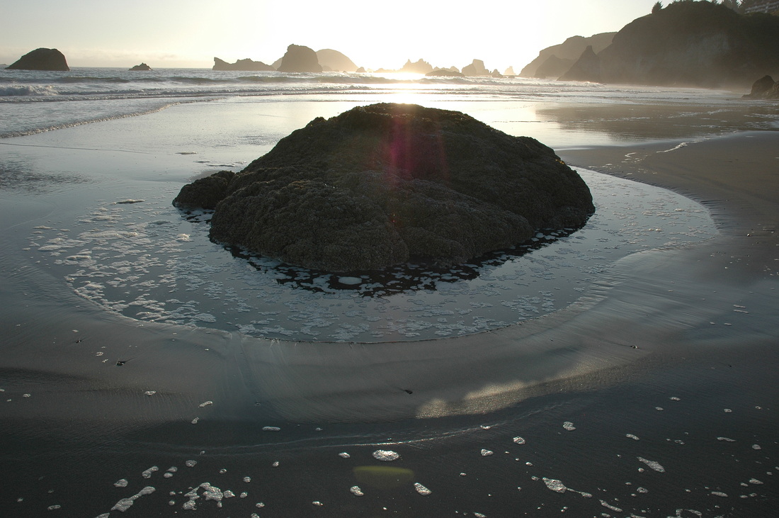
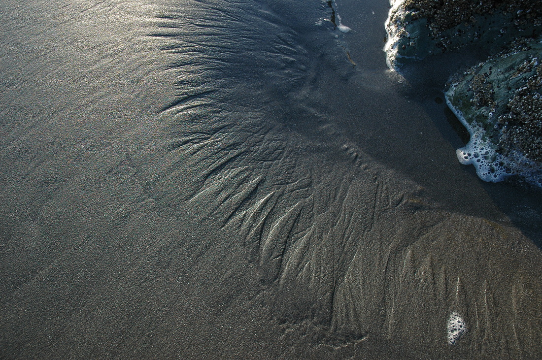
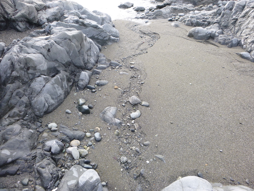
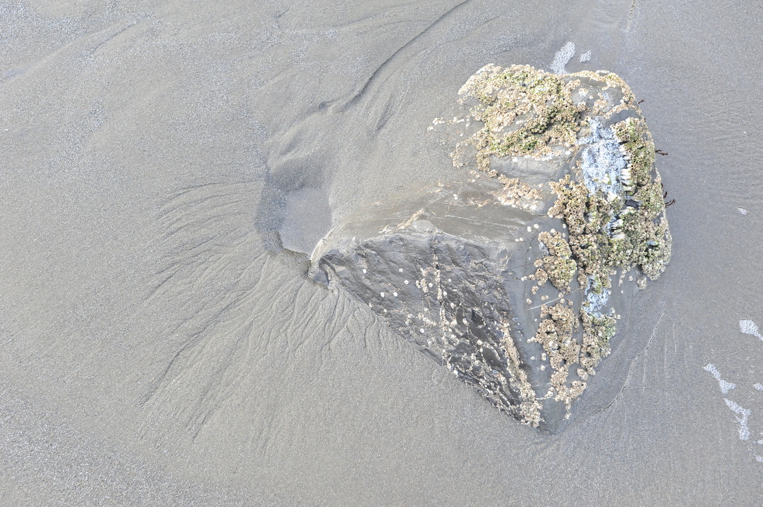
The rock (smoothed by decades if not centuries of abrasion by sand and gravel) creates an obstruction in the back swash as does a boulder in a river. The velocity of the back swash increases as it flows around the rock, allowing the water to scour deeper. Notice that the only clasts near the rock are cobbles. The fast-flowing back swash has moved the gravels seaward.
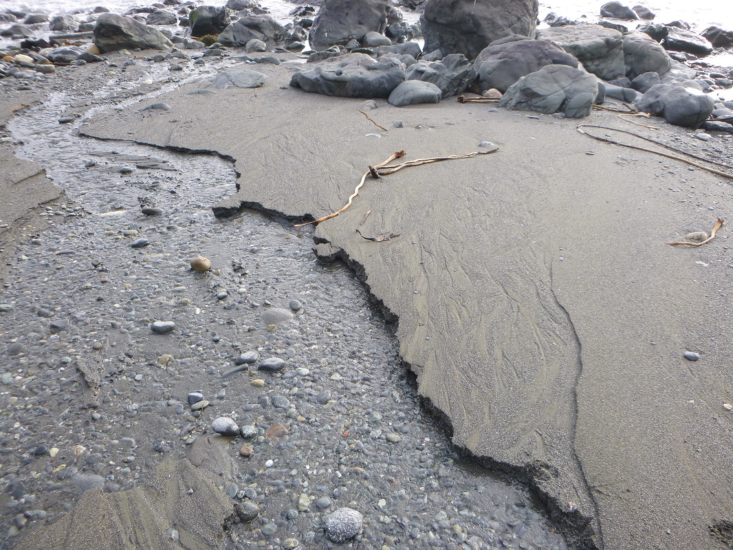
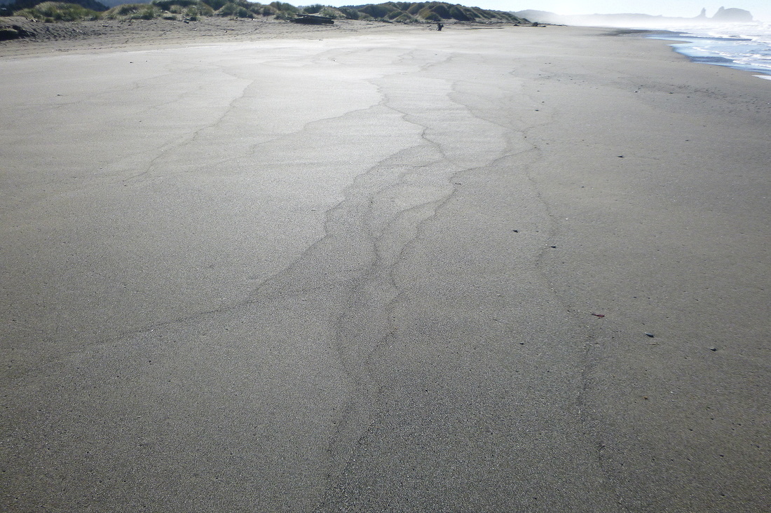
Looking seaward down an area being eroded by groundwater from a stream emerging from the base of the bluff (behind the photographer). When the tide was higher, the stream created distributary channels (braided) in the well-graded (fine to coarse) sand. As the tide dropped, the stream down-cut into the deposit it had created only hours before. This feature is a nice model for what happened as sea levels dropped following the last Ice Age glacial maximum. I.e., as sea level dropped, streams cut down into deposits they or the ocean left behind when sea level was higher.
|
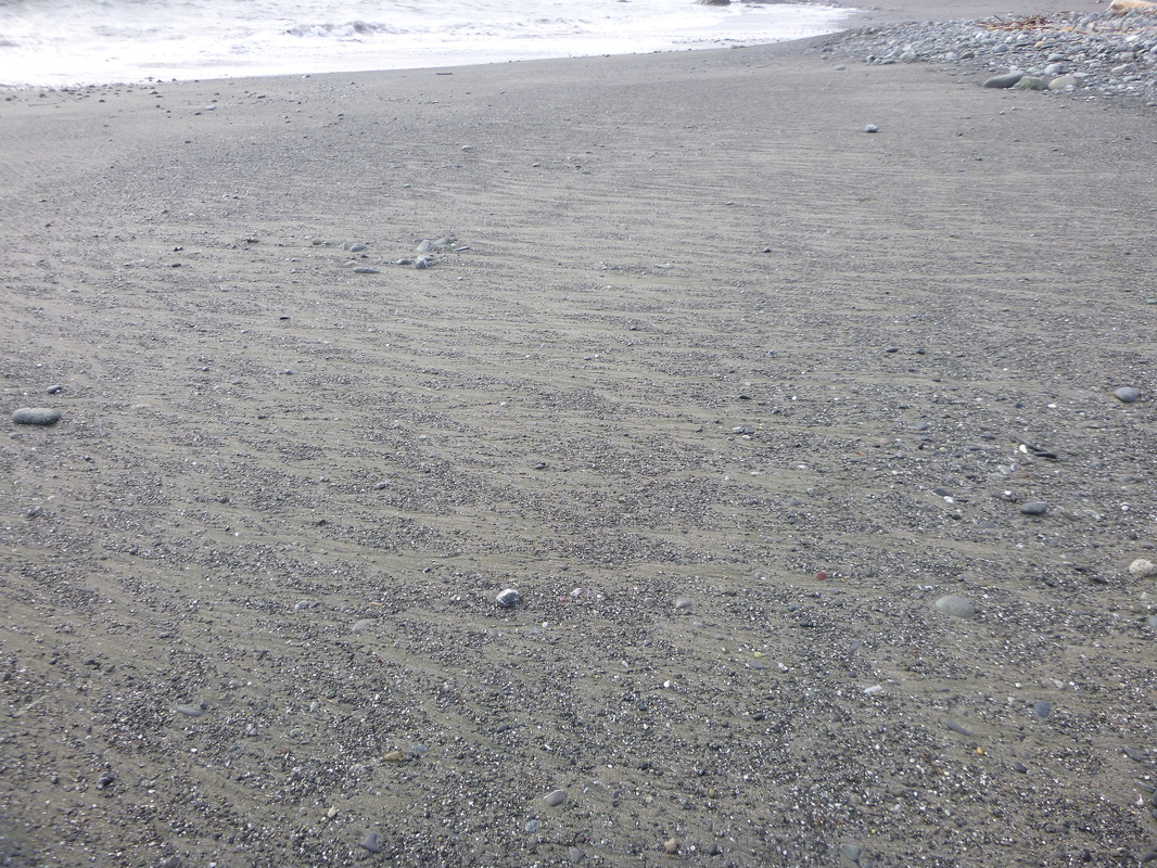
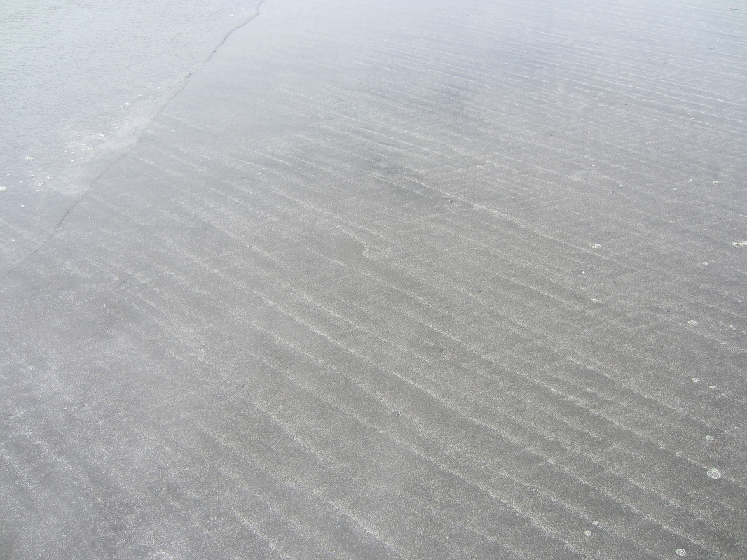
Looking upcoast (westerly) across the lower part of the face visible in photo 1. The brown sand is fine, remnant summer sand. The coarse sand and fine gravel is the "stable" grain size for the winter beach. The winter waves are stripping the fine brown sand off the beach, moving it offshore, leaving the coarser grains on the beach. In the background is a "horn" (protrusion into the face) composed of cobbles and gravels.
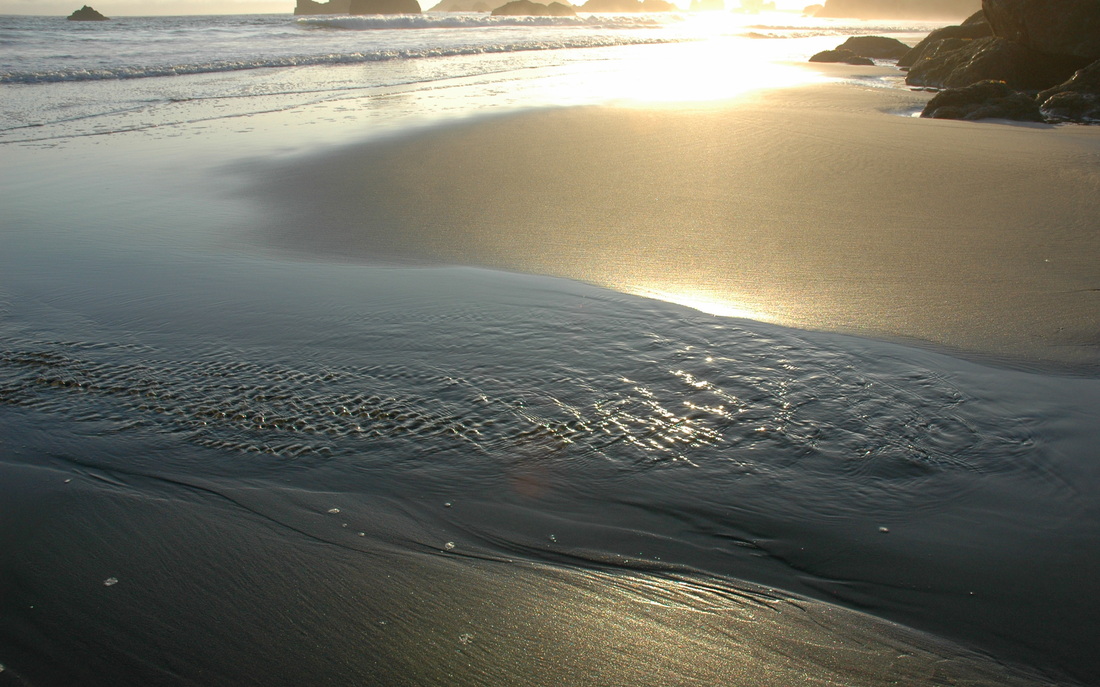
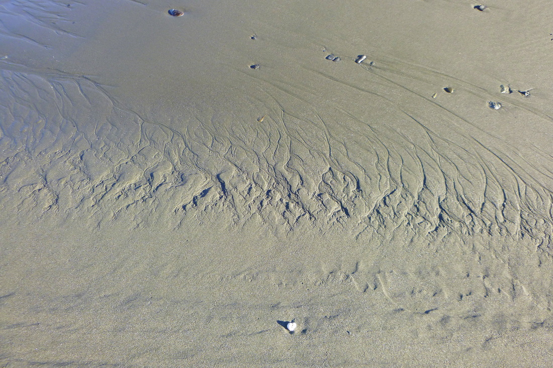
Scour marks or crescent scour marks. The current that made them (a back swash) moved from left front to right rear.
Here, concentrated water draining from the toe of the bluff has eroded a channel into the otherwise smooth sand. That is, this is an erosion feature.
A close up of the braided channels of the distributary system of the photo to the left.
|
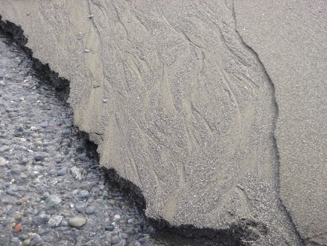
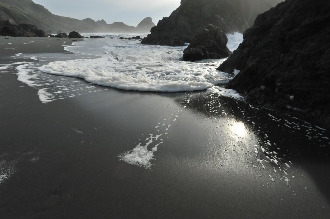
9. Sisters Rocks - Pigeon Point, Oregon

|
|
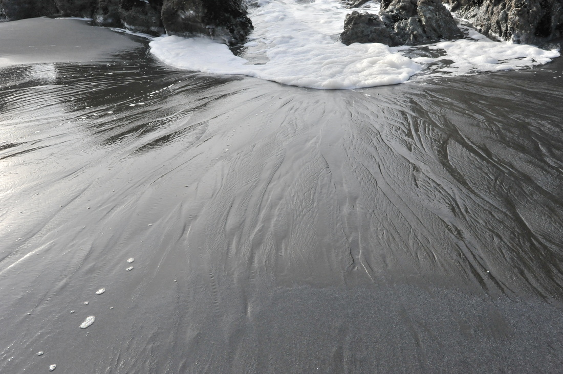
10. Nesika Beach, Oregon
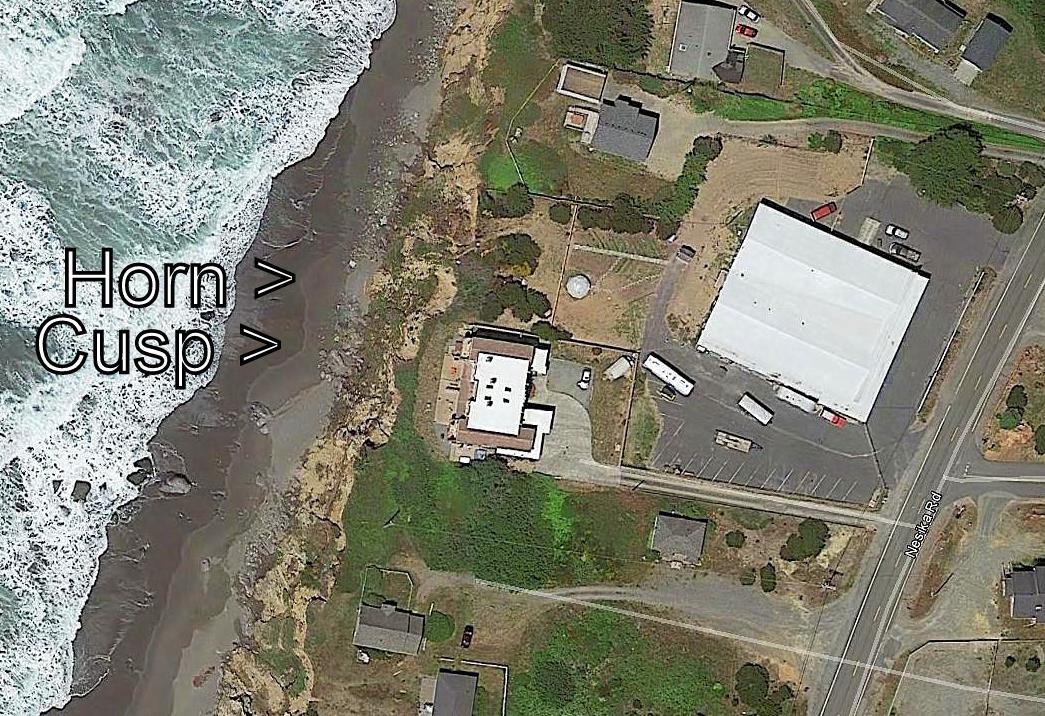
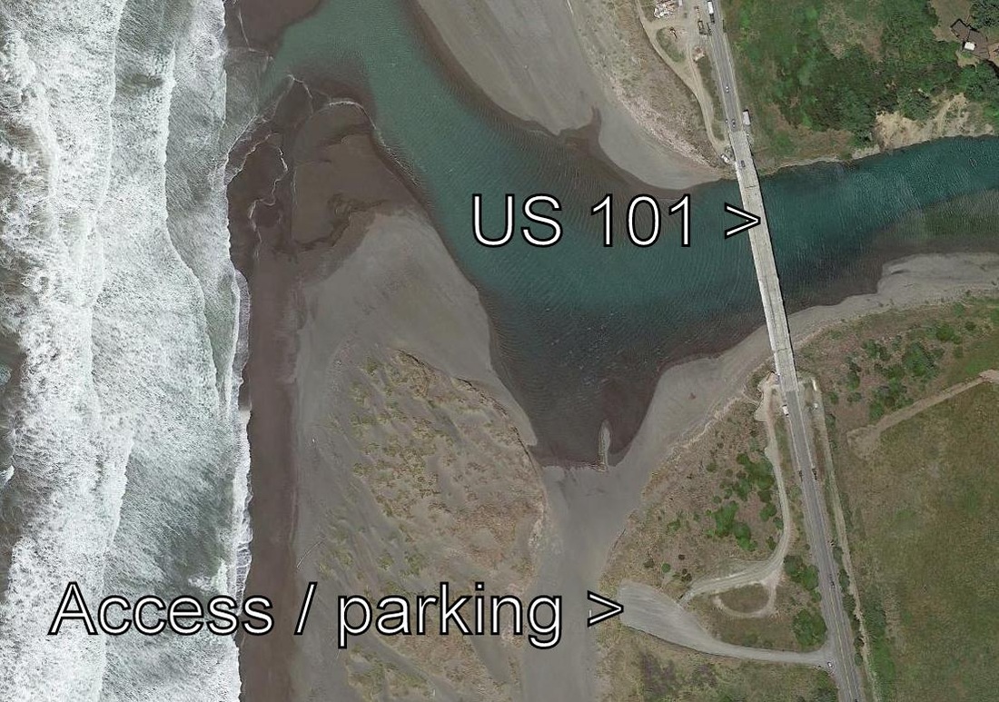
This Google earth photo shows the portion of the terrace edge, bluff top, and beach near the north end of Nesika Beach where Nesika Road turns to meet US 101. A "horn" is a mound-like beach face feature that is convex (protrudes) seaward. A "cusp" is a concave feature. Onrushing swash tends to focus into the cusps by deflecting off the sides of the horns. Since the beach was a steep winter beach when I took the following photos (in early March, 2015), the normally straight sided rhombs formed by the backwash are curved. I was pressed for time and had the wrong camera, but the following photos give the idea. Compare with photos of rhombohedral ripple marks from other beaches.