Contact Information: Click on "Home" and fill out a Contact Form, email [email protected], or phone 541-469-7300 or FAX (541-469-2903) the Harbor, Oregon, office. Please send administrative inquiries to [email protected].
This page last updated 7/09/2017.
|
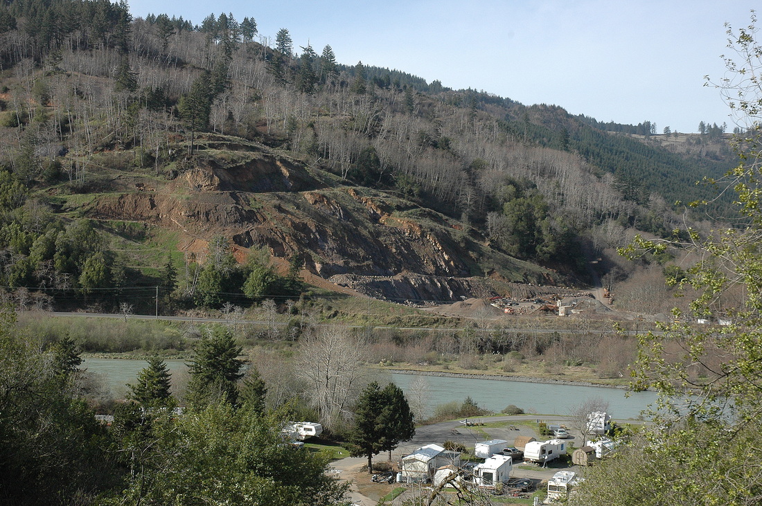
Datone Quarry, Curry County, viewed from South Bank Chetco River Road. Here the regional bedrock (the 165,000,000-year-old Dothan Fm.) is layered sandstone and mudstone that dip steeply north.
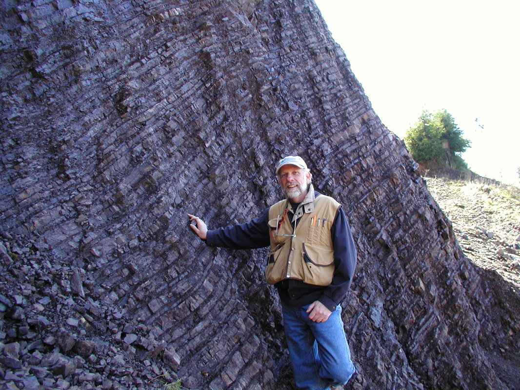
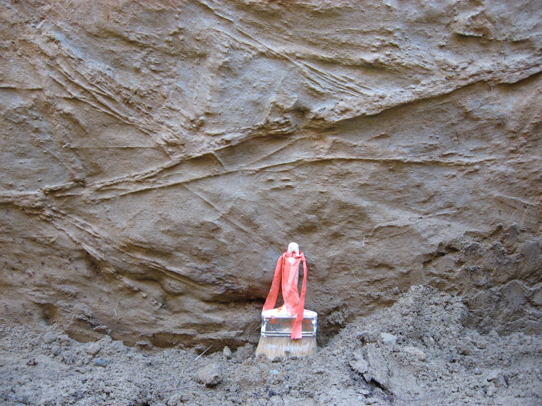
Deep-water turbidite deposits: alternating thin layers of siltstone and mudstone originally deposited as silt and mud on the abyssal plain, then drug down into the earth in a subduction zone, then uplifted. Lobster Creek Quarry, Gold Beach, Oregon. BGC Principal Bob Busch.

Getting ready to pour a slab-on-grade over "tricky" soils, south Eureka, CA.
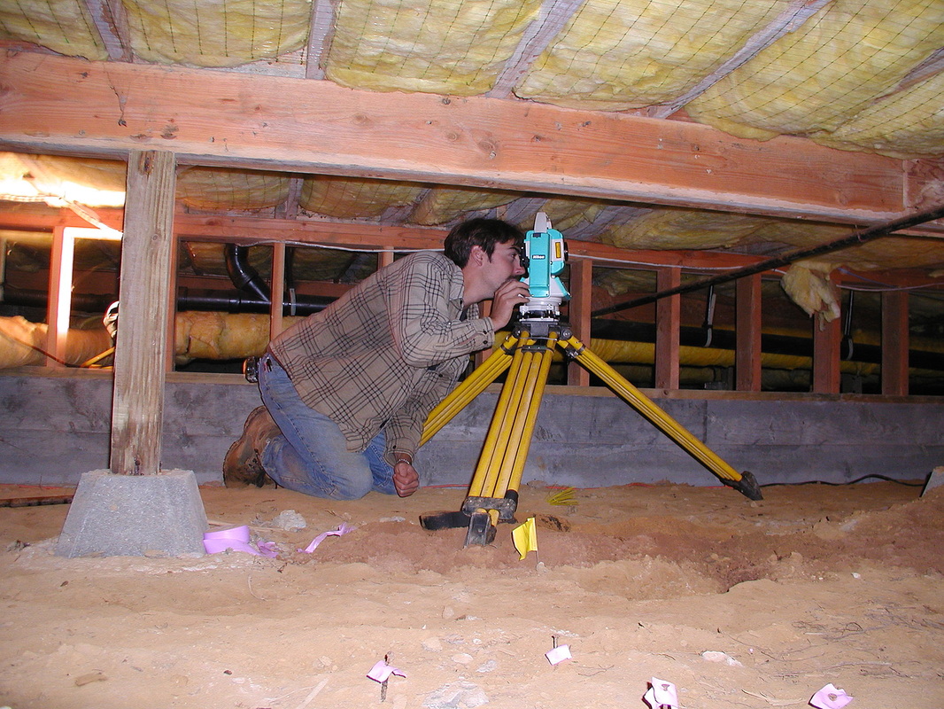
Former staff engineering geologist Beau Whitney using a total station to survey ground cracks in the crawl space of a home on Harris Street in Eureka, CA. The home was constructed on a deep sand fill that settled dramatically.
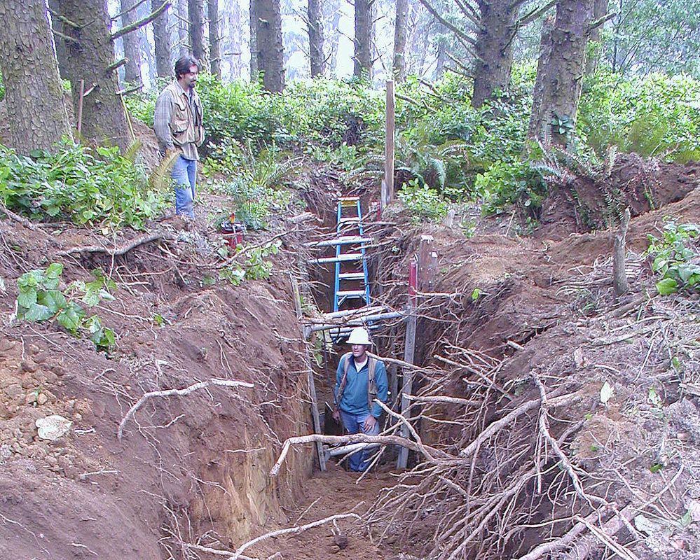
Former BGC engineering geologists Beau Whitney (left) and Steve Bacon working a trench excavated through ominous ground warps on a bluff-top homesite near Crook Point, OR. A setback was in order.
An active head scarp on a recently graded slope in the Bald Hills Road (Pine Creek) landslide, Hoopa, CA. BGC geologists have worked on this landslide for many years to support stabilization efforts by the project engineers.
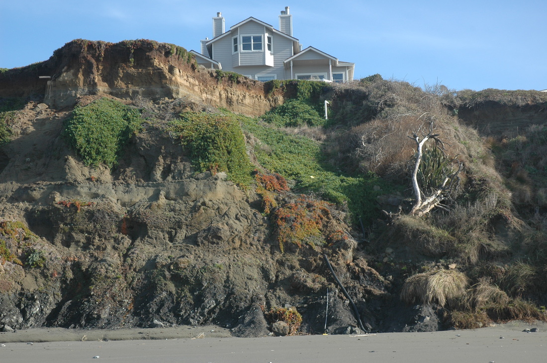
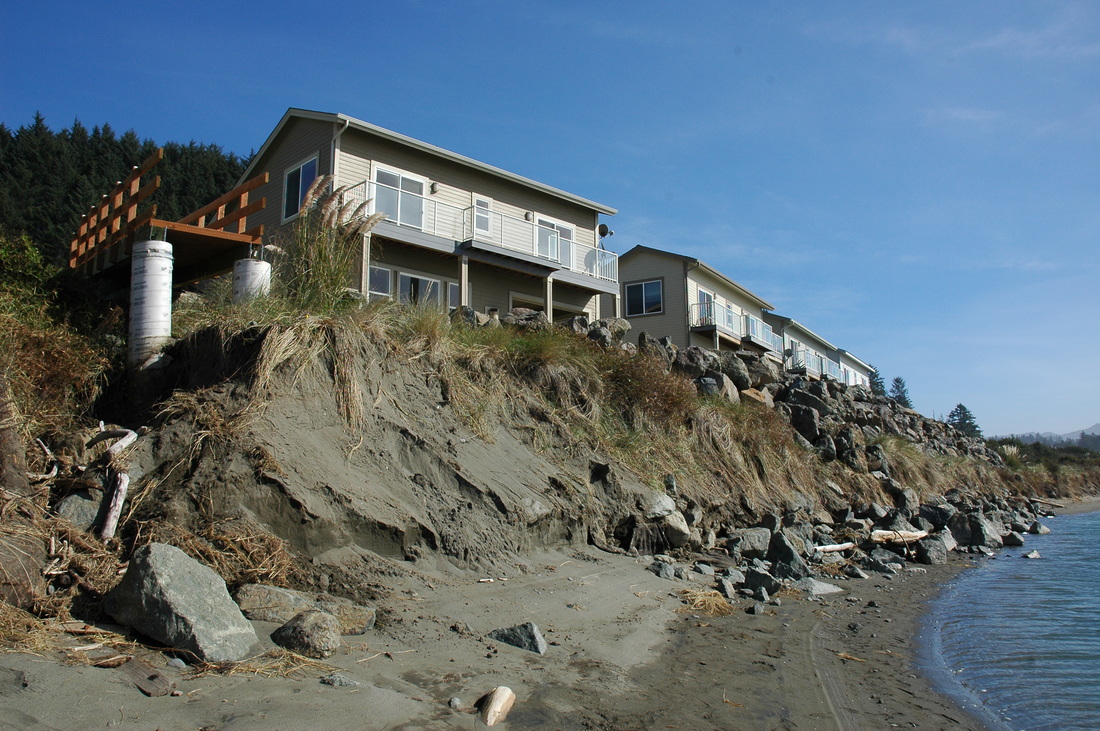
The top of a magnificent two-story home in Nesika Beach, OR, viewed from the beach. Rapid-rate seacliff erosion is threating many homes along this strand of coast. We evaluated the erosion rate and provided hazard and risk disclosure information to the owner (JPMorgan Chase Bank) and the eventual buyer.
A small displacement fault associated with the Trinidad fault near West Haven, CA. The faults and fractures occur in a broad zone of dispersive shear within uplifted late Pleistocene (Ice-Age) marine terrace sediments about 83,000 years old. At this site the displacement on any individual fault is only a few centimeters.
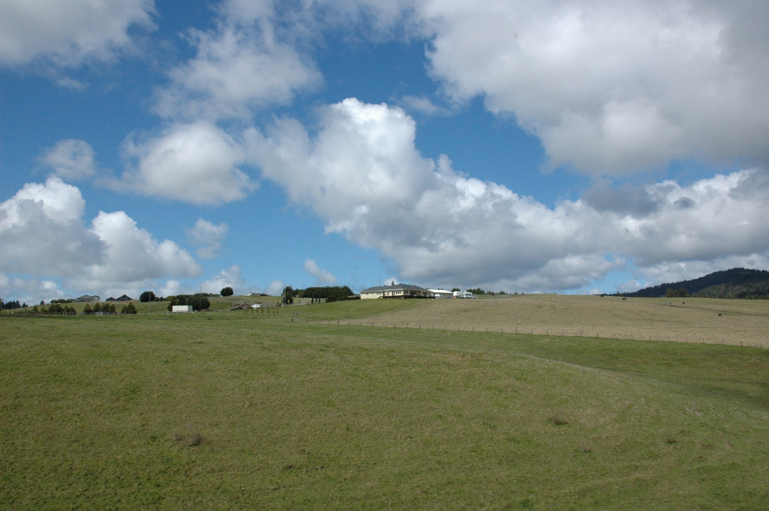
Pastureland and widely separated homes in the Victoria Ranch subdivision in Hydesville, CA, one of the many rural subdivisions we have worked on. This area of Humboldt County is a region of exceptionally rapid uplift with consequential rapid river downcutting.
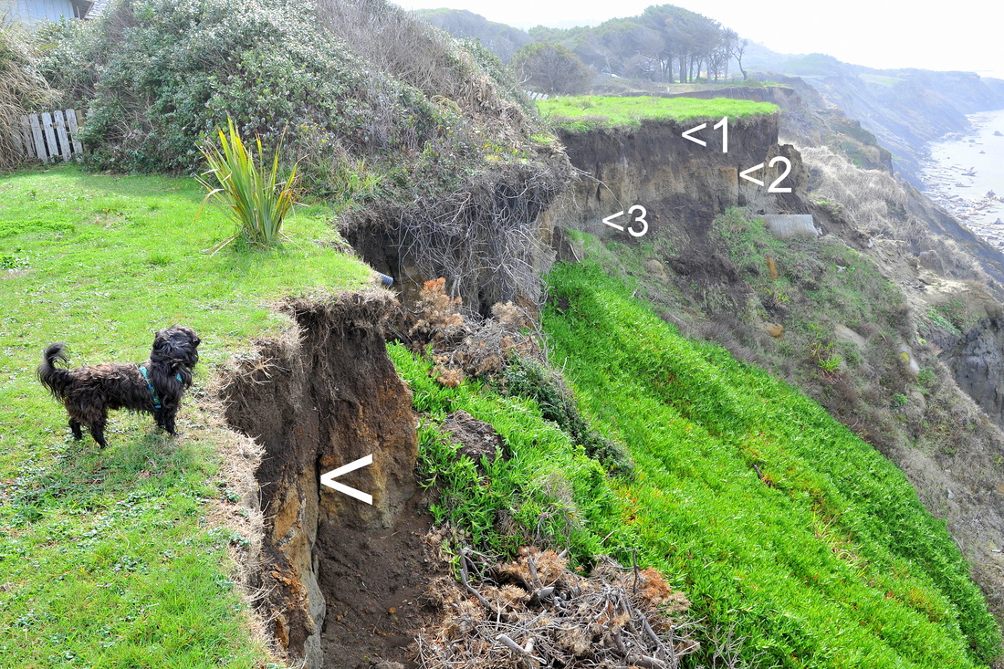
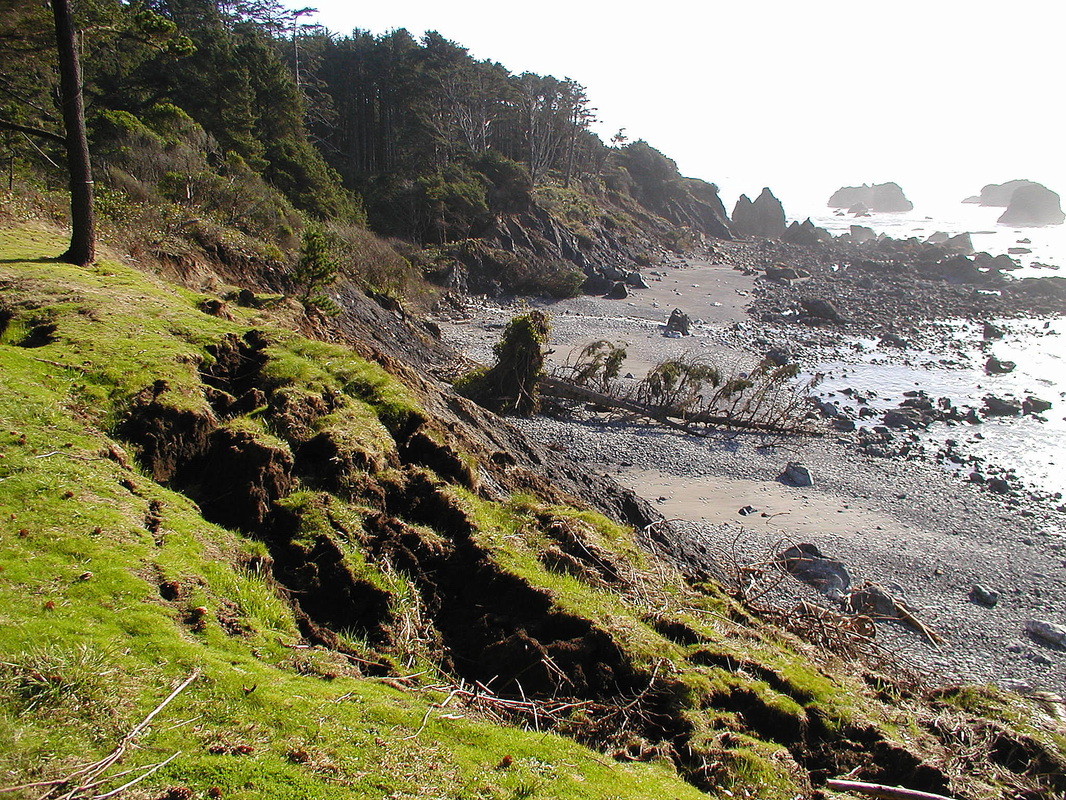
Looking south along the Nesika Beach shoreline at the foot of Williams Street. Trusty Doodle is standing at the bluff edge. The nearest < points to a stress-relief crack that defines the back edge of a decoupled block of soil that soon will topple or slide downslope. <1 is the topsoil layer; <2 is oxidized, clayey sands; <3 is gray fine-grained marine terrace sands.
|
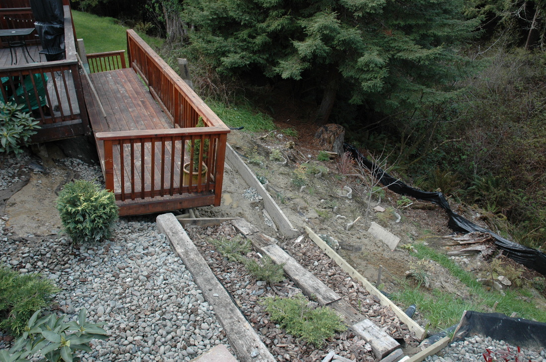
Before it was even finished a new deck began sliding downhill. The contractor had not reviewed the geology report on the subdivision or requested a site-specific soils report. The deck was constructed on unstable fill identified as such in BGC's subdivision report.
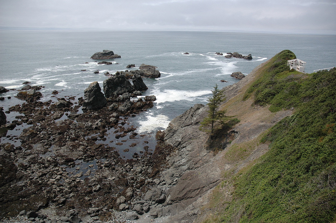
One type of coastline setting in Brookings, OR. Unfortunately, unstable rock types are juxtaposed against more compentent ones along the coast, so site-specific studies are a must.
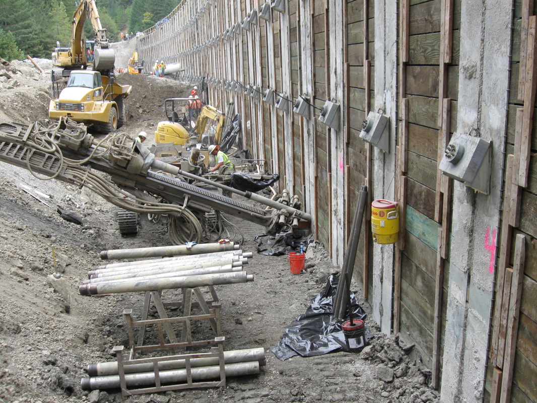
The contractor building this soldier pile wall along US 101 near Redway, CA, hired BGC to monitor the construction to remain in compliance with the contract with CalTrans.
A road committee discusses the implications of a recent significant road failure caused by earthflow, McKinleyville, CA. The home owner's association hired BGC to provide reconstruction recommendations.
"Above-and-beyond" erosion-control efforts by a conscientious developer, Trillium Creek subdivision, Arcata, CA.
Building the toe of a structural fill for a subdivision access road. BGC designed the fill to save redwood trees and allow them to grow within the fill. Note the protection around the tree trunk. Trillium Creek Subdivision, Arcata, CA.
A mess in the making? A condominium complex in Gold Beach, OR, threatened by marine erosion. When the mouth of Hunter Creek has migrated far enough north, ocean waves enter it and erode the shoreline. BGC provided the project engineer with hazard and risk information and also monitored the addition of rip-rap to the shoreline.
Looking down a stretch of coastline south of Nesika Beach, OR. Here marine erosion of structurally weak bedrock is causing rapid-rate cliff retreat that threatens homes and property. The home owner eventually moved the home back, remodeling it in the process.
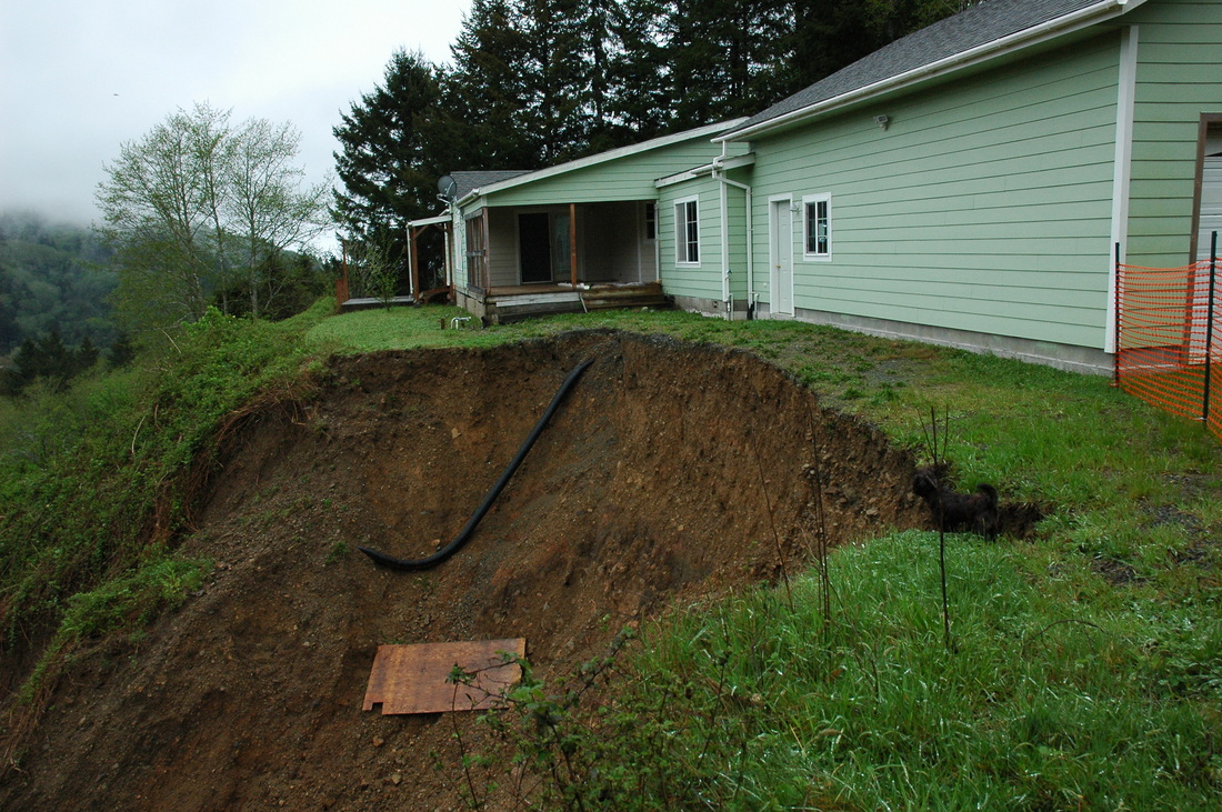
A dramatic and threatening head of a debris slide. Doodle (little black Brussels Griffon) for scale (also the piece of 4x8 plywood). The ground under the part of the home in line with the right edge of the failure is already cracked and settling. More sliding is imminent. This home is now gone, torn down by the bank that owned the property (after a foreclosure).
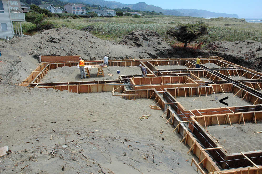
BGC Staff Geologist Dylan Caldwell is reviewing the foundation plans for this upper-end home under construction at the Rogue Shores subdivision in Wedderburn, OR. The foundation had to be designed to resist scour so it is complex. It consists of massive grade beams (being formed now) tied to cast-in-place piers that will support another group of grade beams. When the bottom level of grade beams and the CIP piers are cured, the contractor will push sand back into the footprint, then build the top beams and the home.
|