Busch Geotechnical Consultants
  • Home
    • Contact Information
    • Contact Form
    • Firm Capabilities
    • Principal's Vitae
    • Firm History
    • BGC's Former Arcata office
    • BGC's Harbor office
  • Services
    • Services--Lay Description
    • Services for Realtors, Homeowners, and Developers
    • Services for Design Professionals
  • Service Areas
  • Past Clients & Jobs
    • Photo Examples (working)
    • Firms, Cities, Counties
    • Water Tank Jobs
  • Photo Galleries
    • Rocks
    • Rocks on LSD
    • Oops!
    • Beach Features
    • Guest Contributions
  • Recent Work
    • 2017 Jobs
    • 2016 Jobs
    • 2015 Jobs
    • 2014 Jobs
    • 2013 Jobs
    • 2012 Jobs
    • Case Histories
  • Sand Collection
    • Sand Photographs
    • Updated List of Sand Samples
    • References
  • Glossary
Key to Services Color Codes:  Past  / Present

Alquist-Priolo (and other) Fault Investigations
Analysis of Sequential Stereo Pairs of Aerial Photos
Basic Geologic Research and Mapping
Borehole and Cone Penetrometer Logging
Cell Tower Siting Studies
Crack Mapping and Analysis

Damage Evaluations (Earthquake, Landslide, Flood)
Disclosure Reports for Real Estate Transactions
Erosion-Control Prescriptions
Erosion-Rate Studies
Fault Lineament Mapping
Floor-Level Surveys for Settlement Analysis
Geologic Hazard and Risk Assessments

Geomorphic (Landform) Mapping and Analysis
Geotechnical Reports
Groundwater Evaluations
Guest Lectures (Especially for Realtors)
Interactive Work with Engineers, Architects, Designers

Laboratory Testing
Landslide Mapping
Landslide Stabilization Support for Engineers
Liquefaction Potential Analysis
Literature Review / Critical Analysis / Summaries
Litigation and Arbitration Support
Verbal Assessments for Real Estate Purch
ase Decisions
Oblique Aerial Photography (digital)
Photogrametrics
Planning Support (e.g., Ordinance Development)
Project Feasibility Investigations
Quarry Compliance Monitoring
Real Estate Support Services
Resource Management Support
Road Alignment and Stability Evaluations
Rock and Soil Sampling / Soil Testing
Septic Disposal System Evaluation and Design (CA)
Settlement Monitoring
Slope Monitoring with Inclinometers, Tiltmeters, Grids
Soil Reports (Residential, Commercial, Industrial)

Studies for Water Lines, Storm Drains, Utilities
Subdivision Studies and Reports

Timber Harvest Plan Geologic Elements
Topographic and Geohazards Mapping
Water Tank Foundation Materials Assessments 

Picture
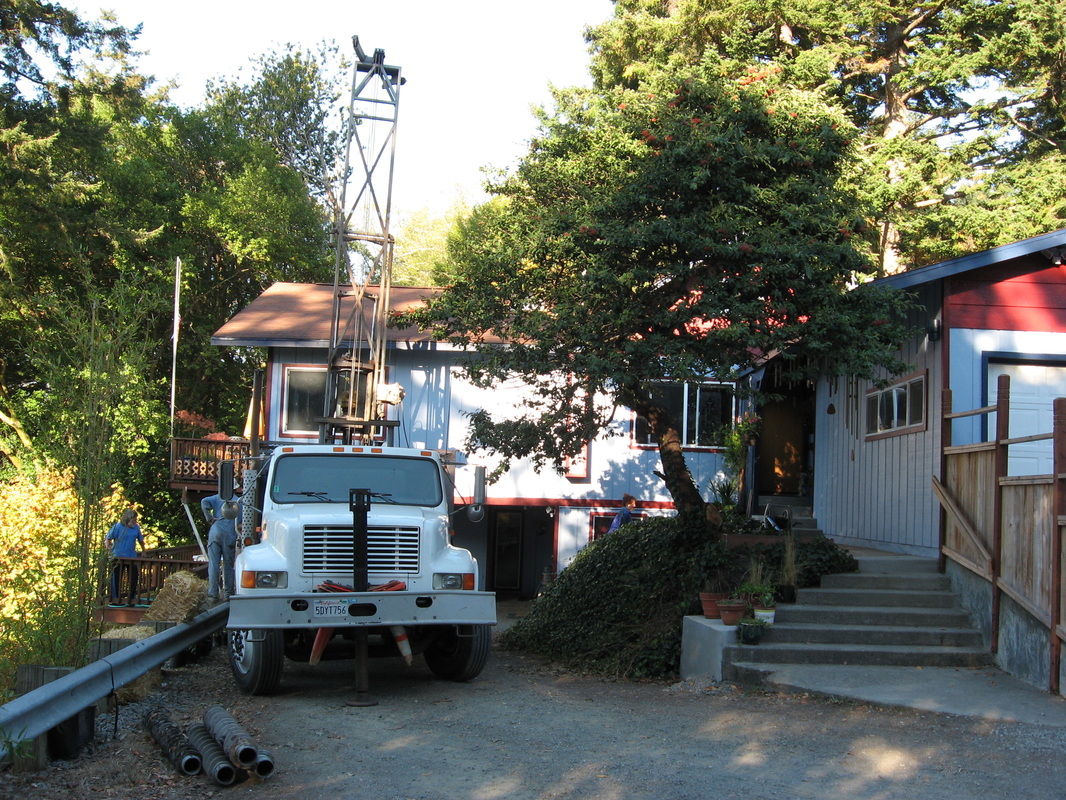
Drilling to set a slope inclinometer at the head of a landslide, South Bank Chetco River Road, Brookings, Oregon
Picture
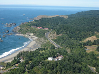
Aerial view of the Rainbow Rock Condominium Complex just north of Brookings. Stability evaluations are essential for development activities in this strand of coastline.
Picture
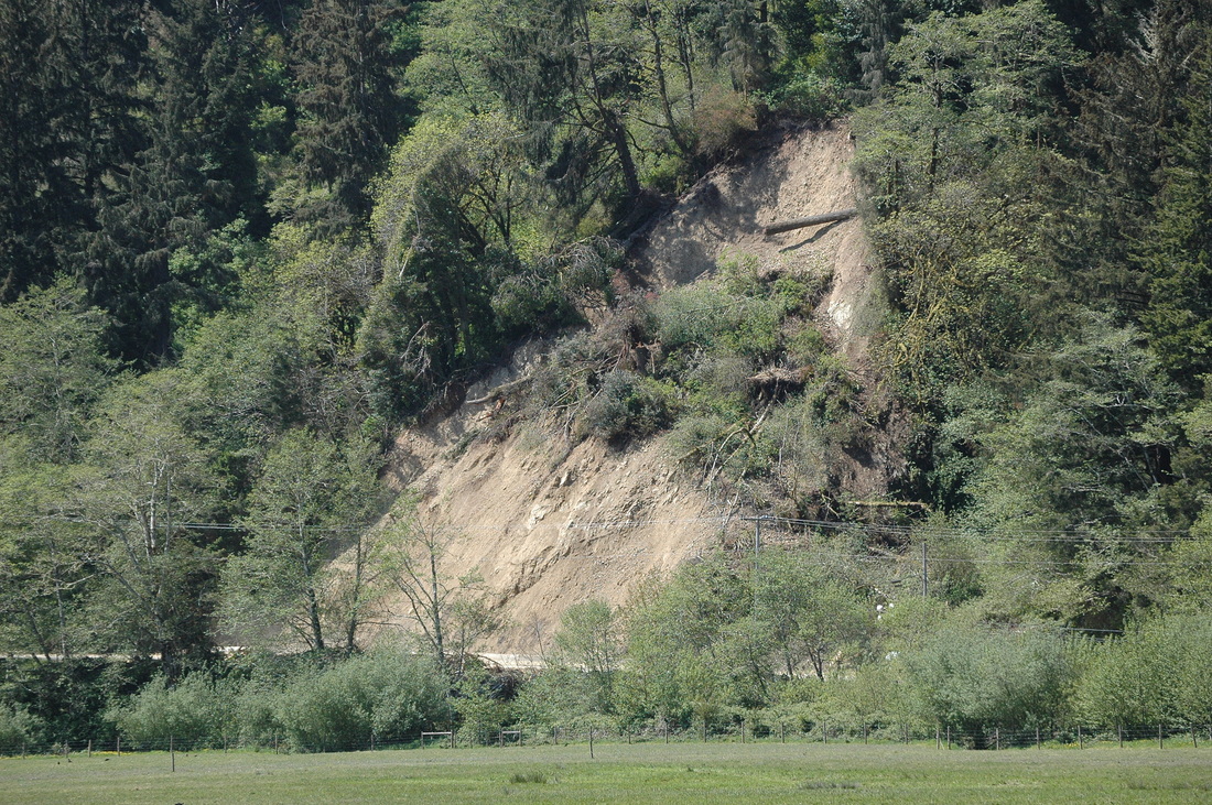
A debris slide along Requa Road, Del Norte County, CA, triggered by a high-rainfall event. This slide closed the road.
Picture
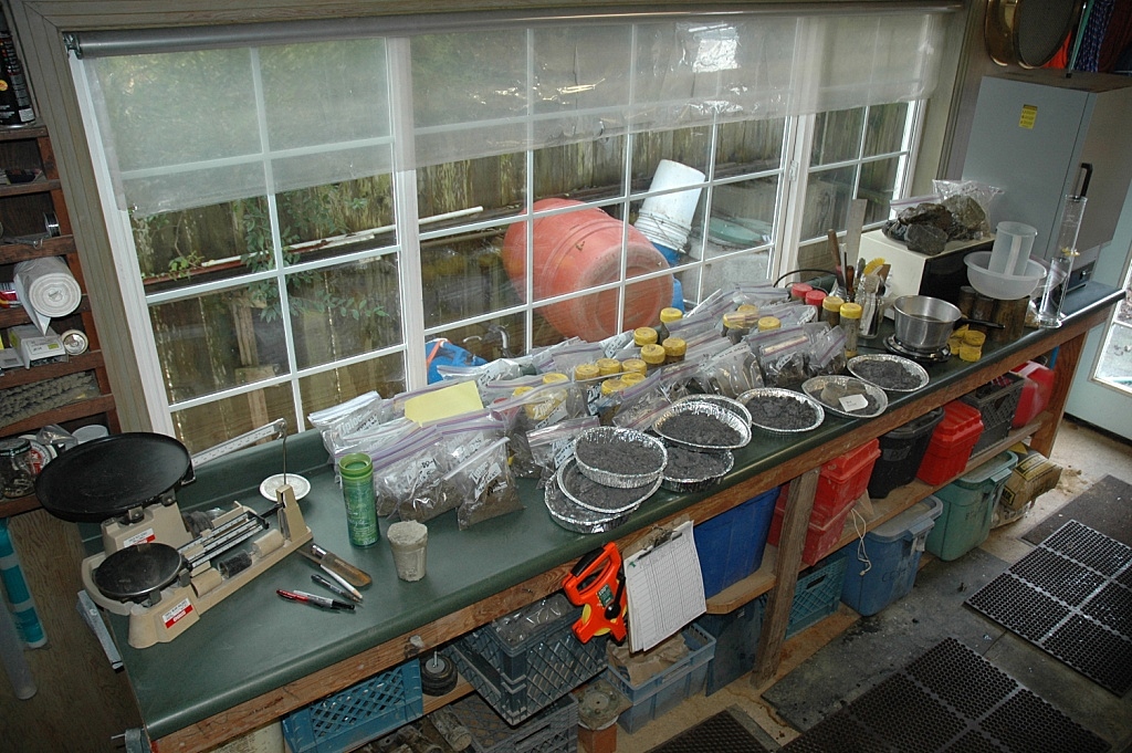
Part of BGC's Arcata, CA, soil lab. The pie tins contain samples dried to determine %-moisture.
Picture
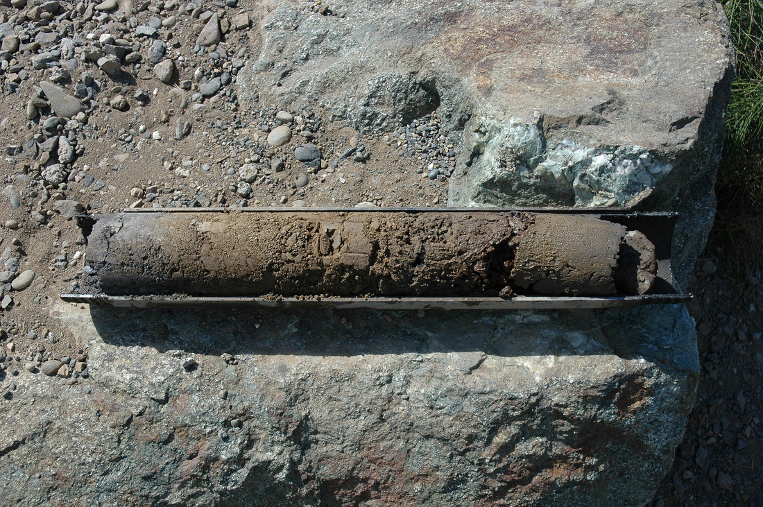
Half of a Standard Penetration Testing split-spoon sampler containing brown marine terrace soils over gray weathered bedrock.
This is an educational website.
Powered by Mother Earth, Weebly, and REB