Photographic Examples of Great Projects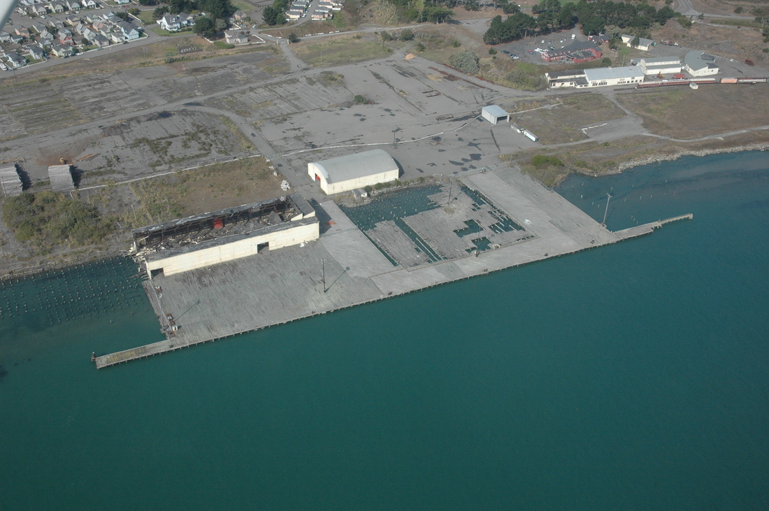
In 1999, Pacific Affiliates, Inc., Eureka, hired BGC to advance boreholes and cone penetrometer probes through this old Louisiana-Pacific dock beside the deep-water channel in Humboldt Bay. Our goal was to determine the sediment stratigraphy and risk of liquefaction and/or lateral spreading in order to support the engineering design of repairs and upgrades.
|
The former Chetco Federal Credit Union (now Rogue Federal Credit Union)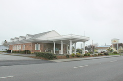 ,,,hired BGC to provide soils information to support the engineering design of the Crescent City, CA, branch office.
Winzler & Kelly Engineers, now GHD, in Eureka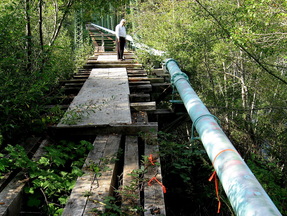 ...has hired BGC many times since 1986 to provide geologic and geotechnical information to support their design of roads, water tanks and tank pads, seismic retrofits, utility corridors, and structures. Here Stephen Peacock, SE (Ret.), looks over an abandoned trestle in Blue Lake, CA. The trestle carries main water lines to the city.
The McKinleyville Community Services District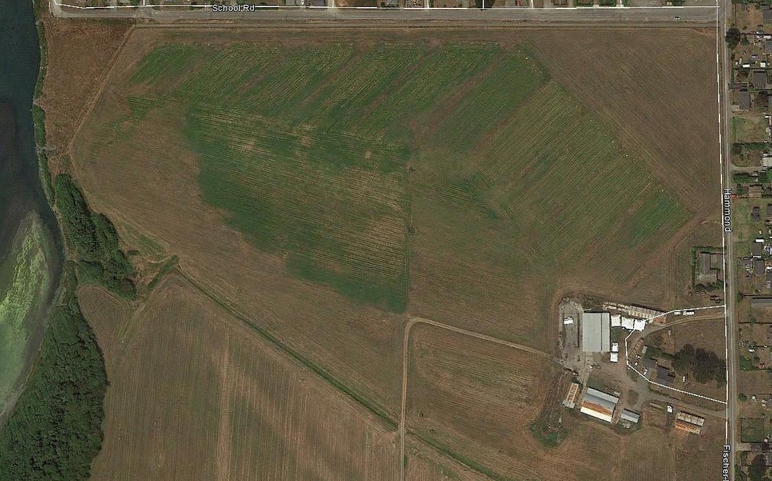
...hired BGC geologists to prepare an underground map (a fence diagram) of the sedimentary layers (the stratigraphy) of this large land tract so the project engineer could assess its potential to treat large volumes of treated effluent. This is a 2013 Google Earth photo of the McKinleyville community leachfield south of the junction of School Road and Fischer.
Lenders, Owners, Sellers, Buyers, and Potential Buyers ...have hired BGC to assess the risk to homes in Nesika Beach, OR, a chronically eroding coastal strand. As part of our work we estimate (calculate) the probable economic lifespan of the home.
Individual homeowners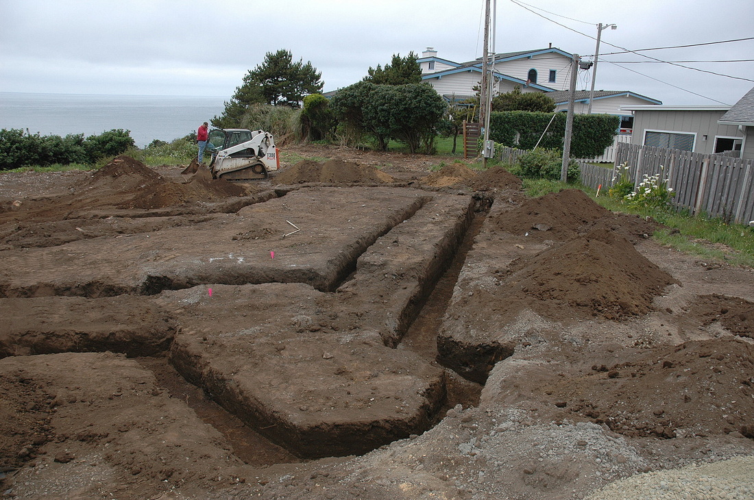 ...planning their first home, dream home, or retirement home have hired us to provide the geologic report necessary to support engineering and/or architectural design work and the building permit application. Later, at the start of construction of some of the homes, we return to inspect the foundation excavations for conformance with our recommendations.
Real Estate Brokers and Agents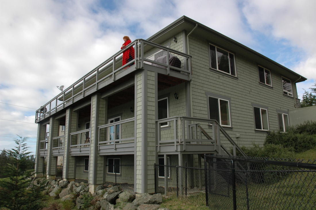 concerned about their liability have hired BGC to evaluate property conditions independent of their clients. Here, the columns in this new high-end home are out-of-plumb: the bottom of each column is kicked out to the left, toward a steep slope below the home. The piers supporting the decks were now embedded deeply enough.
Cellular Tower Companies or Their Agents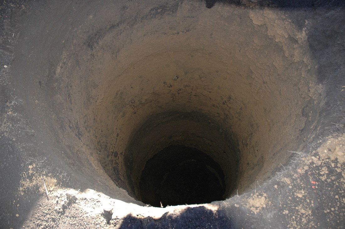 ...have hired BGC to provide site reports and construction monitoring. Here is one big hole for a cell tower foundation in Fortuna, CA. It's ready for a rebar cage. The photo below shows just how big that cage is.

Many Different Developers from Many Different States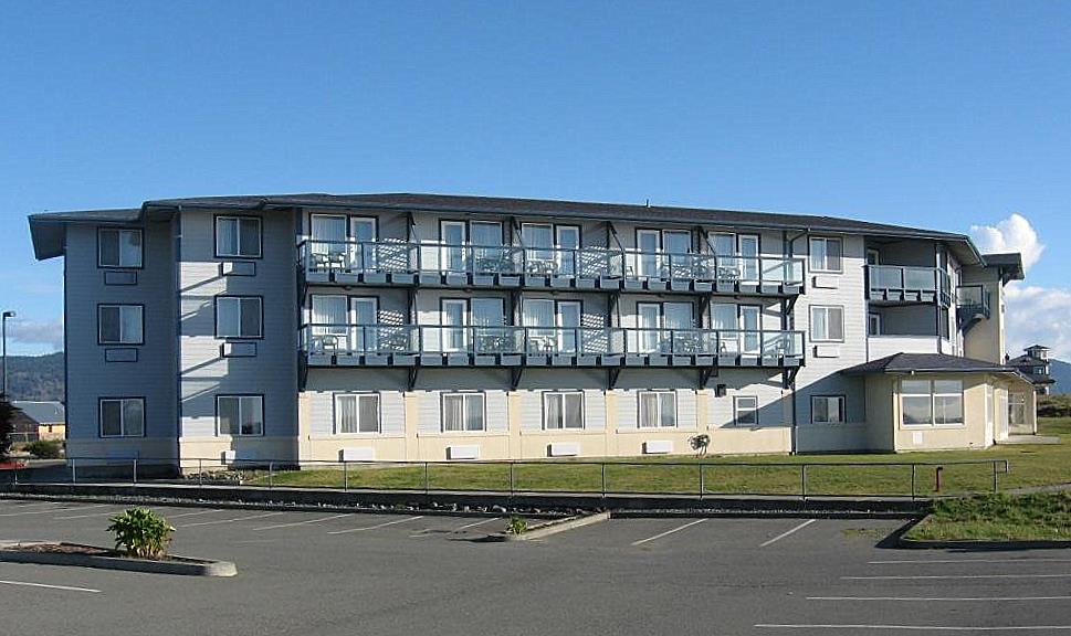 ...have hired us to support their work. We typically provide foundation soils information, hazard and risk analysis, support for the project engineer or architect, and follow-up construction monitoring. This is the Hampton Inn in Crescent City, CA. Our report sailed through the regulatory agencies, including the California Coastal Commission.
Cites, Counties, and their Subcontracted Engineers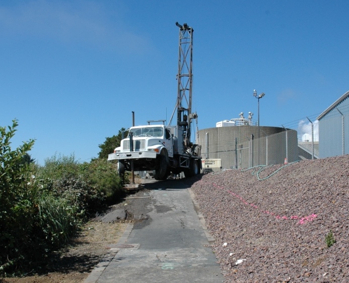 ...have hired BGC to provide stability analyses for water tanks, utilities lines, community wastewater disposal fields, public buildings, and roads. Here is a drill pad perched on an unstable bluff top threatening a part of a community wastewater treatment facility. The neon line is the footprint of a proposed deep soldier pile wall.
Engineers, Contractors, and Individuals ...have hired BGC to provide soil parameters to support design work. Here's part of the firm's Arcata, CA, soils lab.
Quarry Owners and Potential Quarry Owners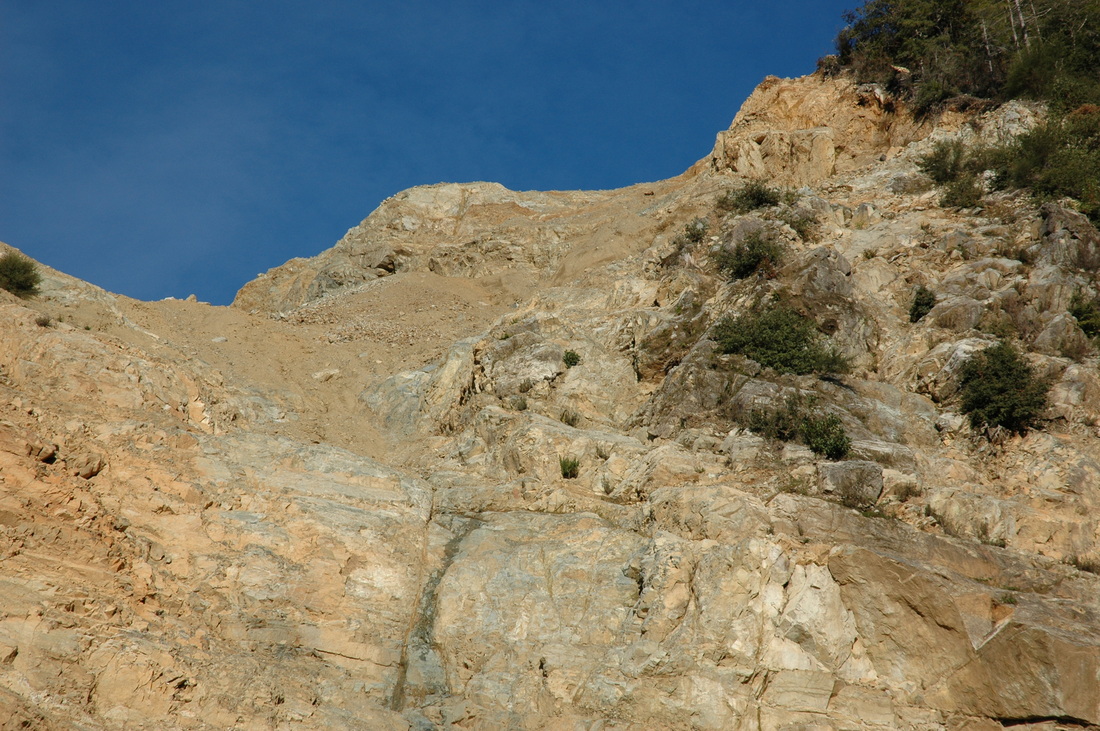 ...have hired BGC to assess rock and over-burden volumes and quality, provide stability analyses, sample for asbestos, monitor erosion-control BMPs (Best Management Practices), and provide compliance documents. This is the steepest face in the Scheve Quarry in Gasquest, CA. The quarry overlooks the pristine Smith River and abuts USFS lands. During our tenure as the project geologist there was never a sediment discharge to the Smith.
Individuals and Firms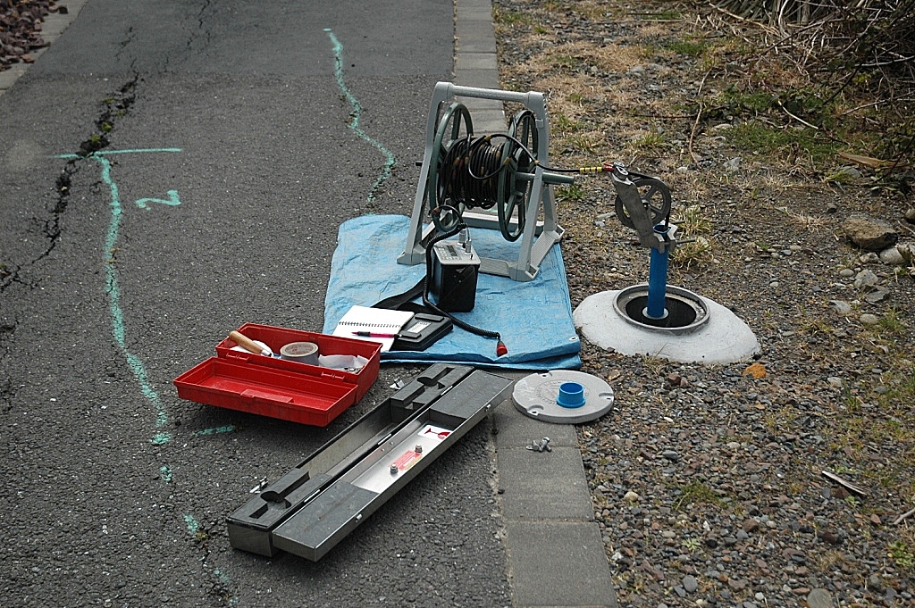 ...have hired BGC to install and monitor unstable and questionably stable hillslopes (and sometimes, structures). Here is the slope inclinometer setup--data recorder, cable, and sensor (already down-hole)--ready to monitor a casing that we installed on a bluff top. Not the cracks left (upslope) of the casing.
Private Land Owners and Corporations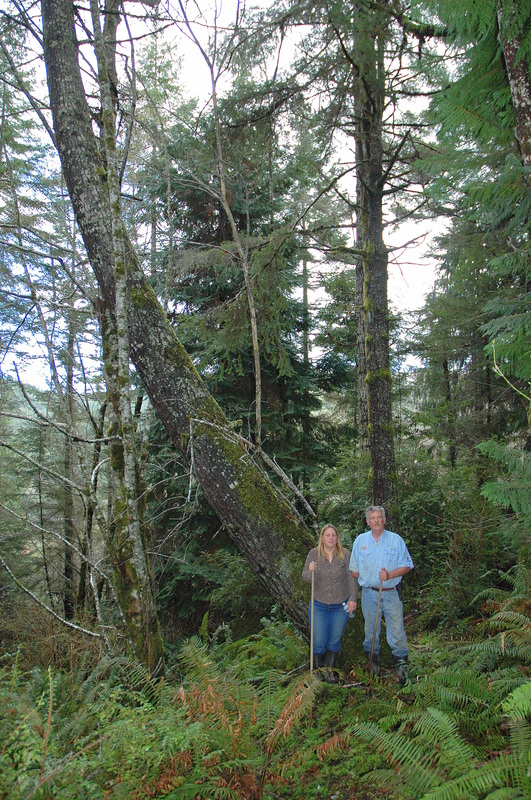 ...have hired BGC to provide the geologic component of timber harvest plans and/or slope stability analysis for the registered forest doing the plans. This couple, who love to raise goats, hired us to evaluate the stability of a forested landslide above their property.
ODOT, the Oregon Department of Transportation,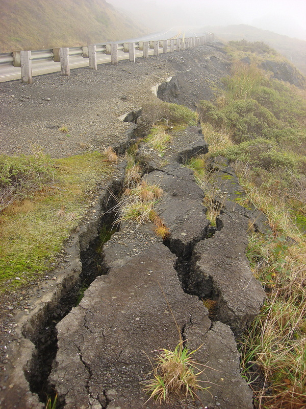
...has hired BGC to provide subsurface information about questionably stable slopes. Here is an obviously unstable, now abandoned portion of US 101 at Sister's Rocks / Pigeon Point, Oregon. Here the highway crosses an active slump/earthflow landslide that is moving the road and hundreds of acres of land below it.
Owners of shoreline properties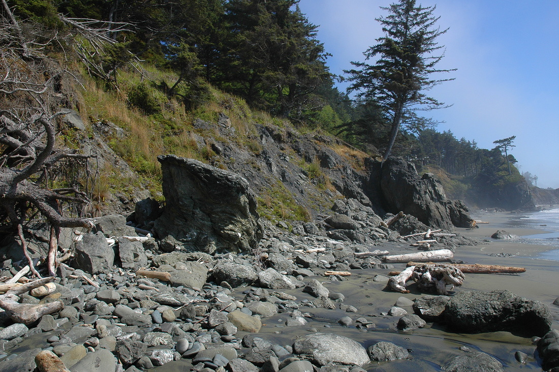 ...hire BGC to assess the risk to their home due to coastal instability and erosion. Here is the toe of an unstable bluff face near Hubbard Mound, OR. The rocks on the beach weather out of the unstable JuraCretaceous Otter Point Formation bedrock as the ocean erodes the toe and the toe slides into the ocean. Rounded rocks have been on the beach a while; angular ones have just arrived. Note the leaning conifer.
|