Busch Geotechnical Consultants
  • Home
    • Contact Information
    • Contact Form
    • Firm Capabilities
    • Principal's Vitae
    • Firm History
    • BGC's Former Arcata office
    • BGC's Harbor office
  • Services
    • Services--Lay Description
    • Services for Realtors, Homeowners, and Developers
    • Services for Design Professionals
  • Service Areas
  • Past Clients & Jobs
    • Photo Examples (working)
    • Firms, Cities, Counties
    • Water Tank Jobs
  • Photo Galleries
    • Rocks
    • Rocks on LSD
    • Oops!
    • Beach Features
    • Guest Contributions
  • Recent Work
    • 2017 Jobs
    • 2016 Jobs
    • 2015 Jobs
    • 2014 Jobs
    • 2013 Jobs
    • 2012 Jobs
    • Case Histories
  • Sand Collection
    • Sand Photographs
    • Updated List of Sand Samples
    • References
  • Glossary

This page updated March 28, 2015.

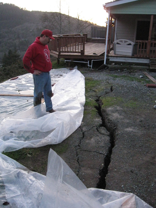
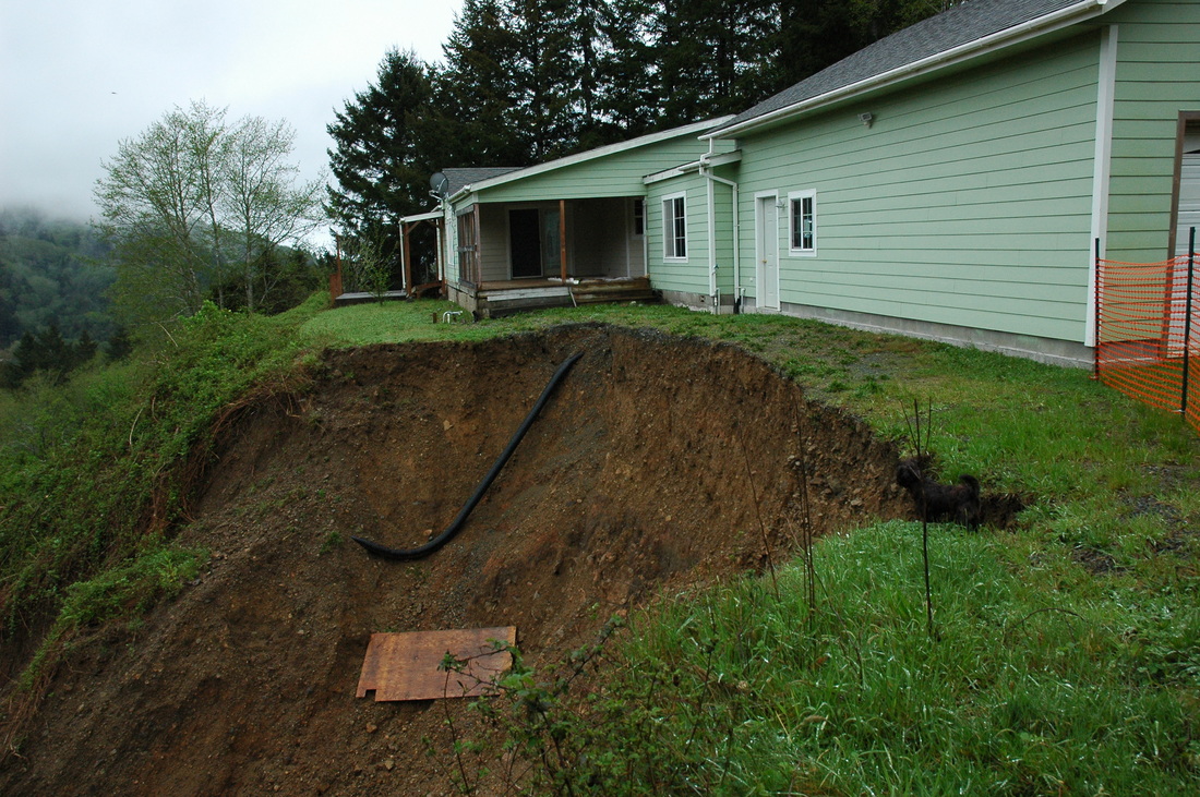
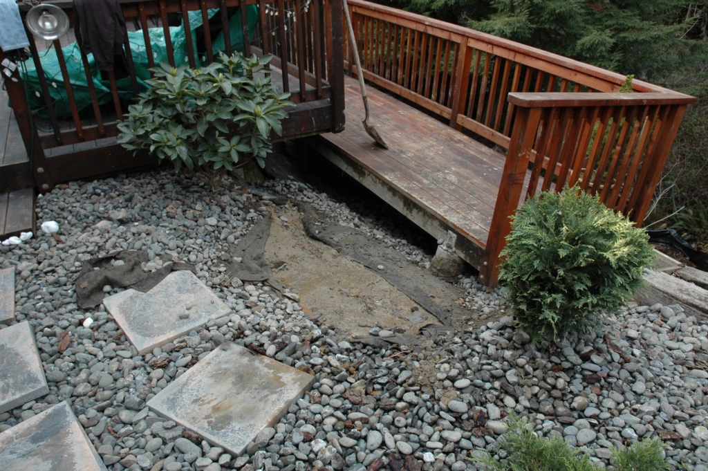
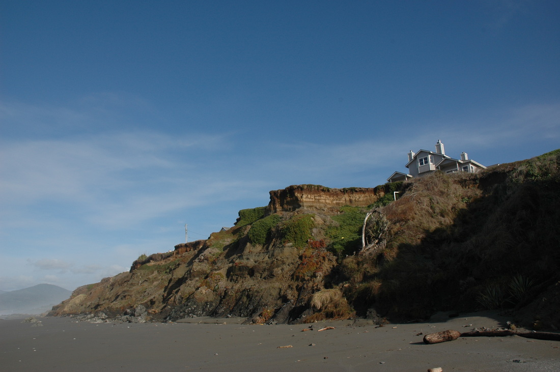
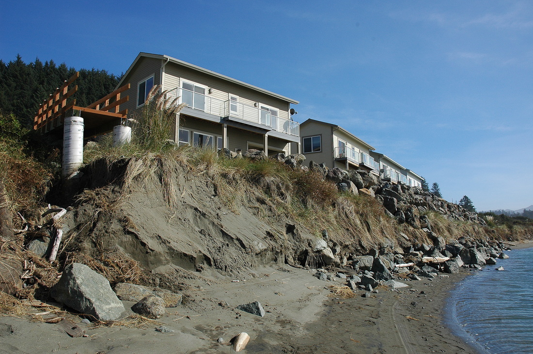
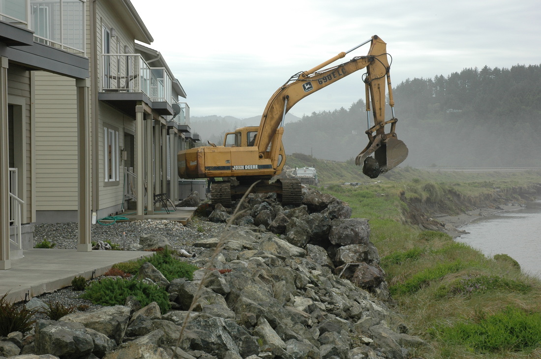
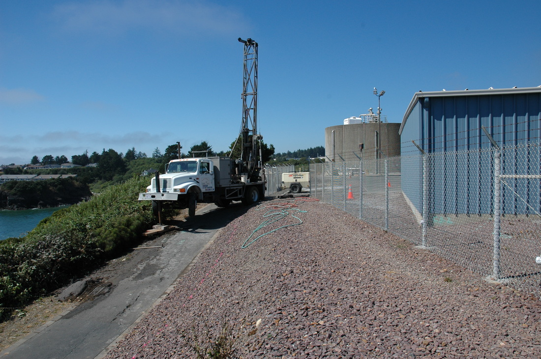
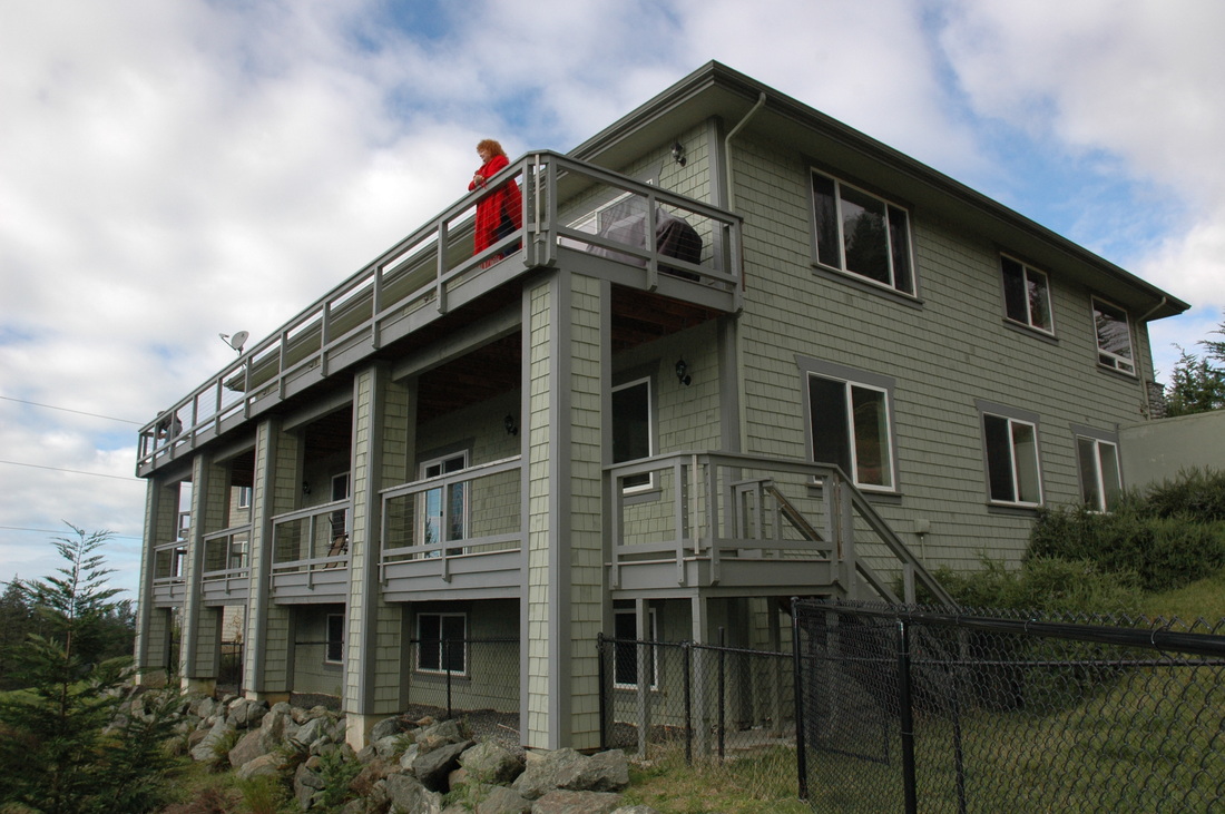
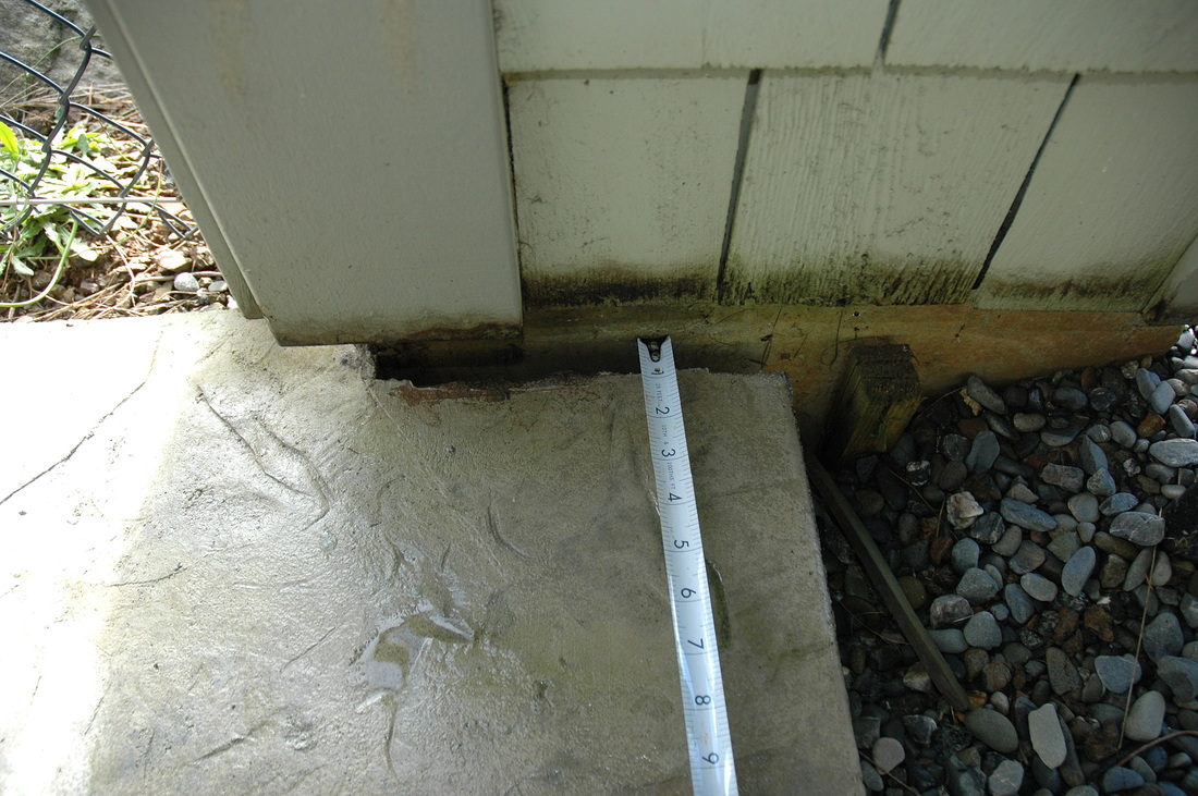
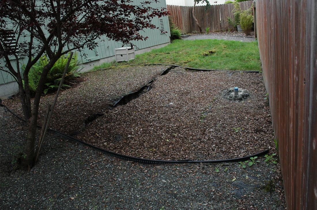
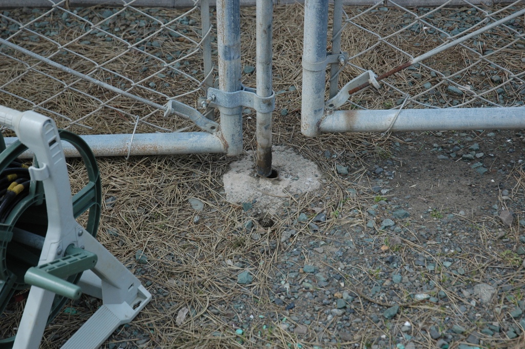
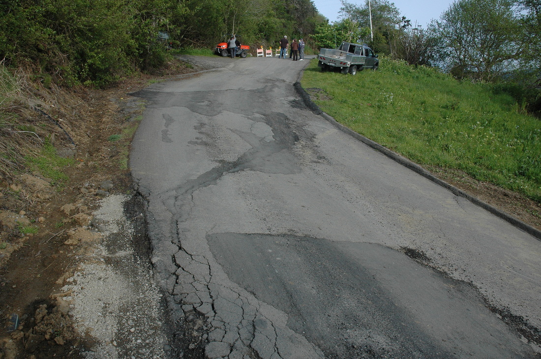
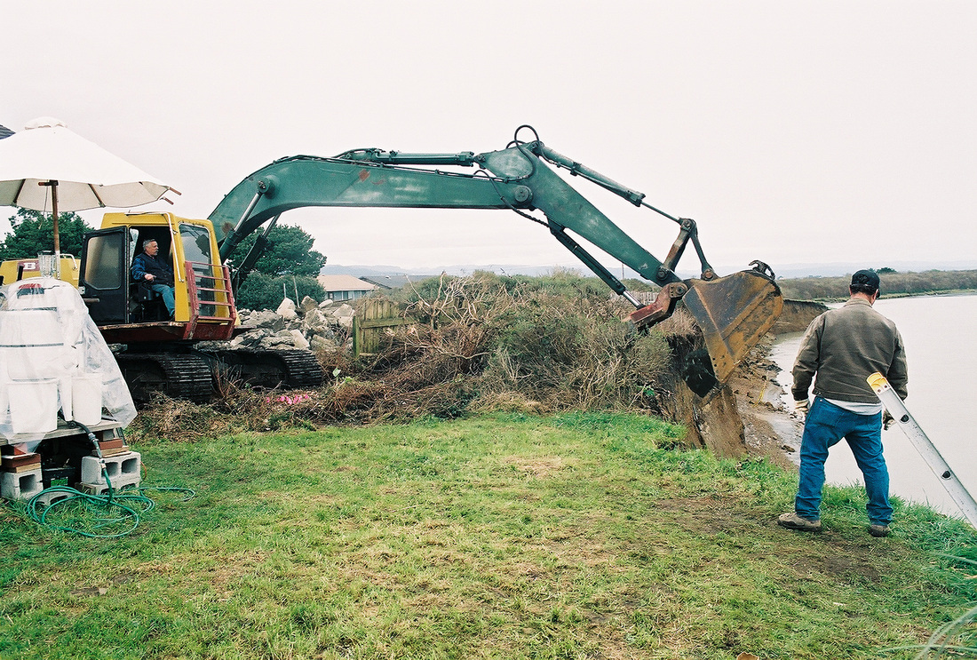
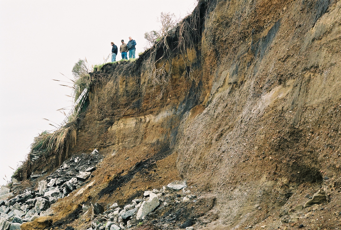
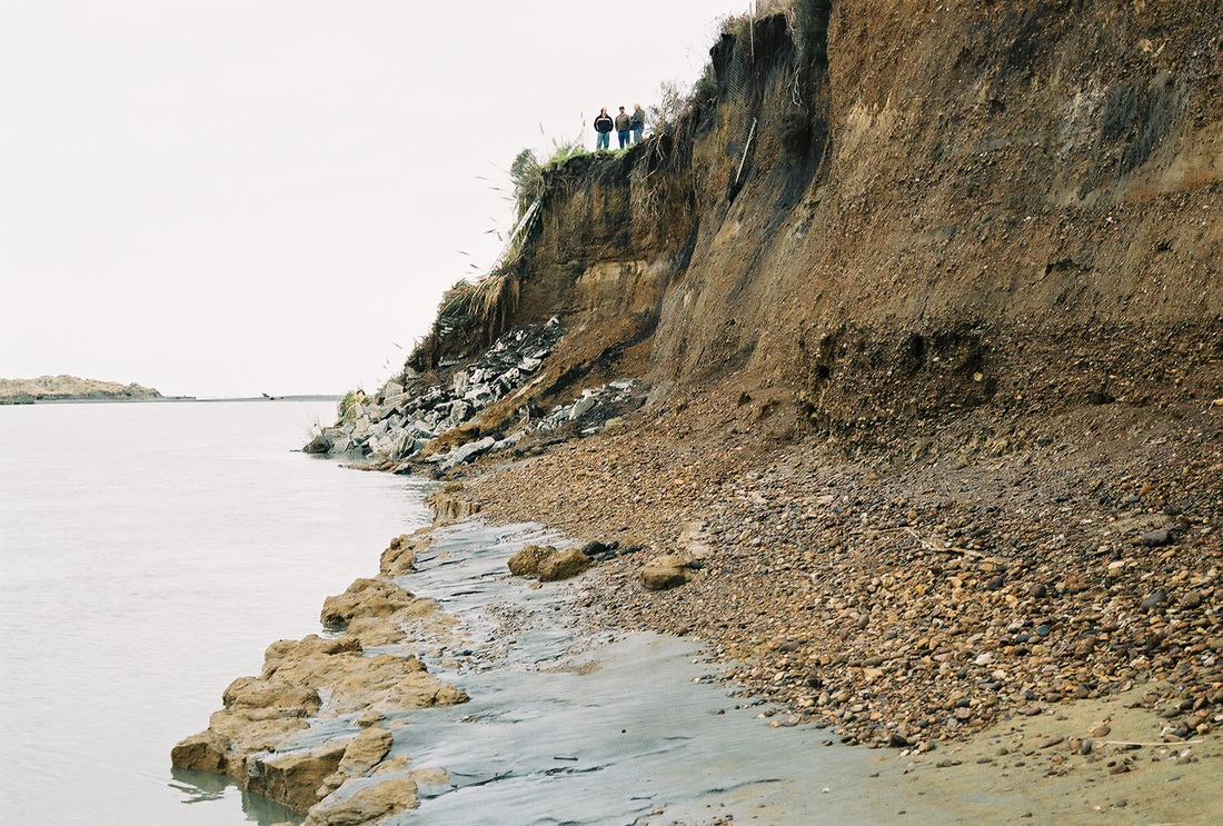
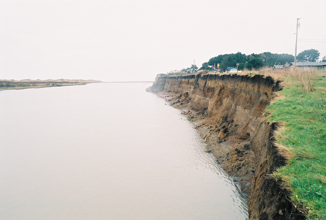
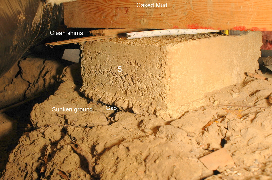
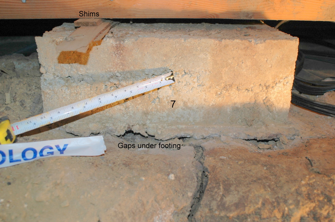
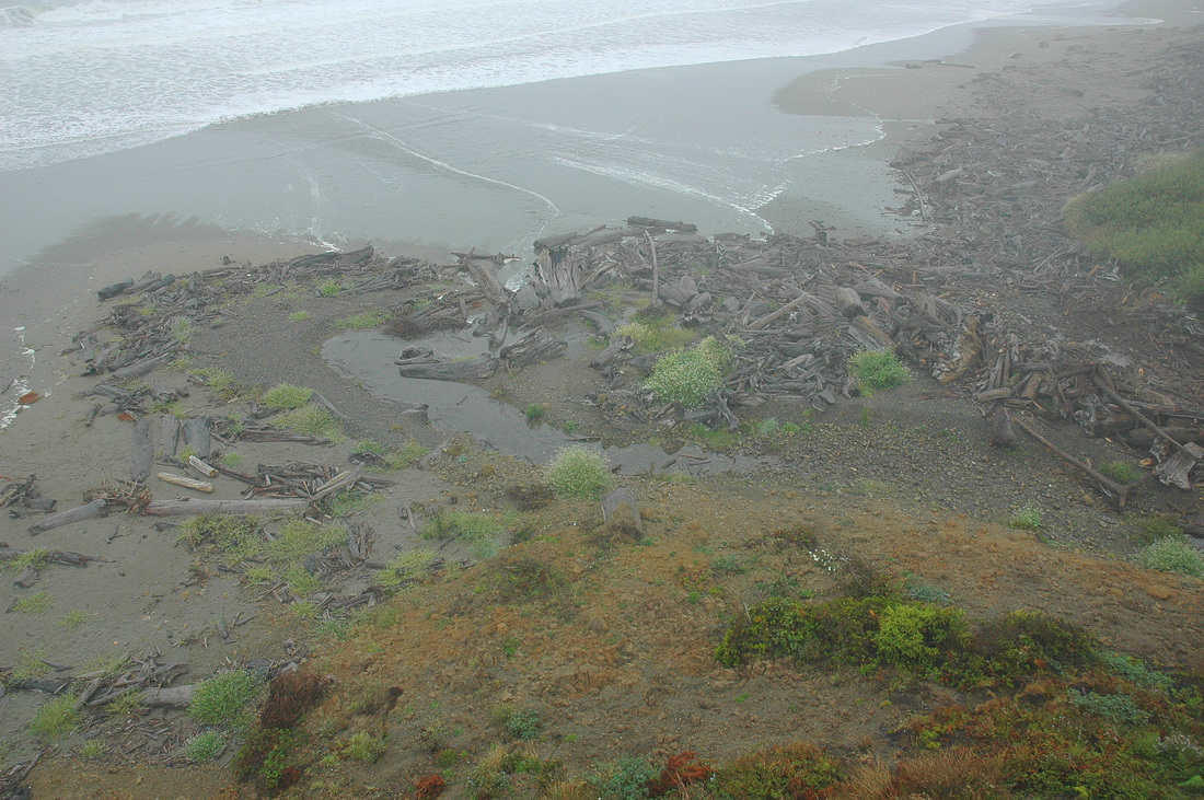
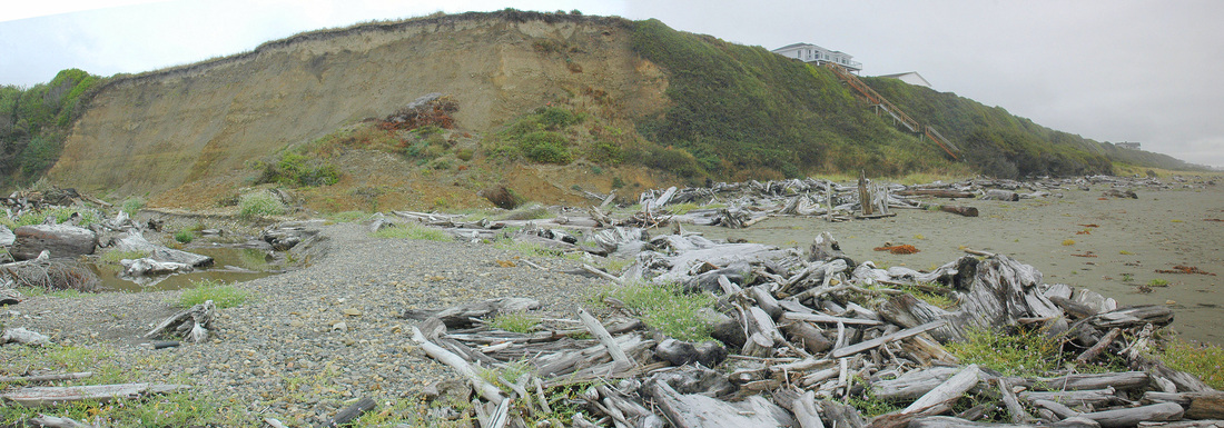
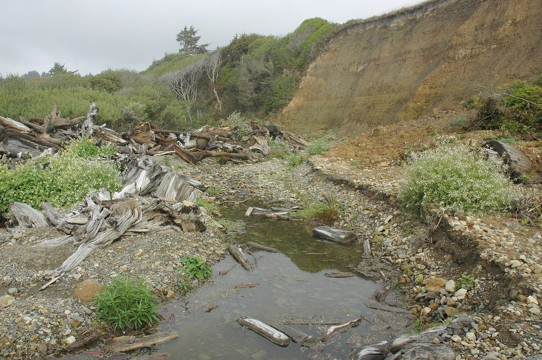
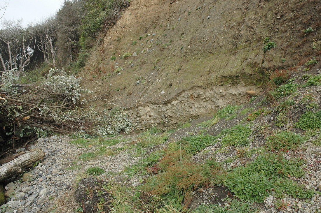
The following "Oops" photographs show consequences from a variety of investigation short-comings, incorrect geologic or engineering assumptions, design errors, and/or construction failures.  Hover the cursor over the photo to read the caption.

NOTE:  The web designer (not me) changed the operation of the gallery system after I completed my initial entries, so the grouping and captioning works differently (worse) than it does for later additions.  Hopefully I'll get around to fixing that.

Although I've tried to take a light-hearted approach, each group of photos in fact shows some level of expensive personal, corporate, or public tragedy, be it mere headache or terminal cancer.  Photos from the same site have the same number.  So, for example, Oops 1 and Oops 2 show different sites, whereas Oops 1A and Oops 1B are the same location.


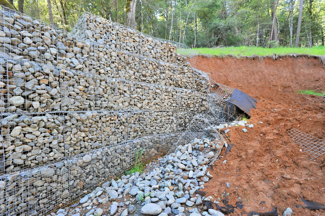
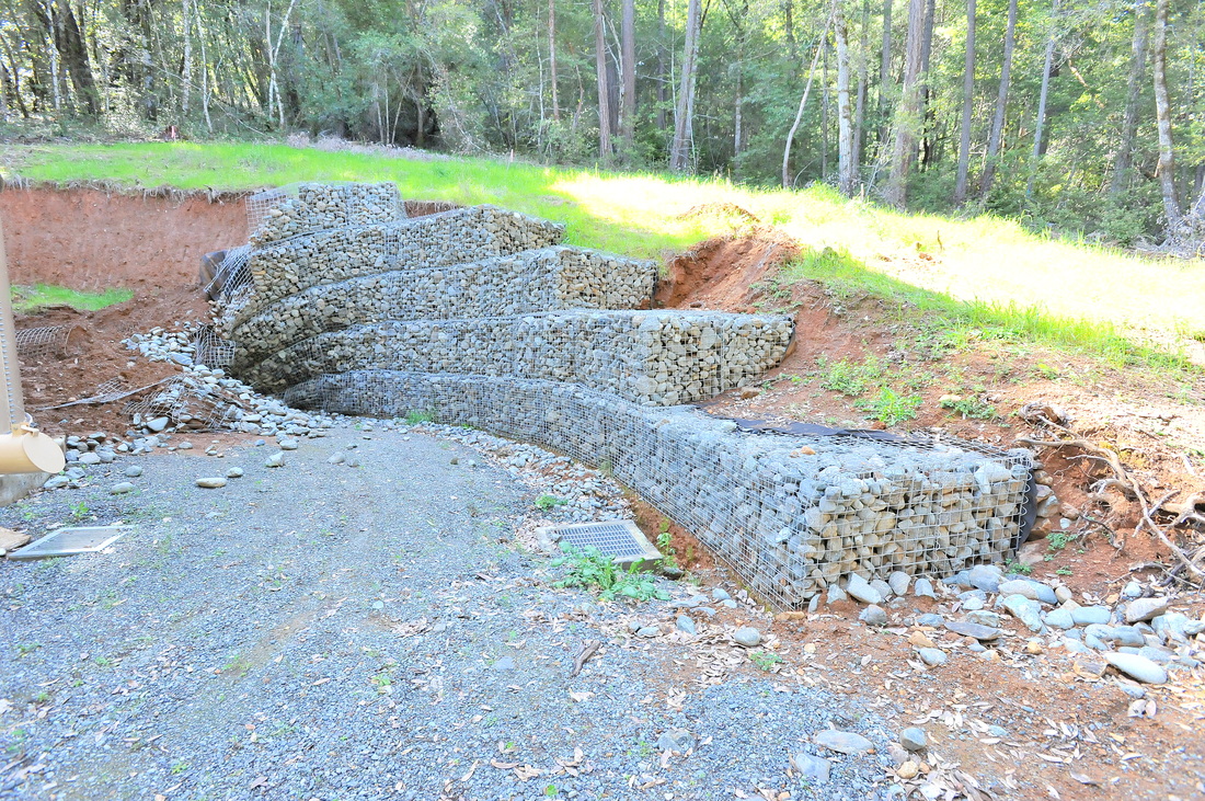
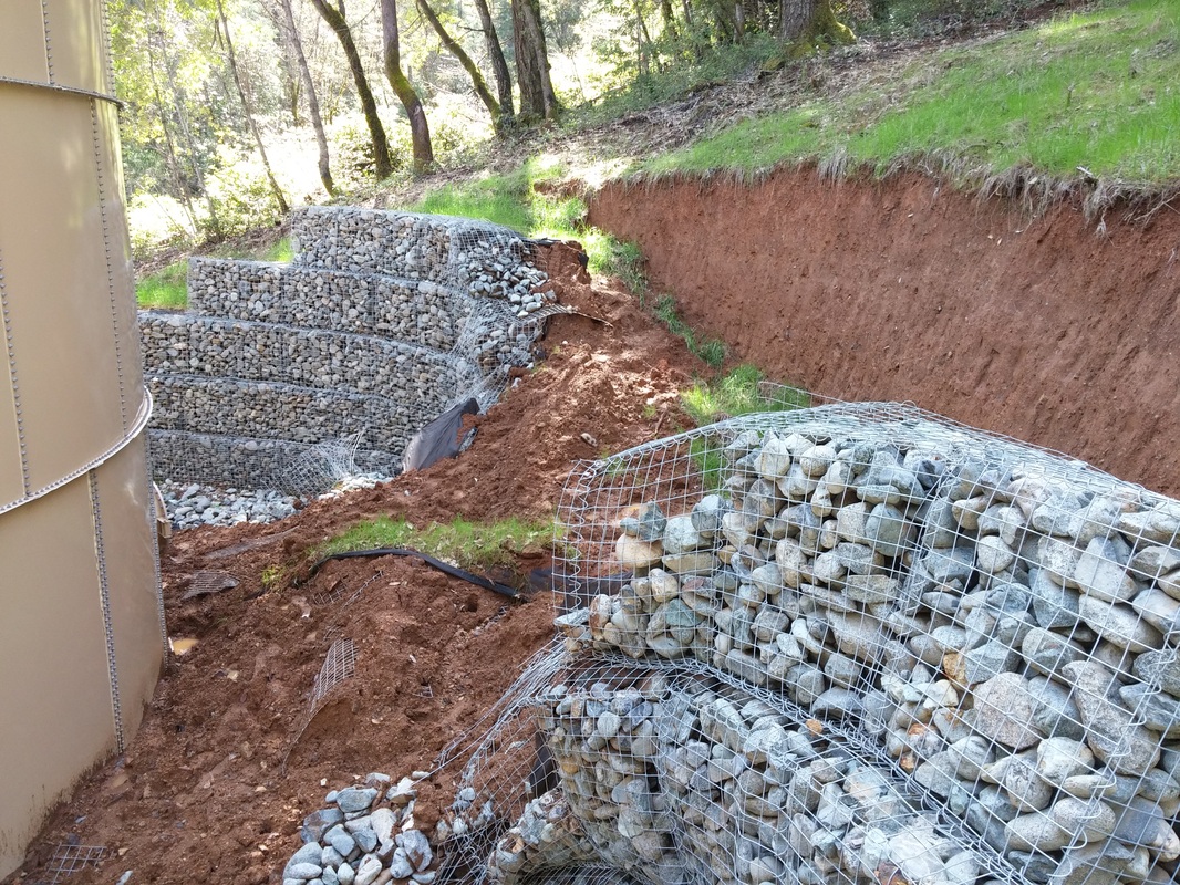
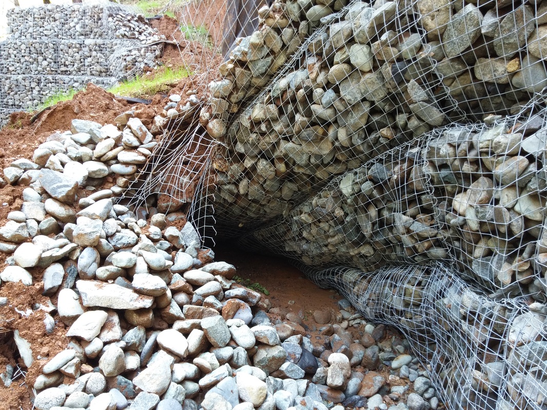
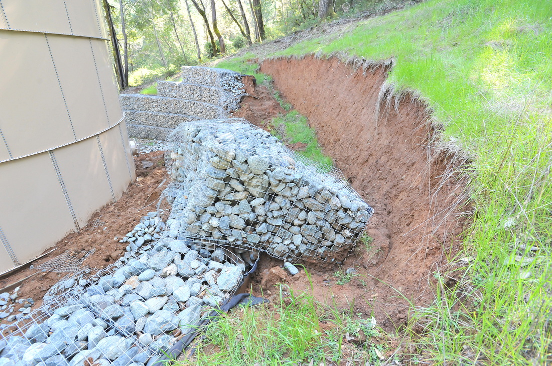
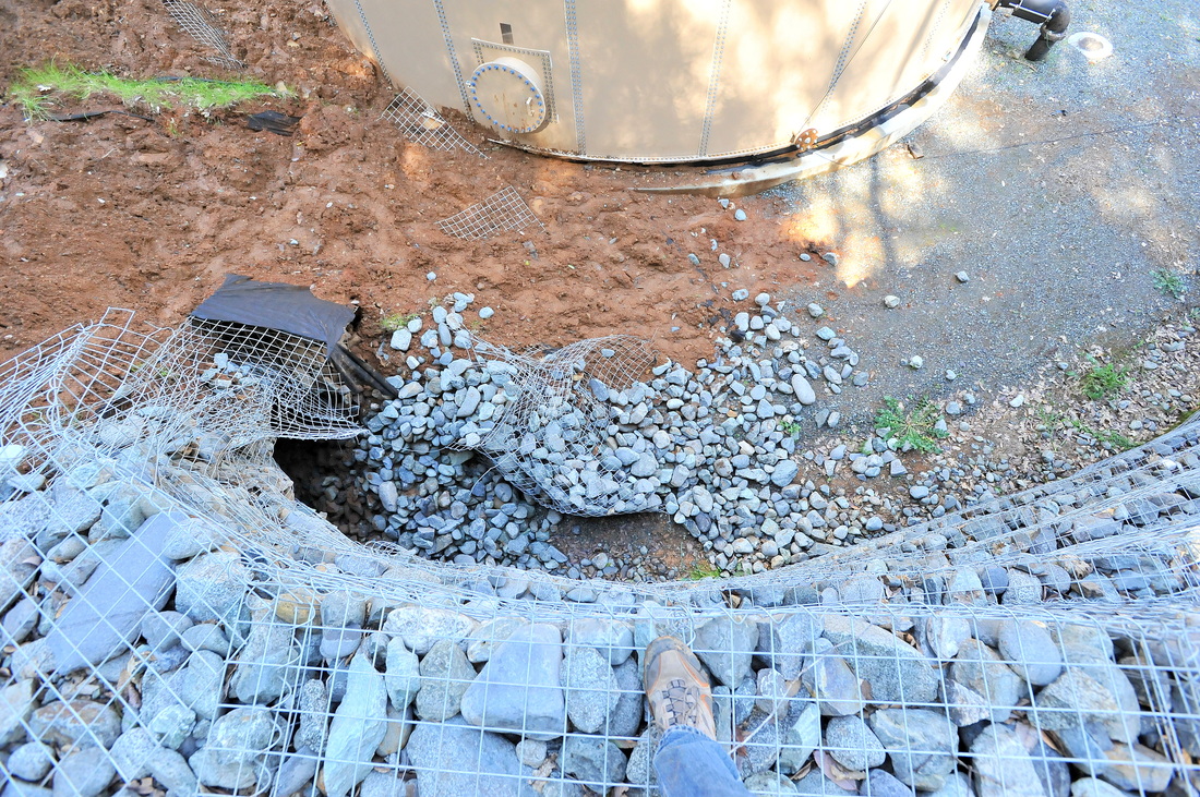
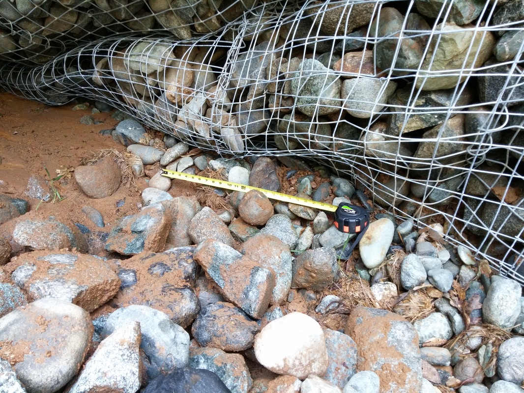
Oops #15.  BGC Job #15-012.  GABION WALL FAILURE.  The following photos show an early 2015 gabion wall failure behind a water tank.  Until the causes of the failure and who will pay to rebuild the wall are determined, I can't provide any of the fascinating background details. 

Oops #15A. Looking at the right lateral side of the gabion wall (the left side as viewed from the front). The collapsed portion is in the middle of the wall where it was 15 ft high.
Oops #15B. Close-up view of the left side of the failure. Note that some gabion baskets are torn apart.
Oops #15C. View of the left lateral (right) side of the wall, viewed from the front. On this side, the baskets folded over more than they broke.
Oops #15D. A view that shows the debris that fell against the water tank. Fortunately, the failure did not damage the tank.
Oops #14E. Another view from the right side of the tank.
Oops #14F. What a mess! To best determine how the failure occurred, it will be necessary to exhume the bottom baskets carefully, without damaging the rest of the wall (in case it can be saved).
Oops #15G. It's very unsettling to step into that cave of sorts.
Oops #15H. Whereas the gabions on the left side of the failure tore apart or remained mostly in-place, the gabions on this right side of the failure tended to roll over or, at the top, back-tilt into the space left by the vacated soil.
Oops #15I. 15 ft to the bottom.
Oops #15J. A close-up of crushed bottom baskets on the right side of the failure. The tape lays on cobbles that (I believe) were pushed up out of a ditch that ran along in front of the wall.

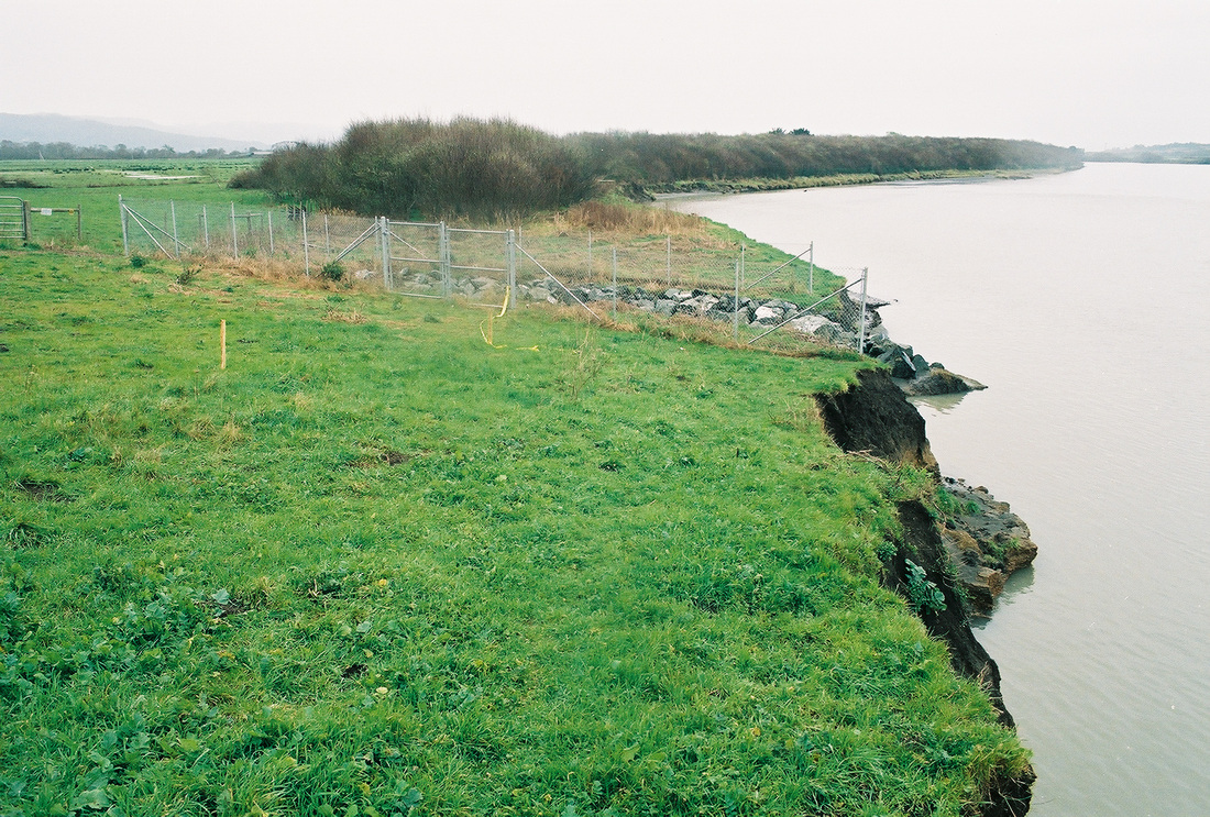
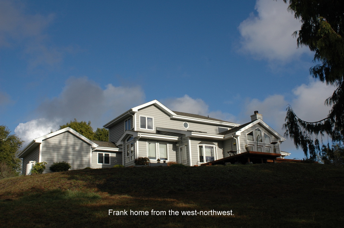
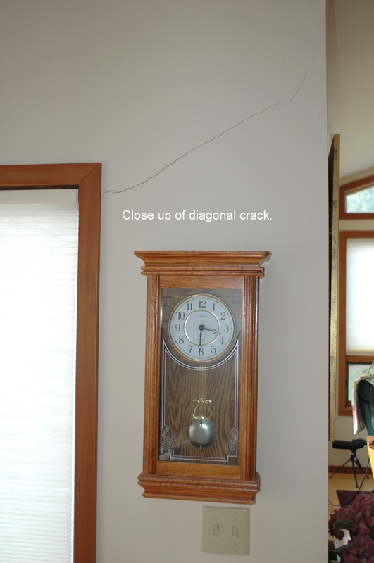
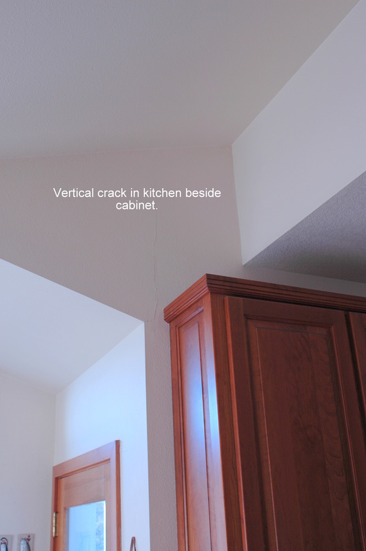
A Popourri of Oopsies

The following photographs are the first ones I placed in the page.  There are eleven sites within the group.
Oops #1A, circa 2008. Maybe I shouldn't have built on all that unconsolidated fill I had the bulldozer push over the edge of the hill.
Oops #1B, April 2012. I guess I should have followed that geologist's advice. He told me to intercept all that road and driveway water running down onto the lawn.
Oops #2. Maybe I should have read the part of the subdivision report on this lot...or had an engineering geologist do a site-specific first. Foxwood Subdivision, Eureka, CA.
Oops #3 (and there are many of these). Maybe I shouldn't have built so close to the edge, given all the geologic information that actually exists. Nesika Beach, OR.
Oops #4A. Maybe I should have followed the engineering geologist's recommendation to build an appropriate protective structure?
Oops 4B. I wish I didn't have to add thousands of dollars worth of rip-rap boulders to try to protect these condos from marine erosion! And too bad it's illegal and I'm probably going to get in even more trouble.
Oops #5. Maybe I should have had a geologist evaluate the site beforehand...or, since we built so long ago, before geology studies were common, maybe I should have setback farther. Brookings, OR. Now it is going to cost the taxpayers a small fortune to build a long, deep retaining wall to protect the sewage treatment plant.
Oops #6A. Maybe I should have asked a geologist about that steep slope below the lot, or had a site-specific evaluation done for the home. That might have kept the bottoms of the cast-in-place concrete piers supporting the decks from creeping down the hill.
Oops #6B. This is a photo of the concrete walkway inside of the pier beneath the wife in red on Oops #6A. The pier has pulled away from the slab nearly an inch. The other end of the slab has pulled away from the main foundation of the house as well, so the movement downhill is over an inch. Oops!
Oops #7. Hmmm. I'd better check my realty papers to see if the developer disclosed that he pushed tons of fill to the back of the lot, the fill that is settling and worrying me and my neighbors to death. (The straight black line that leads to the tree is a ground break...a landslide head scarp. Everything to the right of it is sliding downslope.)
Oops #8A. I know I wanted a bigger parking lot but I guess I shouldn't have pushed all that unconsolidated fill onto the top of that steep slope.
Oops #8B. Yeah. It looks even worse from this view.
Oops #9 (goes with Oops #5). I guess if you build a hurricane fence gate on moving soil, sooner or later the gate's locking mechanism won't mate with the part in the ground.
Oops #10. We don't know if the original owner of this home built too close to the bluff edge, or if groundwater is piping away sand under the foundation, but something is causing these nasty cracks to form in a concrete block foundation many few back in the home.
Oops #11. There might not have been away around this, seeing as we put the road across an active landslide, but, heck, why did we let that guy put those millions of pounds of fill dirt on the edge of the road?

Trying to Curtail Fluvial Erosion

Like the gallery series Oops 14 (farther below), this Oops 12 series shows ill-advised (and illegal) steps a homeowner on the Mad River in Arcata took to try to slow the rapid-rate erosion of the riverbank beside his home.  It didn't work.

Oops #12A. An excavator illegally dumps concrete debris over the top of the bluff along the Mad River, Humboldt County, as a homeowner attempts to slow the erosion rate. A different homeowner hired BGC, one who knew the dumping was illegal and who was concerned that the debris would increase the erosion rate in front of her property.
Oops #12B. A view from the base of the bluff. The Mad River makes a bend (meander) just upstream of this location and as it leaves the meander the river aligns with this part of the riverbank.
Oops #12C. Looking downriver. The excavator dumped concrete debris just upriver of the part of the bluff that juts out into the current, hoping to deflect the river toward the other bank.
Oops #12D. Looking upriver from the top edge of the bluff near the very end of School Road, McKinleyville, CA. During this erosion event, blocks of soil would fall off the top-of-bluff every few minutes.
Oops #12E. A view looking upriver at the eroding river bank. The main McKinleyville sewage treatment plant leachfield is at the far end of the bluff.
Oops #12E. The eroding bluff face at the riverside edge of the McKinleyville Community Services District leachfield at the end of School Road. The long-term prognosis for this area is grim unless the district can find a legal way to protect the toe of the slope.

A Home Construction Tragedy

Oops #13.  The following photos, which are labeled because we used them in a report, show the impacts and causes of ill-advised home construction.  Specifically, the designer/owner/builder placed the foundation on deep expansive topsoils and additionally placed some interior load-bearing supports on top of low cutbanks under the home.  The resulting shrinkage and load-induced soil failures caused widespread damage to the interior of the home.

Oops #13A. A beautiful hilltop home in Coquille, OR. The second owners unknowningly purchased a significant soil bearing capacity problem that began appearing as cracks in interior walls.
Oops #13B. Note the diagonal crack beginning at the window molding. This is one of many, many cracks in the home.
Oops #13C. Another crack on the first floor.
Oops #13D. This crack at the wall-ceiling join is wider than most.
Oops #13E. Former Staff Engineering Geologist Beau Whitney, now in Western Australia finishing a Ph.D., disgruntedly after discovering yet another cause of damage on the property.
Oops #13F. We did multiple foundation excavations to expose the base of the footing. In every case the footing rested on several feet of expansive topsoil.
Oops #13G. One of many cracks in the perimeter foundation. Most of the cracks were diagonal, indicating that one side of the crack settled more than the other.
Oops #13H. Another diagonal crack in a perimeter foundation bearing on deep topsoil.
Oops #13I. This diagonal crack bifurcated as it passed through the base of the footing.
Oops #13J. Whereas the perimeter of the home settled relatively uniformly (relatively), the interior settled differentially due to unequal loading on foundation elements. Note the tilted pier block.
Oops #13K. Another view of the same pier block. Note the low cutbank behind it. Other foundation elements sit on top of the cutbank at the very edge. Placing them there was a recipe for disaster.
Oops #13L. The foundation with the number 3 on it is on top of the cutbank, loading it.
Oops #13M. The topsoil...yellowish in the flood lights we used (rather than dark brown)...was wet when the owner-builders constructed the foundation. Over time, the topsoil dried (almost completely), and shrank, causing the cracks.
Oops #13N. An exceptionally wide crack in the cutbank face.
Oops #13O. Two cracks near the corner of isolated interior pier #3.
Oops #13P. We're pretty sure that the original owners began recognizing the problem and placed shims under the subsiding pier blocks. Regardless, they did not disclose the soil problems to the new buyers (our clients), and the statue of limitations had passed so they could not litigate to recover damages. A very sad situation that could have been avoided from the get-go.
Oops #13Q. Pier block #7. Same story, same verse. Although, working with an engineer we came up with a solution, the cost of the stabilization work and repairs of cosmetic and structural damage was high.

In-Stream Modifications (Illegal)

Oops #14.  I added the following "Oops" gallery (of foggy day photos) on October 20, 2012, shortly after I worked the site.  The photos show the impact of one neighbor's alleged rerouting of a stream channel by manually moving rocks, which led to repeated bluff failures on the other side of the creek, which led to the owner of the bluff-top lot allegedly hiring an excavator to realign the channel to protect his property.  Also see 2012 Work.  Hopefully sunny day photos will replace these sooner or later.  Hopefully, no one will go to jail or be fined excessively.

Oops #14A. A view from the top of a bluff down at a stream channel. Before an excavator moved the driftwood toward the base of the bluff, the channel ran along the base, eating into it and triggering episodic landslides of considerable volume.
Oops 14B. Another view looking toward the mouth of the stream.
Oops 14C. The "delta" of the stream. The large cliffside failures (perhaps four or more) choked the channel and forced the stream to the edge of the slide debris. This view shows the former "estuary" (the small pond) within a mass of gravel that has been reworked by the stream and marine waves. Landslide debris is in the foreground.
Oops 14D. A "stitched" photo that better shows the entire channel developed by the excavator, plus the driftwood it moved to the south.
Oops 14E. A view toward the SE looking over the nose of the "delta" in Oops 13C at the length of bare cliff. A pile of landslide debris, partially vegetated, is visible at the change in angle of the bluff face. Note that the bluff face to the south (right) is densely vegetated, despite facing the open ocean.
Oops 14F. Looking eastward over the now-abandoned channel. Note the bank of exposed gravels. The next photo (13G) was taken at the far end of the cliff.
Oops 14G. This view tells the tale. The lighter exposure of gravels is a recently undercut part of the cliff. The excavator pushed the driftwood up against this section to move the channel away. The foreground is another pile of landslide debris.
This is an educational website.
Powered by Mother Earth, Weebly, and REB