Contact Information: Click on "Home," email [email protected], or phone 707-822-7300 (California) or 541-469-7300 (Oregon). Email administrative inquiries to ma[email protected].
LAST UPDATE: November 25, 2015.
LAST UPDATE: November 25, 2015.
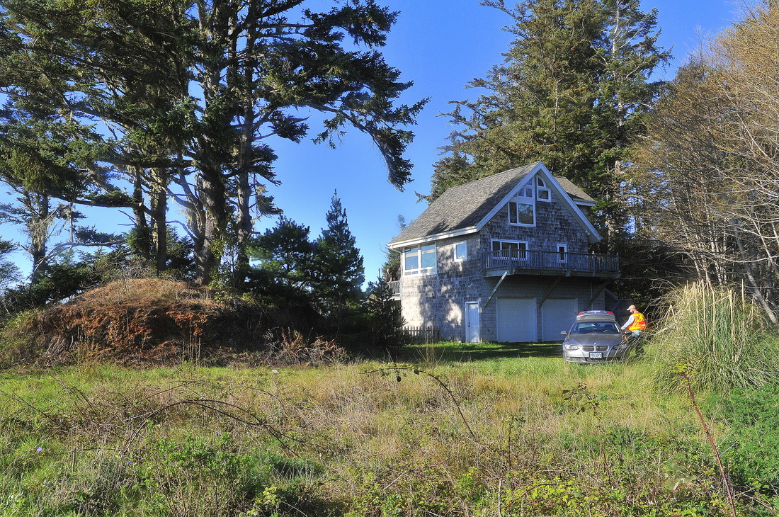
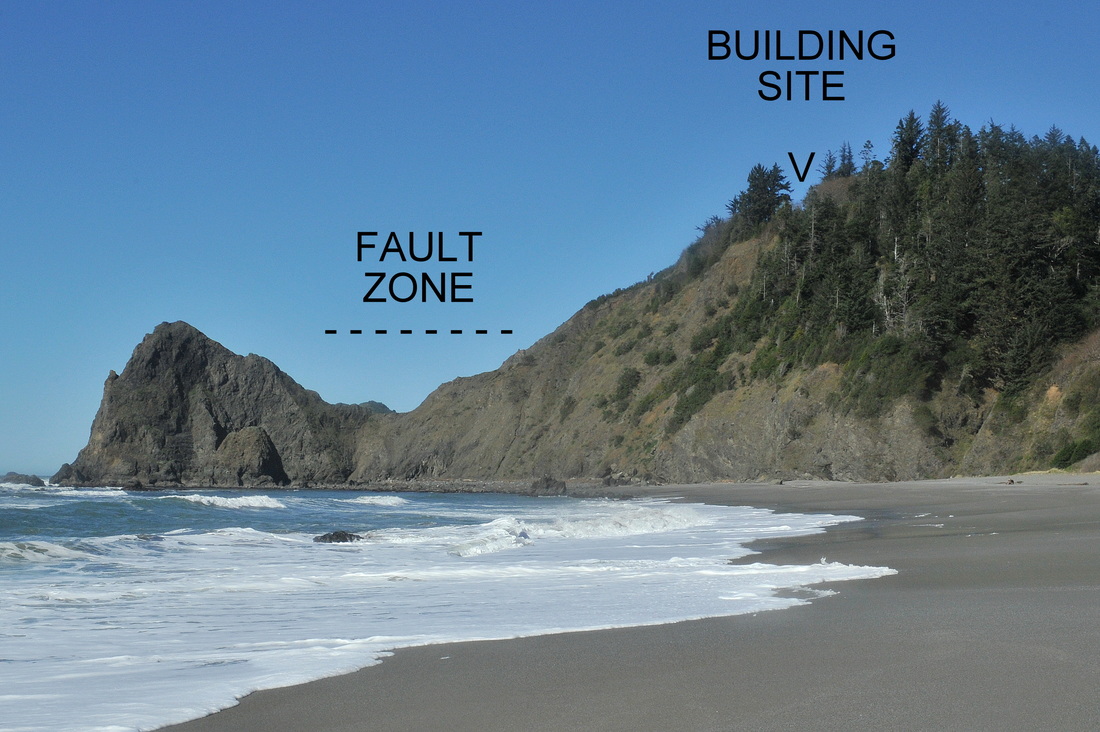
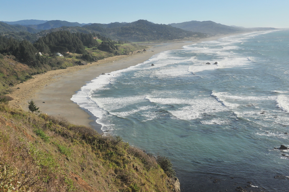
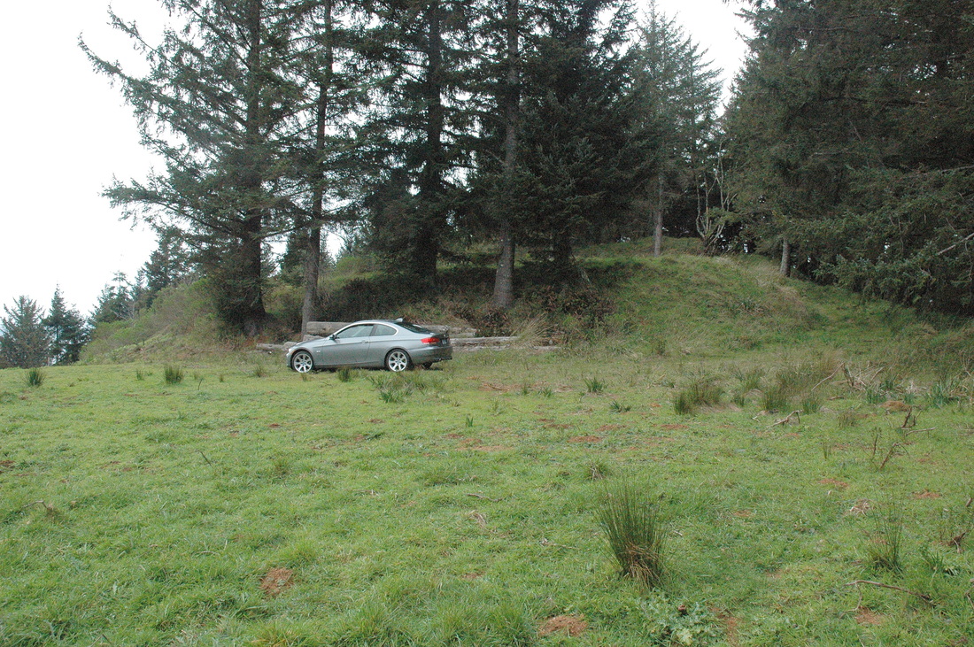
#15-019. MAKE WAY FOR A BIG BOY. This cute little cabin sits 300 ft above sea level on a knife-edge ridge north of Ophir, OR. The new owner plans to enlarge the cabin and connect it to a 6,000 sq ft home with a daylight basement dug 10 feet into the rock. That's a good idea because seaward to the north and west are sheer cliffs! The following two photos respectively show the building site from the beach and the view to the south from that site. We finished a topographic / geomorphic map and a detailed "How to Build It" report. Design work is in progress. OMG! FLASH...UPDATE. The owner just sold the property to someone who wants to cut off the top 20-30 ft of the hill to enlarge the pad. STAY TUNED!
|
|
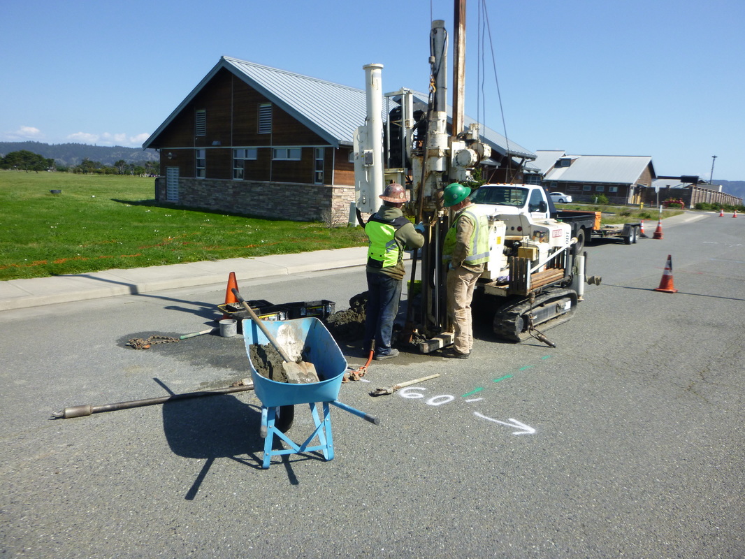
#15-014. WHAT WILL THE NEW CRESCENT CITY SEWAGE LINE BEAR ON? We used a subcontracted track-mounted (baby) drill rig to power through the asphalt and then drill to below the planned line depth, sampling and logging the soils as we went. Later, BGC's Ace draftsman put together a map showing the connections (and lack of connections) between various soil units within the alignment. Our work will help the bidding contractors estimate the types and volumes of fill to be removed.
#15-011. WHAT A NICE SURPRISE! It was a nice surprise to find out that most of the site for a commercial building in Brookings, OR, is a late Pleistocene seastack that was graded down to a flat surface decades ago. Of course, few things are perfect and, sure enough, the bedrock plunged to about 8 feet deep on the far side of the site, complicating foundation design. Report issued. Final engineering design in progress.
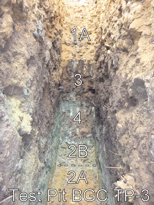
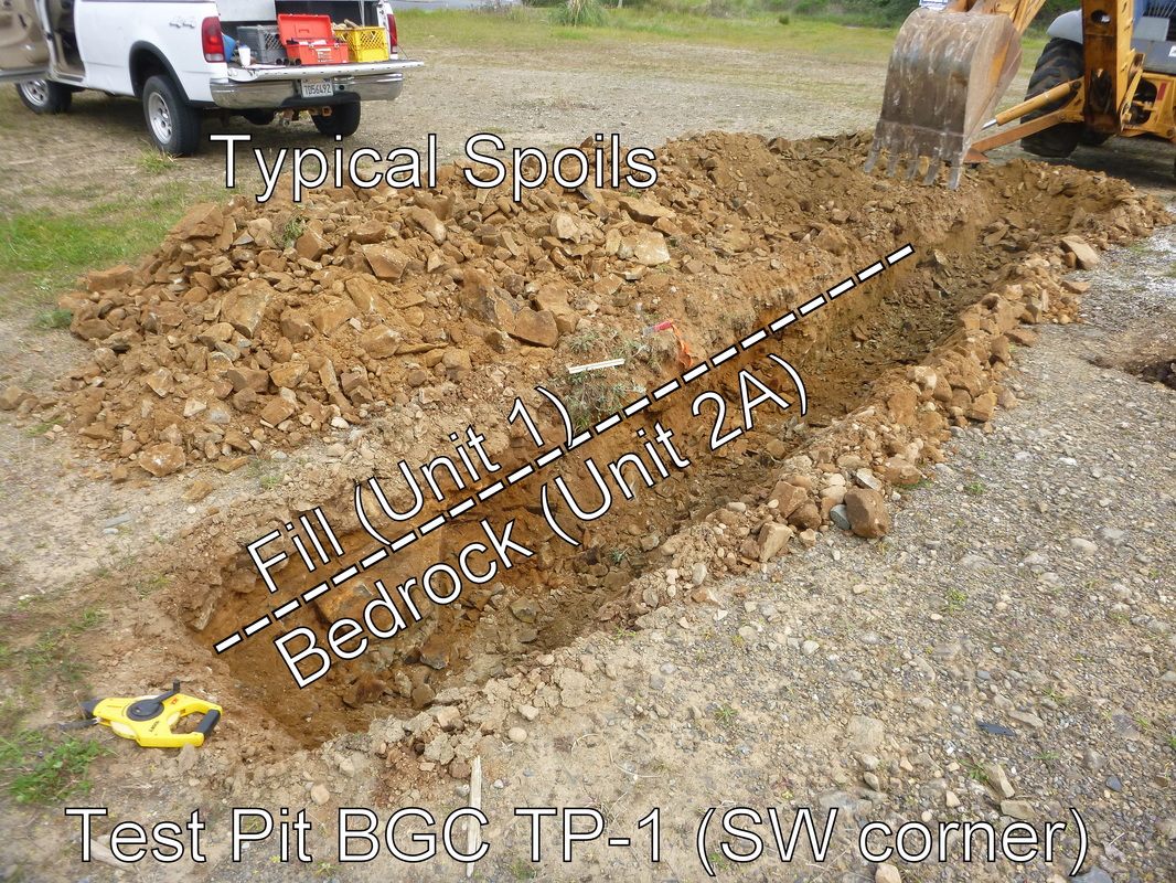
#15-011. THE COMPLEX PART OF THE SITE. At this location, a rocky fill (1A) lies on top of a buried topsoil / bog soil (3). Below that is a reduced unit (4) composed of various soils (silty sand, clayey sand, sandy clay) plus subangular clasts of the bedrock...and everything is greenish gray (because the water table was above the unit for decades). The reduced soils lie on top of the bedrock, which has a reduced zone (2B) overlying rock that is still oxidized (2A). The building foundations will bear on 3-bag sand slurry that in turn will bear on the bedrock. Report issued with maps, appendices, and photos to help everyone understand the complex conditions.
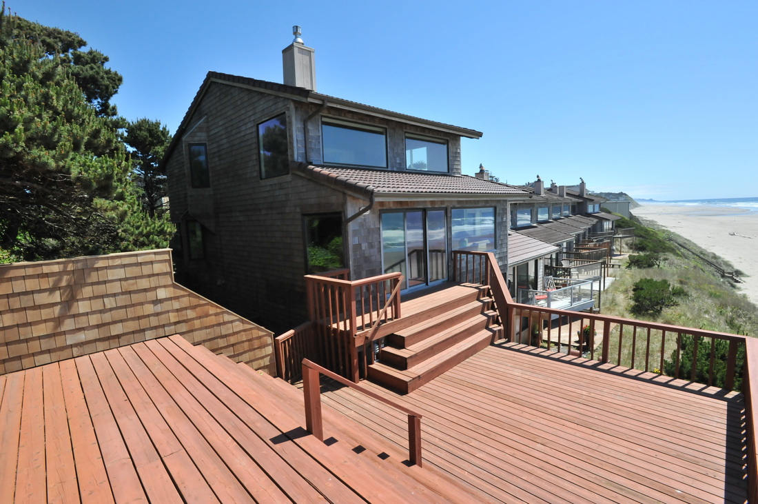
#15-024. WHAT A DECK (and this isn't all of it)! A client hired me to evaluate the risk of instability to this condo unit in Lincoln City, OR. The structure is four decades old and although it was not possible to determine if the foundation bears on bedrock or sand, the condo is structurally sound and my client, who has been looking for years, purchased it as a much-needed retreat from her grueling job. I presented a verbal summary and followed-up with a short-form report. CONGRATULATIONS to my client!

#15-024. PERSPECTIVE VIEW. Google earth photo of the coastal strand near the Lincoln City condo jobsite. Isolated higher-than-typical remnants of abrasion platform and a wide, flat beach offer "semi-protection" to the coastline. The base-of-cliff also is partially protected by a stabilized foredune. The base-of-cliff is rip-rapped in other areas.
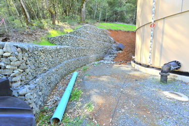
#15-012. OOPS! A GABION WALL FAILURE. As you might guess, I can't tell you very much about this boo-boo. The ultimate question (attorneys might be asking) was it an Geologist's Investigation error? Lab Testing error? Engineer's Design error? Construction error? Combination of errors? The 15-ft-high central portion of this wall behind a water tank failed following prolonged rains. We know little more at this early stage in the investigation. We have provided our client with our preliminary opinion about the cause(s) of the failure. Now we wait to see what comes next. Please see our Oops! page (in Photo Galleries) for more photos of this site.
#15-010. TWO PADS FOR A PAD (AND A GARAGE). Our clients had us evaluate two side-by-side lots in Gold Beach. Each one has a cut/fill pad on it. They want to put a home on the upper one and a garage on the lower one. There's an awesome view to the south from the upper pad, so it sounds like a good plan. We sent the clients a "bullet summary" of our main findings and then discussed the lots over the phone to answer their questions and provide additional information. They are in escrow!

#15-010. TALK ABOUT STEEP! This is the hillslope just north of the building pad. Is it stable? Should our clients worry? Could a slope failure extend into a pad? These are just some of the issues we addressed at the property to provide the geologic information our clients needed to decide whether to buy the properties.
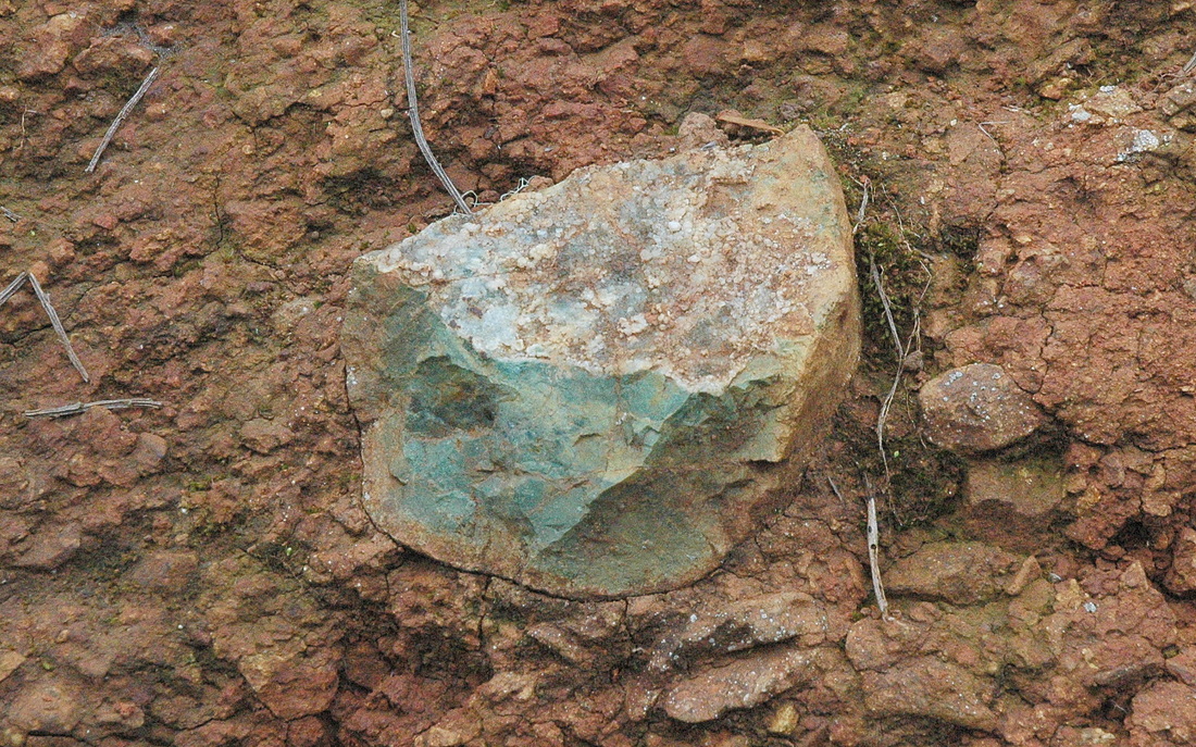
#15-010. SO WHAT'S THE BEDROCK HERE? The lovely green rock, California's state rock, is the clue (all the other rocks in the photo are the same type but are deeply weathered). A second question is, "What is this one unweathered rock doing "floating" within the surrounding soil?" This was the only fresh rock we saw in all of the cutbanks along the roads, driveways, and pads on the property (although there are tons of this rock cropping out in the subdivision to the south). Answer 1: Serpentinite. Answer 2: We don't know yet.
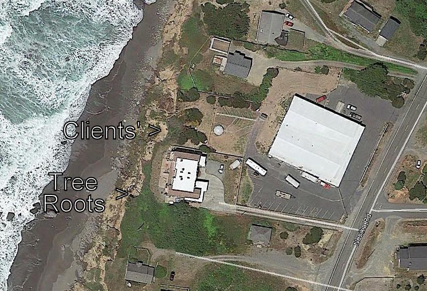

#15-009. ANOTHER NESIKA BEACH TOP-OF-BLUFF FAILURE. Our clients, whose home is 135 ft back from the edge-of-bluff, nevertheless had a variety of questions about the two failures eating into their property (the southern one is in the center of the photo to the left; the most southern failure is on the neighbor's property). The northwestern corner of the home to the south (i.e., a vacation rental) is only 25 ft from the edge of the failure on our clients' property. We explored the upper part of the face of the bluff on the clients' property and the neighbor's and saw some pretty interesting things. We summarized our findings in a letter to the owners (see following photos).
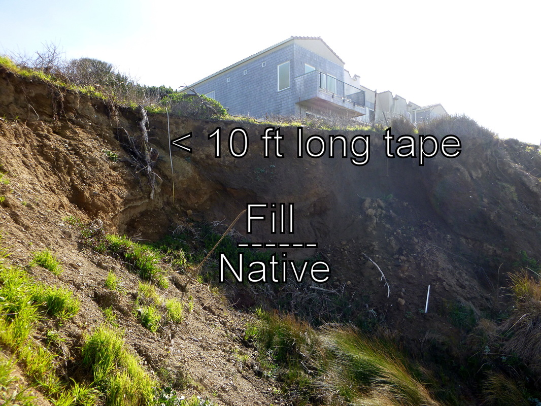
#15-009. BACK IN THE 1940's people pushed sandy fill (and lots of cultural trash) into an excavation they graded down into the seacliff. The excavation was wider than this photo. Then much later others filled in the trough. In the south bluff failure, the fill is ~14-15 ft deep. The beach below is littered with rusted car parts that are weathering out of the hillslope (see the photo above this one).

#15-009. THE CONTACT. We dug through the loose sand covering the contact. Here, the fill is a yellow-brown dune and beach sand containing dime-sized clasts of subsoil. It overlies gray poorly graded (same-size) native beach and littoral marine sands. The abruptness of the contact and the absence of soil tells us that there once was an excavation here rather than a natural drainage swale.
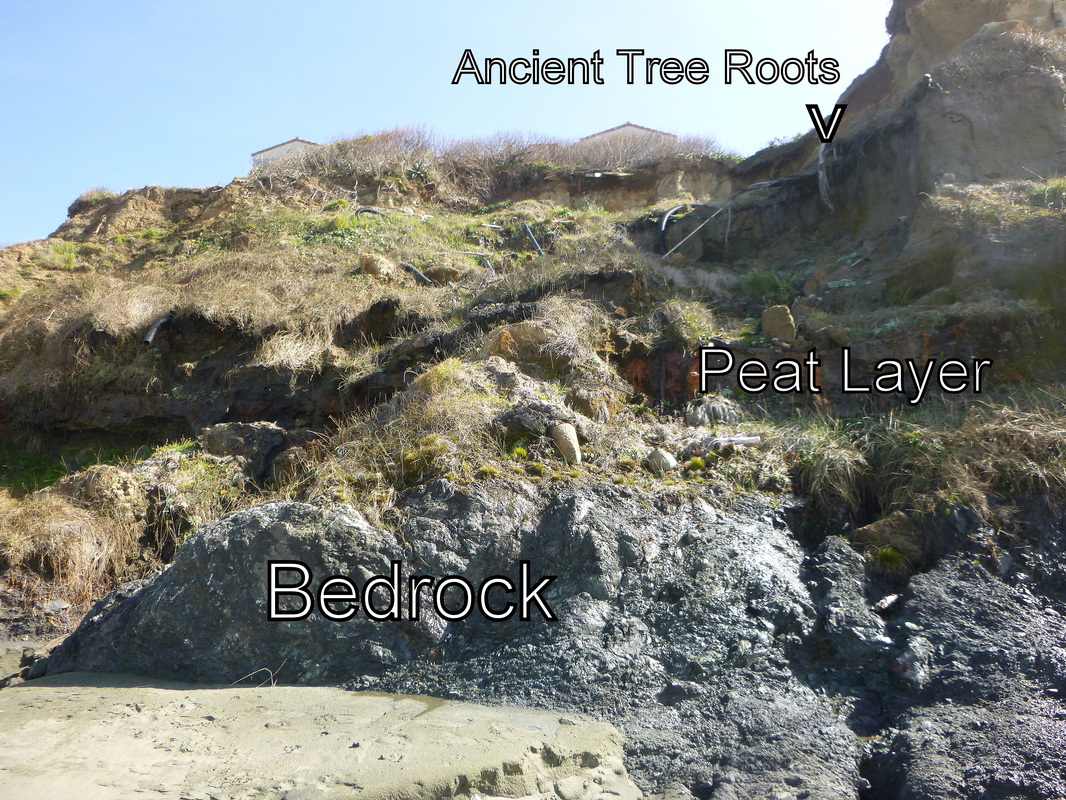
#15-009. LATERAL VARIABILITY. South of our clients' bluff face the stratigraphy (soil layer pattern) is quite different. Here the bedrock includes an erosion-resistant lithology, not just erosion-prone weathered claystone. And the overlying terrace sediments include at least two peat layers. The upper one contains tree roots and stumps in growth position. In addition, there is a native soil profile (not fill) in the top-of-bluff (see following two photos).
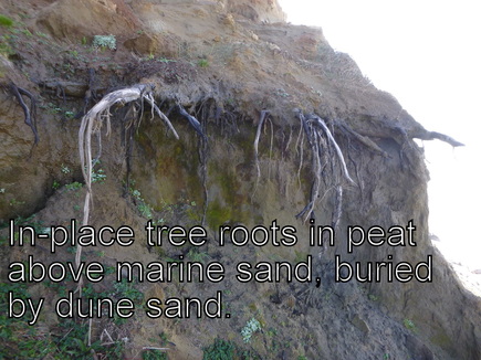
#15-009. THERE WAS AN ICE-AGE FOREST HERE. ~125,000 years or so ago during the late Pleistocene epoch there was a coastal forest here. These are ancient roots of stumps in growth position. Elsewhere along the Nesika Beach shoreline there are logs in this peat layer (and the lower one).
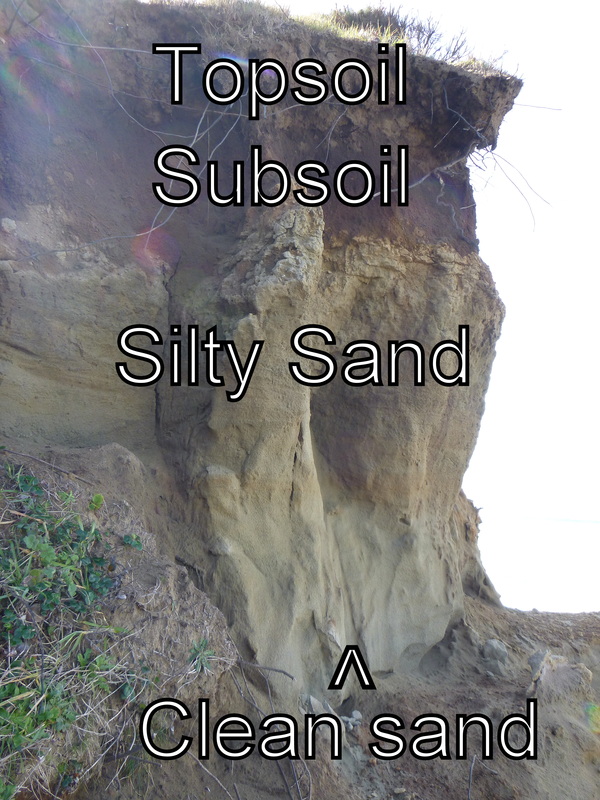
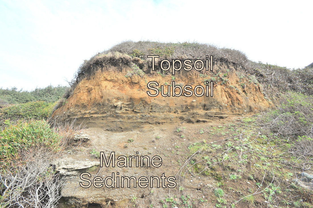
#15-009. NATIVE MARINE TERRACE SOILS AND SEDIMENTS. This Nesika Beach bluff top exhibits classic soil horizonation. A dark sandy silt topsoil layer overlies a reddish brown clayey silt layer (older topsoil and aeolian or wind-blown deposits) that grade downward into a silty fine sand. That sand, and at least part of the clean sand below, are dune deposits. Considered overall, the stratigraphy of the Nesika Beach bluffs is fascinating, whether you're a geologist or not. (The photo is less than perfect due to glare on the lens.)
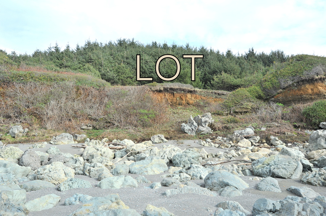
#15-005. ONE OF THE LAST LOTS. This is one of THE last bluff-top lots north of Gilbert Creek, Del Norte County, CA. It is stable and semi-protected by a wide boulder-strewn beach. The boulders have been freed from Franciscan melange and Broken Formation bedrock that forms an erosion-resistant spine to the north (left) of the lot. Our job was to provide a geotechnical realty disclosure report (RDR) for the seller so he could provide full disclosure of geologic hazards and risks to potential buyers. The lot itself is "safe," but it is below the predicted tsunami inundation elevation from a Cascadia subduction zone earthquake. We finished and delivered our report and the lot is for sale. Interested? Call Dave.
#15-005. Here's a close-up of the ice-age marine terrace stratigraphy at the lot. Here, topsoils and subsoils, both primarily of aeolian (wind-blown) origin, overlie silty to "clean" marine terrace sands and sandy gravels. However, only a few hundred feet upcoast the marine terrace deposits are interbedded lenses of cobbles and gravels. The terrace is about 125,000 years old (per research scientists).
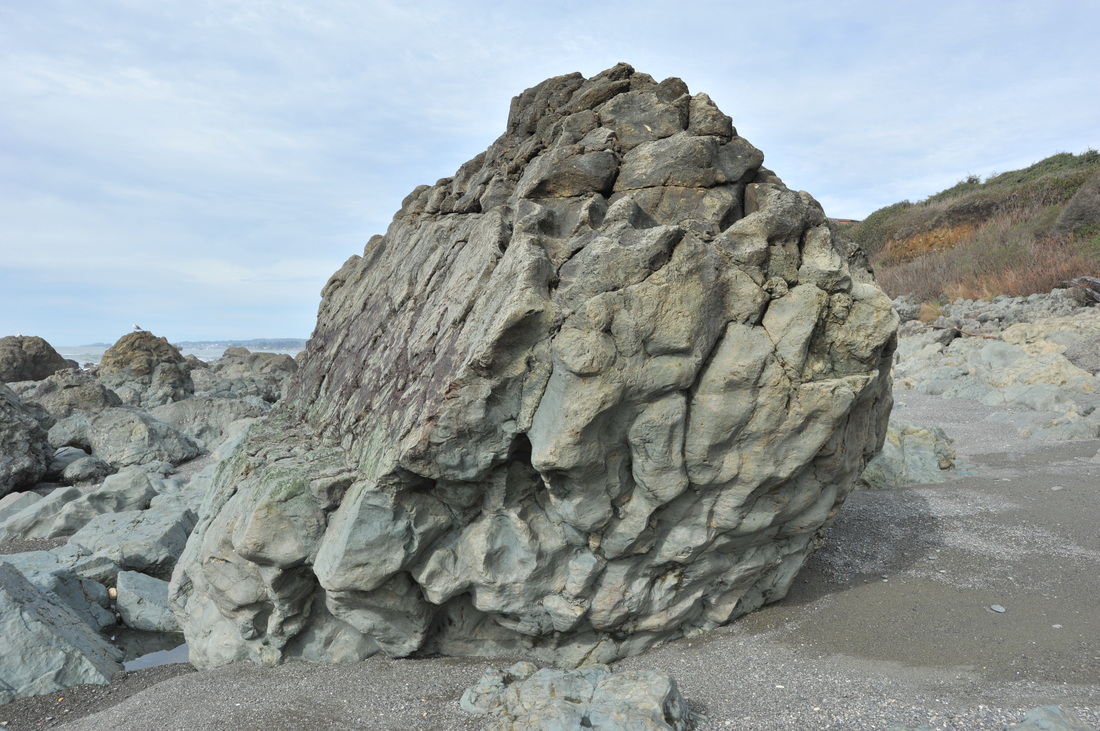
#15-005. GREENSTONE (altered pillow basalt). This is one cool rock on the beach seaward of the lot. The bulbous shapes are "pillows" of basalt that came from an undersea volcanic vent. As the basalt extruded, its surface rapidly cooled forcing the lava to burble out somewhere else, creating pillow after pillow.

#15-006. A RETIREMENT DREAM! Here's the home, set on 2+ acres high on a ridgeline overlooking all of the Harbor Bench and Brookings. It is bearing on bedrock, as did the decades-old home it replaced. Should the clients buy it? (It turns out that some other buyers snapped it up.)
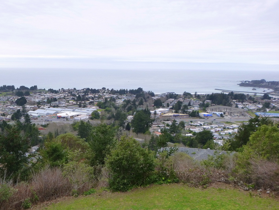
#15-006. Here's one fourth of the view from that home. The little burg of Harbor is in the midground and the groins that border the mouth of the Chetco River are on the far right. Brookings is out of sight to the right.
 This is "Matthew," one of three remaining conifers on the property. The ground on the downslope (left) side of this tree has been settling for decades. The elevation difference between the top of the root on the left edge and the top on the right is over 6 ft. There are 4 several-feet-high scarps upslope of this tree plus two few-month-old pull apart cracks very near the tree. Good Luck, Matthew, and God bless you.
#14-003. RESURVEY OF GRID PIN ARRAY DETERMINED GROUND MOTION. Our first report of 2015 went to a long-term client in Trinidad, CA. We have monitored her property for close to two decades. In March, 2014, we installed an array of 33 plastic-capped rebar "grid pins" and used a total station to survey their locations from a stable platform (our client's deck). Then we resurveyed the grid in November (and did other work). The following map (assuming it will upload) shows the site topography, our mapping of scarps and sllump blocks, the location of three mature conifers our client loves dearly (and has given Biblical names), and the location of the grid pins, our survey stations, and other monitoring devices. The short line beside each "bulls eye" symbol (a grid pin with a circular ring showing our survey precision) shows the direction and scaled amount each pin moved during the monitoring period. We also state the amount of horizontal displacement and rise or drop of the pin (in feet). The recorded movements were not great despite the general instability of much of the surveyed ground because the monitoring period records "dry season" data; we anticipate our Spring 2015 survey data will better characterize the ground motions at the bluff-top property. Stay Tuned for an UPDATE.
| oreilly_monpt_map_final_1-8-2015.pdf |